Heading towards Peter Both from the Pavillon

The climb to Cilaos is reputed to be long and tiring – why not stop off at Le Pavillon on the way for a walk that you can extend as far as Peter Both?
The path has just been refurbished by the ONF, much to our delight, and Îlet-Haut is secluded and unspoilt.
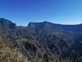
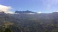
A truly unique viewpoint overlooking the peaks of the Cilaos cirque. If you’re heading up to Cilaos for the first time, this is a great introduction to understanding just how isolated the cirque is.

Details

2712510
Creation:
Last update:
Last review:
  • Walking
    Activity: Walking
  • ↔
    Distance: 3.53 mi
  • ◔
    Average duration: 3h 10 
  • ▲
    Difficulty: Moderate

  • ⚐
    Back to start: Yes
  • ↗
    Ascent: + 1,729 ft
  • ↘
    Descent: - 1,722 ft

  • ▲
    Highest point: 2,457 ft
  • ▼
    Lowest point: 1,283 ft

Photos

Description of the walk

When you reach the hamlet of Le Pavillon, coming from Saint-Louis, cross the metal bridge; the road then passes between the two or three houses that make up the hamlet.
Above these houses, less than 50 metres away, a very wide track on your left allows you to park without obstructing access to the EDF site.
To the right of the road to Cilaos is the bus stop.

(S/E) Follow the first circular tarmac road bend uphill to find, in the dip of the second circular bend, a path signposted with a sign reading “Le Pavillon – alt 405m, Îlet-Haut 1h00”.

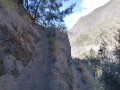
(1) This recently resurfaced path takes you downhill to cross the “Petit Bras de Cilaos” stream, then climbs very steeply for an hour to reach Îlet-Haut (signposted).

(2) The main path is well signposted on the descent and winds its way between the houses; all other access routes are private. There are no signposts in Îlet-Haut.

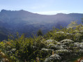
(3) Once over the ridge, the path follows the 730-metre contour line, offering some very pretty views of the Pitons de Cilaos.

(4) Due to a lack of time, we stopped at this final viewpoint before descending into the ravine, but the path continues towards Peter Both without any difficulty other than the descent.
The return journey follows the same route (S/E).


Waypoints

  1. S/E : mi 0 - alt. 1,316 ft - Parking available or bus stop. Close to the - Bras de Cilaos (rivière) - La Réunion -
  2. 1 : mi 0.12 - alt. 1,391 ft - Recently developed trail
  3. 2 : mi 0.9 - alt. 2,228 ft - Arrival at the top of Îlet-Haut
  4. 3 : mi 1.29 - alt. 2,329 ft - Ridge crossing
  5. 4 : mi 1.76 - alt. 2,431 ft - Our route ends at the final viewpoint.
  6. S/E : mi 3.53 - alt. 1,316 ft - Parking available or bus stop

Notes

No water sources. You’ll need to cross the Petit Bras de Cilaos at the start and on the way back – take care if the water is flowing strongly.
A makeshift lodge (still in use??) at Îlet-Haut.
Low-cut walking shoes are sufficient; walking poles are useful. The climb begins immediately and takes an hour. Avoid this route in wet weather – it’s slippery! – but it is doable...

Private property must be avoided; the locals are friendly but do not appreciate trespassing on private land.
Take great care with your walking poles and shoes not to damage the water supply pipes running along the path – it’s a matter of survival here.

Worth a visit

Our car journey took us to Cilaos, so the hiking break was most welcome.
Please note that this walking route ended at the last viewpoint, before the descent into the ravine; if you have time, you can do the round trip to Peter Both. In that case, allow around 5 hours.

However, having spoken to locals, it may be more efficient in terms of elevation gain and quicker in terms of time to take the No. 60 bus from Saint-Pierre, get off at Peter Both at elevation 874, hike via Îlet-Haut to Le Pavillon, and then take the No. 60 bus back to Cilaos or return to Saint-Pierre, as there’s a bus stop at Le Pavillon. It’s simply a one-way hike in the opposite direction, but shorter and more complete.

A quick reminder about the bus stops: mention this to the bus driver at the start of the journey and clap your hands when you arrive at Peter Both – he’ll stop at elevation 874. It’s magical!

Reviews and comments

5 / 5
Based on 2 reviews

Reliability of the description
5 / 5
Ease of following the route
5 / 5
Route interest
5 / 5
Gwenatre
Gwenatre

Overall rating : 5 / 5

Date of your route : Oct 19, 2024
Reliability of the description : ★★★★★ Very good
Ease of following the route : ★★★★★ Very good
Route interest : ★★★★★ Very good
Very busy route : No

A really lovely walk with a 1½-hour climb, followed by a flat section and then the descent back down.
Some lovely views
Please note, however, that there are ‘path closed’ signs, so you hike at your own risk; the path is well maintained apart from a 50cm section affected by a rockfall.

Machine-translated

Orando974
Orando974 ★

Overall rating : 5 / 5

Date of your route : Aug 14, 2021
Reliability of the description : Not used / Not applicable
Ease of following the route : Not used / Not applicable
Route interest : ★★★★★ Very good
Very busy route : No

I did a round-trip hike today, all the way to Palmiste Rouge. A lovely walk with magnificent views of the Cirque de Cilaos. I hardly came across anyone at all during the whole walk. Alone in the world, right in the middle of the mountains. For those who want to carry on to Palmiste Rouge, allow a good three extra hours for the round trip. However, the most beautiful scenery is already covered in this guide. The section not included, whilst beautiful, is less interesting.

Machine-translated

Other walks in the area

For more walks, use our search engine .

The GPS track and description are the property of this route's author. Please do not copy them without permission.