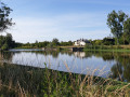
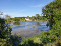
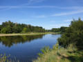
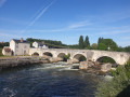
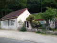
From Mareuil-sur-Cher to Saint-Aignan-sur-Cher, following the banks of the Cher

This unpretentious one-way route is an invitation to discover the banks of the Cher and admire one of the remains of the dams regulating the river, complete with its operational building. Partially shaded, it is particularly beautiful and the light is at its best if walked in the afternoon from 4.00 pm in summer. The town of Saint-Aignan is in talks with the riverside landowners to extend the path for the final kilometre and a half.
Journey time (there and back): 3 hours

Details

3490241
Creation:
Last update:
Last review:
  • Walking
    Activity: Walking
  • ↔
    Distance: 3.26 mi
  • ◔
    Average duration: 1h 30 
  • ▲
    Difficulty: Easy

  • ⚐
    Back to start: No
  • ↗
    Ascent: + 23 ft
  • ↘
    Descent: - 10 ft

  • ▲
    Highest point: 243 ft
  • ▼
    Lowest point: 210 ft
  • ⚐ Country: France
  • ⚐ City: Mareuil-sur-Cher (41110)
  • ⚑
    Start: N 47.293768° / E 1.329684°
  • ⚑
    End: N 47.271329° / E 1.375571°
  • ❏
    IGN map(s): Ref. 2023SB
  • Hour-by-hour weather

Photos

Description of the walk

On arrival in Mareuil-sur-Cher, park behind the church, near the campsite and the post office, to the north-west of the village.

(S) Looking north, opposite the campsite, you’ll see a beautiful building on your left, locally known as ‘the Château’.
Walk between this building and the campsite fence, heading west towards the tennis courts and other sports facilities located there.
Turn right towards the north to reach the river, then, once at the river’s edge, follow the path heading south-southeast, keeping the campsite’s fenced perimeter on your right.
Follow the path along the bank of the Cher towards the east, staying as close to the riverbank as possible. There are a few access points to the water’s edge and footbridges crossing the streams flowing into the river.

(1) When you reach the only fork in the road, take the left-hand path, which runs closest to the bank of the Cher; the other path disappears a little further on into a cultivated field.

(2) You’ll reach the lock. The area hasn’t been developed yet. There’s a lovely view of the lock-keeper’s house and the remains of the dam.

(3) Naturally, the wide path veers away from the riverbank, as the riverside path is not very well cleared along this section (as of June 2020). At the next junction, turn left, heading due north, to rejoin the riverbank and the path heading east.

(4) End of the current section of the path running alongside the Cher. Continue along the banks of the Cher for 30 metres (with a few fruit trees on your right), then cross a stream without using a footbridge.
Turn right before the sewage treatment works. Join the road heading south, walking alongside the fence of the sewage treatment works. You will come out onto the road to Saint-(E) Aignan.

(5) Complete the final kilometre (and a half) by following the road heading east, taking care of oncoming traffic, until you reach the place known as “Le Four à Chaux”, then cross over to take the safe path that runs alongside the same road to the centre of Saint-Aignan.

You’ll arrive at the Saint-Aignan bridge, which has a lock designed differently from the previous ones.

If you’re up for it, the return journey follows the same route (3 hours there and back). Please, on your return, do not cut across the campsite to shorten the journey, out of respect for the campers.

Waypoints

  1. S : mi 0 - alt. 220 ft - Car park behind the church, in front of the campsite
  2. 1 : mi 0.43 - alt. 213 ft - Turn left at the fork in the road
  3. 2 : mi 1.02 - alt. 213 ft - Lock
  4. 3 : mi 1.76 - alt. 217 ft - Distance from the riverbank - Le Cher
  5. 4 : mi 2.4 - alt. 220 ft - End of the signposted trail (June 2020)
  6. 5 : mi 2.46 - alt. 226 ft - Route de Saint-Agnan
  7. E : mi 3.26 - alt. 233 ft - Arrival at the Saint-Aignan bridge, another lock

Notes

No known water source. Basic countryside walking gear; suitable low-cut shoes.
Most walkers are picked up by car in Saint-Aignan to return home, after taking a short tour of the town (the castle is worth a visit).

Worth a visit

Continuing further west along the same bank, you’ll easily reach a second weir and its equally pretty house.
You can clearly see the lock piers on which the structure rested to accommodate the ‘needles’ – large, thick wooden beams operated by the lock-keeper to regulate the flow and thus adjust the water level of the Cher to make it navigable. It was a delicate, difficult job requiring a constant presence during the season, hence the official residence on the right bank. In winter, the Cher was ‘unblocked’ to prevent flooding. Navigation was suspended.
The weirs on the Cher are all built to the same design: a lock on the right bank for boats to pass through, the ‘aiguilles’ weir in the middle, and the overflow spillway on the left bank.
Note that in Montrichard, the lock-keeper’s house has been converted into a rural lodge; it is very easy to reach on foot.

South of Saint-Aignan lies Beauval Zoo – a huge surprise for anyone who hasn’t been there before.
Mareuil-sur-Cher welcomes holidaymakers to its campsite or to lodges run by the local council.
Also visit Montrichard and its keep, and Saint-Aignan and its castle.
Enjoy local wines – AOC Touraine – in moderation.

Reviews and comments

4.7 / 5
Based on 2 reviews

Reliability of the description
5 / 5
Ease of following the route
4.5 / 5
Route interest
4.5 / 5
Richardjlo1
Richardjlo1

Overall rating : 4.7 / 5

Date of your route : Sep 04, 2022
Reliability of the description : ★★★★★ Very good
Ease of following the route : ★★★★★ Very good
Route interest : ★★★★☆ Good
Very busy route : No

With the sun shining, it was lovely

Machine-translated

Pierre des Vignes
Pierre des Vignes

Overall rating : 4.7 / 5

Date of your route : Feb 21, 2021
Reliability of the description : ★★★★★ Very good
Ease of following the route : ★★★★☆ Good
Route interest : ★★★★★ Very good
Very busy route : No

A tribute to the Cher in winter: this tributary was swollen in mid-February following the snowmelt, though it did not actually burst its banks. Some sections of the path were flooded, which forced us to take a few detours, making waterproof, high-top walking boots essential. We were able to walk behind the water treatment plant as the path had been cleared of undergrowth. There was a whole group of black storks on the Cher, battling against the current.

Machine-translated

Other walks in the area

For more walks, use our search engine .

The GPS track and description are the property of this route's author. Please do not copy them without permission.