Descend from La Roche de Mio towards La Plagne Bellecôte

In summer, the resort of La Plagne offers a number of hiking routes that are very accessible thanks to the cable cars.
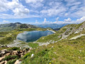
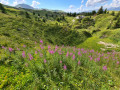
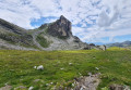
This entirely downhill walk allows you to admire the area from a high vantage point (2,710 m) and discover a varied mountain landscape along a very pleasant path to La Plagne Bellecôte.
Suitable for the whole family, provided everyone can cover this distance; please note that there are no shortcuts if you get tired.

Details

3824886
Creation:
Last update:
Last review:
  • Walking
    Activity: Walking
  • ↔
    Distance: 4.47 mi
  • ◔
    Average duration: 2h 05 
  • ▲
    Difficulty: Moderate

  • ⚐
    Back to start: No
  • ↗
    Ascent: + 0 ft
  • ↘
    Descent: - 2,592 ft

  • ▲
    Highest point: 8,911 ft
  • ▼
    Lowest point: 6,319 ft
  • ⚐ Country: France
  • ⚐
    Areas: Alps, Vanoise
  • ⚐ City: Bellentre (73210)
  • ⚑
    Start: N 45.49362° / E 6.735694°
  • ⚑
    End: N 45.512393° / E 6.697382°
  • ❏
    IGN map(s): Ref. 3532ET, 3532ETR, 3532OT, 3532OTR
  • Hour-by-hour weather

Photos

Description of the walk

(S) On leaving the cable car station, walk round the building and head south-west.
Join a wide service track which winds its way down towards ‘Le Lac des Blanchets’ and ‘La Plagne Bellecôte’.
Follow these directions as far as the lake; the signposts with a beige background are quite few and far between but well placed.
You’ll quickly lose altitude as you follow the winding track, which passes beneath the Canellaz chairlift.

(1) A well-marked path on the left joins the winding track further down and shortens the distance.

(2) At the start of a second shortcut, it is best to follow the less clearly marked route which passes beneath the gondola lift, heading due west along the ridge of a small hill, to view the marsh where a gigantic boulder, fallen from the Roc des Blanchets, lies.
Do not cross the protective fence surrounding this wildlife and rare plant reserve.

Join the farm track and follow it for 80 m.

(3) Turn right onto the west-facing path leading up to the lake. Follow the signpost for “Lac des Blanchets 0h10 – Belle Plagne 1h15”
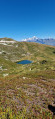
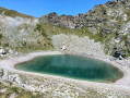
The path climbs gradually to overlook Lac des Blanchets, before descending again to bring you closer to the lake.
Do not go down to the lake’s shore for reasons of hygiene (the resort’s drinking water reserve) and safety (very strong water suction).

Go round the lake to the west to reach the top of the Blanchets chairlift.

(4) Continue along the maintenance track towards “Belle Plagne” and “La Plagne Bellecôte”, heading north then north-west.
The track keeps the mountain on your left and offers ever-changing views of the resort on your right.
Continue the descent towards La Plagne (signs for “Les Plagnes” or “Belle Plagne”, “La Plagne Bellecôte”). The track heads broadly north.

Do not rely on the large ski run signposts (with blue or red colour-coded difficulty ratings), as these are misleading regarding the distances involved.

(5) At the Plan Leychoum crossroads, the mountain bike track joins the hiking trail; continue northwards towards “La Plagne Bellecôte”.

(6) The path continues to descend, turns eastwards and passes under a ski lift (Col de Forcle 2).
Again, do not take the mountain bike trails as shortcuts due to the speed at which cyclists travel. Stay on the forest path.
The path descends a little more steeply to reach another junction. Turn left towards the north. (follow “La Plagne Bellecôte”)

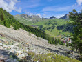
(7) Follow the path through a narrow but very pretty little valley facing north, which takes you downhill all the way to La Plagne Bellecôte.
The route ends at the La Plagne Bellecôte cable car station, in the heart of the resort (E).

Waypoints

  1. S : mi 0 - alt. 8,911 ft - Leave the station and head for the path.
  2. 1 : mi 0.94 - alt. 8,350 ft - Turn left at the fork
  3. 2 : mi 1.25 - alt. 8,143 ft - Detour to the rock and the marsh
  4. 3 : mi 1.49 - alt. 7,999 ft - Path leading uphill to the right
  5. 4 : mi 2.64 - alt. 7,470 ft - Top of the Blanchets chairlift.
  6. 5 : mi 3.23 - alt. 7,090 ft - Map of Leychoum
  7. 6 : mi 3.6 - alt. 6,873 ft - Eastern fork
  8. 7 : mi 3.84 - alt. 6,736 ft - North-facing path reserved for walkers
  9. E : mi 4.47 - alt. 6,319 ft - Arrival at the Roche de Mio cable car station

Notes

There’s no drinking water on site, but there’s a restaurant and toilets at the start of the trail.
There are also toilets at La Plagne Bellecôte.

Mountain kit is essential in case the weather changes; you’ll be at an altitude of between 2,700 and 2,000 metres, so you’ll need to bring warm and rainwear, as even during a heatwave the temperature up there is only around 18° to 20°. The sun is your only source of warmth.

Walking boots are preferable to trainers, as the stony path is slippery.
Walking poles are useful but not essential.

If you’re arriving by car, to reach the cable car, it’s best to park in the free covered car park at altitude 1,897.
A lift will take you back to the entrance to the resort’s park, where you’ll find the cable car station right in front of you.

Worth a visit

To reach the start of the trail, take the Roche de Mio cable car from La Plagne-Bellecôte (or the Belle-Plagne intermediate station, though seats for a family are less guaranteed). This will take you up to 2,700 m.
2020 price: 6 euros.

Additional information: it’s possible to go on a glacier hike in the morning and finish with this descent on foot. Allow 2 hours on the glacier, then 2 hours 30 minutes. (And a rather steep price of 20 euros)

Reviews and comments

4.3 / 5
Based on 2 reviews

Reliability of the description
4 / 5
Ease of following the route
4 / 5
Route interest
5 / 5
dougere
dougere

Overall rating : 5 / 5

Date of your route : Aug 22, 2024
Reliability of the description : Not used / Not applicable
Ease of following the route : Not used / Not applicable
Route interest : ★★★★★ Very good
Very busy route : Yes

We followed the app’s sat-nav, but we had to adjust the route several times as there were various roadworks. The unobstructed view makes it easy to find your way. The panoramic view is exceptional. The descent is easy.

Machine-translated

irslo
irslo

Overall rating : 4.3 / 5

Date of your route : Jul 19, 2022
Reliability of the description : ★★★★☆ Good
Ease of following the route : ★★★★☆ Good
Route interest : ★★★★★ Very good
Very busy route : Yes

The view from the summit is superb. Unfortunately, there’s building work right at the top, which spoils the experience a bit with all the heavy machinery coming and going, dust everywhere, and a view that’s not quite as lovely as you might expect.
Well worth a visit! (Especially once the building work is finished!!!)

Machine-translated

Other walks in the area

For more walks, use our search engine .

The GPS track and description are the property of this route's author. Please do not copy them without permission.