The blowholes from Pointe au Sel to Cap du Portail

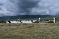
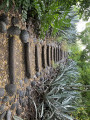
Réunion used to be a self-sufficient producer of sea salt. The salt pans at Pointe au Sel bear witness to this and are open to visitors.
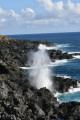
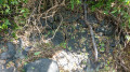
Along the coast, the rough sea crashes with such force that the water passes through the rock faces via crevices known as ‘souffleurs’. The water gushes several metres above the rocks, providing a spectacular sight.
This short walk takes you to discover the ‘souffleurs’ at Pointe au Sel.

Details

n°2712386
Creation:
Last update:
Last review:
  • Walking
    Activity: Walking
  • ↔
    Distance: 1.30 mi
  • ◔
    Average duration: 0h 40 
  • ▲
    Difficulty: Easy

  • ⚐
    Back to start: Yes
  • ↗
    Ascent: + 85 ft
  • ↘
    Descent: - 85 ft

  • ▲
    Highest point: 108 ft
  • ▼
    Lowest point: 10 ft

Photos

Description of the walk

Park at the Pointe au Sel car park.

(S/E) Take the footpath westwards towards the Pointe au Sel coast to visit the salt pans.

(1) The salt pans: a quick tour of the building and the salt ponds.

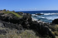
Then head closer to the coast, still heading west, to see the jumble of volcanic rocks forming the barrier battered by the sea.
‘Blowholes’ not marked on the IGN map are clearly visible.

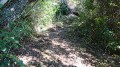
Head south over very rough terrain with no landmarks other than the paths carved out over the years, following the coastline with its beautiful coves. Reach the RN1a.

(2) Turn back and take a path running more or less parallel to the outward route to return to the starting point (S/E).

Waypoints

  1. S/E : mi 0 - alt. 23 ft - Large car park
  2. 1 : mi 0.12 - alt. 30 ft - Visit to Les Salines
  3. 2 : mi 0.79 - alt. 108 ft - When you reach the RN, turn back
  4. S/E : mi 1.3 - alt. 23 ft - Large car park

Notes

Instead, choose a fine day when the wind is blowing along the coast – it’s easy to spot, as you’ll see the white crests on the waves from a distance!
Head for the old coastal road, classified as the N1a, south of Saint Leu, then turn off at the ‘Salines’ sign and park in the large, clearly signposted car park.

This walk is very loosely based on the one described on the Réunion-based website randopitons.re, which suggests a route from Etang Salé to Saint Leu. However, its description is out of date.
Nature has reclaimed the area in many places; the path has partially collapsed just after the viewpoint (2) and, combined with the household rubbish that some inconsiderate people dump on the old main road, the view along this stretch isn’t great!

Hence our deliberate decision to focus on a remarkable viewpoint and a visit to the saltworks.
However, you can then drive about 2.5 km south to a small car park along the RN1a, to get as close as possible to another fumarole and carry on to Cap du Portail.

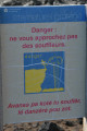
Please also bear in mind that the coastline is dangerous; the blowholes are very powerful and can knock you over onto the sharp volcanic rock, so do not go near them.
The same applies to the coves, which are sometimes frequented by intrepid swimmers; a certain level of skill is required to visit them.

Worth a visit

Saint-Leu Sea Turtle Observatory.
Mascarin Botanical Conservatory in Saint-Leu (notable for its Creole-style house).
Stella Matutina Museum on Réunion, covering its history and that of sugar cane (housed in a former distillery).
The Gol factory in Saint-Louis: during the sugarcane harvest, it’s open to visitors and is well worth a visit in its own right (book in advance and don’t be put off by the noise – headphones are provided).

Reviews and comments

4.2 / 5
Based on 2 reviews

Reliability of the description
4 / 5
Ease of following the route
4.5 / 5
Route interest
4 / 5
marine.m30
marine.m30

Overall rating : 4 / 5

Date of your route : Oct 29, 2021
Reliability of the description : ★★★★☆ Good
Ease of following the route : ★★★★☆ Good
Route interest : ★★★★☆ Good
Very busy route : No

A lovely little walk with some lovely views. The route isn’t very well signposted, but simply head uphill to enjoy the lovely views. Be careful – the rock can be very abrasive near the edge of the cliff.

Machine-translated

Orando974
Orando974 ★

Looking forward to it I also think it’s great that you’ve highlighted how dangerous the area can be in rough seas. The headland harbours some treacherous deeps!
Machine-translated

skyppyy38360
skyppyy38360

Thank you for clarifying that.

Machine-translated

Orando974
Orando974 ★

Overall rating : 4.5 / 5

Date of your route : Jan 23, 2020
Reliability of the description : Not used / Not applicable
Ease of following the route : ★★★★★ Very good
Route interest : ★★★★☆ Good

A really lovely walk. It is, however, very short, but there’s plenty to see! The ‘souffleur’ is well worth a detour when the conditions are right, and the sight of the raging sea is breathtaking! There’s a rather lovely cove with a white sandy beach near the museum and, above all, a beautiful seawater pool called ‘Bassin la Caverne’. Swimming is possible when the sea is calm. When it’s rough, the pool is more of a trap. I mapped out the route using GPS, but you can easily manage without it: just head for the blowhole. All the information about the local vegetation and the history of the area can be found in the museum. I’d just like to add this: the piton overlooking Pointe au Sel is called the Piton des Roches Tendres. It is an ancient volcanic cone dating back to the active period of the Piton des Neiges. It is this famous piton that gave Pointe au Sel its current shape. You’ll also see the basalt resulting from this lava flow. It bears this name because, to build the salt pans, rocks were collected from the piton. However, these rocks broke easily, which is how the piton got its name.

Machine-translated

Other walks in the area

For more walks, use our search engine .

The GPS track and description are the property of this route's author. Please do not copy them without permission.