
Explore the Étang de Vaccarès and pass by the Petit Sauvage ferry crossing

The Étang de Vaccarès is undoubtedly the most iconic lake in the Camargue. Often overlooked because it’s difficult to reach by car, it’s perfectly accessible by bike.
This cycle route takes you around the western part of the lake – its wildest area – and back along the Petit Rhône to discover the Bac du Petit Sauvage, a unique public ferry service.

Details

n°4082819
Creation:
Last update:
Last review:
  • Touring/Gravel
    Activity: Touring/Gravel
  • ↔
    Distance: 30.91 mi
  • ◔
    Duration according to the author: 6 hrs 
  • ▲
    Difficulty: Difficult

  • ⚐
    Back to start: Yes
  • ↗
    Ascent: + 3 ft
  • ↘
    Descent: - 3 ft

  • ▲
    Highest point: 7 ft
  • ▼
    Lowest point: 0 ft

Photos

Description of the route

Suggested starting point: Avenue de la République, Place des Gitans (Town Hall Square).

(S/E) Head north along Rue Joanin Audibert, which continues as the Route de Cacharel (D85 A)
As you leave the town, once you’ve crossed a small bridge, the Vaccarès lake will be on your right.

(1) 4 km after setting off, turn right at the Fork in the road towards “Méjanes, Chemin des Cinq Gorges”, leaving the tarmac road to follow the Chemin des Cinq Gorges, heading north.

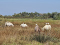
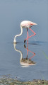
(2) On a simple round trip, a single path on the right takes you close enough to Vaccarès Lake to admire the flocks of flamingos that have come to feed.
The path is clearly marked, though a little uneven in places. It winds its way between private properties, the entrances to which are closed off.

(3) At the crossroads, large signs invite you to enter the Méjanes estate. Turn right towards the south-east. After visiting the Mas, the Manade and the Méjanes Arènes, head back the way you came.

(3) Turn left onto the Chemin des Cinq Gorges.

(2) Carry on straight ahead.

(1) Once back on the tarmac road, turn right onto the Route de Cacharel (D85A) heading north-west as far as the hamlet of Pioch Badet.

(4) Pioch Badet is the only junction with tarmac roads from the Route des Cinq Gorges. Turn left towards the south-west, driving carefully up this stretch of road (about 300 metres), as you are travelling against the flow of traffic.

(5) Turn left and head south along the D570 for about 400 metres (the road is very fast; stay well within the cycle lane).

(6) Turn right onto the D38B, heading west towards Aigues-Mortes.

(7) Turn left towards Les Saintes-Maries and follow the left-hand lane, which passes through Les Cabanes Cambon; this is less busy and joins the D38.

(8) Turn left and head south along the D38 on the cycle lane.

(9) The Sauvage ferry crossing at a place called “Le Petit Sauvage” is on your right; there is a small waiting area to the left of the ferry whilst it manoeuvres (the ferry makes a return journey every half hour).
Continue south on the departmental road; in the distance, you’ll see the church of Les Saintes-Maries rising above the rooftops.

(10) The cycle lane temporarily becomes a cycle path as it veers away from the D38, then disappears as you enter the town.

(11) Keep the harbour on your right until you reach the famous Saintes-Maries roundabout.

(12) At the roundabout, turn left to return to the Place de la Mairie (S/E).

Waypoints

  1. S/E : mi 0 - alt. 3 ft - Place des Gitans (by the town hall)
  2. 1 : mi 2.56 - alt. 3 ft - 4 km from the start, the path is on the right
  3. 2 : mi 3.82 - alt. 3 ft - A detour to the edge of the pond
  4. 3 : mi 10.37 - alt. 3 ft - Entrance to the Domaine de Méjanes
  5. 4 : mi 22.06 - alt. 3 ft - On the left
  6. 5 : mi 22.26 - alt. 7 ft - Drive down the departmental road for about 400 metres
  7. 6 : mi 22.48 - alt. 7 ft - Turn right onto the D38B heading west
  8. 7 : mi 23.64 - alt. 3 ft - Turn left towards Les Saintes-Maries
  9. 8 : mi 24.41 - alt. 3 ft - Start of the descent south of the D38
  10. 9 : mi 26.64 - alt. 7 ft - The Petit Sauvage Ferry - Petit Rhône (fleuve)
  11. 10 : mi 29.78 - alt. 3 ft - Cycle path
  12. 11 : mi 30.43 - alt. 3 ft - The harbour
  13. 12 : mi 30.82 - alt. 3 ft - Turn left at the roundabout
  14. S/E : mi 30.91 - alt. 3 ft - Arrival at Place des Gitans (by the town hall)

Notes

There are no water points or shelters, apart from the Mas de Méjanes.

This route was completed by beginners on electric bikes hired locally in Saintes-Maries. Your legs won’t get tired thanks to the electric assistance, but do remember to take a saddle cover – it’ll make for a more comfortable ride!
The wind blows from the north in the morning and from the sea in the afternoon. So you’ll often have it head-on.

If you’re tempted to carry on past the Mas des Méjanes eastwards to the Mas Neuf observatory, marked on the 1:25,000 map, forget the idea! It’s a scientific observatory for measuring plant growth rates; there’s nothing to see there now.

The 6-hour journey includes long stops for sightseeing; the actual cycling time is around 4 hours.
The roads used very often have cycle lanes, ensuring a degree of safety. A helmet and high-visibility vest are required as you’ll be outside built-up areas.

Of course, if the first leg – the return trip to the Domaine de Méjanes – is enough for you, you can return to Les Saintes-Maries from Cacharel by following the outward route.

During the tourist season, it’s almost impossible to find a parking space in the town, so bear this in mind.

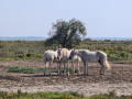
I think it goes without saying that you must never trespass onto private land; both horses and bulls are skittish and would not forgive you, even for the most beautiful photograph in the world.

Worth a visit

The Mas des Méjanes is perfectly situated to welcome you for an extended stay.
There’s a bar and restaurant in this farmhouse, which belongs to the Ricard anisette family; the history of the farmhouse is recounted on information boards.
A small tourist train takes visitors round the estate.

The Bac des Sauvages ferry runs a return service every half hour and is still free of charge, as all public services ought to be.

Visit Les Saintes-Maries, and the church in particular, to understand the town’s name and the designation of Saint Sara as the patron saint of the Romani people.

The Pont de Gau Bird Park, where birds can be observed at close quarters thanks to particularly well-positioned photography hides (3 and 5 km routes). A real treat!!

Reviews and comments

5 / 5
Based on 1 review

Reliability of the description
5 / 5
Ease of following the route
5 / 5
Route interest
5 / 5
juszczyk
juszczyk

Overall rating : 5 / 5

Date of your route : Jan 27, 2025
Reliability of the description : ★★★★★ Very good
Ease of following the route : ★★★★★ Very good
Route interest : ★★★★★ Very good
Very busy route : Yes

A brilliant route to explore by bike or on foot
Discover the wildlife of the Camargue

Machine-translated

SAULNIER Christian
SAULNIER Christian

Over the last few months I’ve printed out several walking routes, but I haven’t managed to do any of them (health issues, Covid-19, etc.)! I hope to make up for it in 2021 and I’ll share my thoughts each time.

Machine-translated

For more walks, use our search engine .

The GPS track and description are the property of this route's author. Please do not copy them without permission.

