A short circular loop near Le Sornin, starting from La Molière

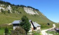
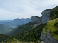
The northern part of the Molière plateau is well worth a visit for its rocky outcrops and lush vegetation.
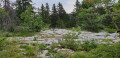
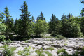
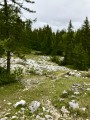
The suggested circular route follows the “Sentier des Génisses” both out and back, coming close to the Sornin without reaching it, to explore a section ofthe GR®9, which is very wild in this area, both in terms of vegetation and as it winds its way through the sharp limestone pavement.
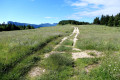
The return journey along the “Sentier des Génisses” is a delightfully gentle walk.

Details

1320658
Creation:
Last update:
Last review:
  • Walking
    Activity: Walking
  • ↔
    Distance: 4.13 mi
  • ◔
    Average duration: 2h 20 
  • ▲
    Difficulty: Moderate

  • ⚐
    Back to start: Yes
  • ↗
    Ascent: + 469 ft
  • ↘
    Descent: - 479 ft

  • ▲
    Highest point: 5,358 ft
  • ▼
    Lowest point: 4,931 ft

Photos

Description of the walk

Park in the Molière car park.

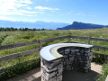
(S/E) Walk up the path, which is blocked by a chain, leading to the viewpoint heading east.
At the viewpoint, turn left towards the north to take the “Sentier des Génisses”. Pass through the meadow gate using the rollers provided.

(1) A few metres past the gate, turn right onto the path leading down towards the north-east.
It is signposted on the sign saying “Les Génisses alt: 1630” and “Sharp limestone pavement 1.6 km, Sornin 2.8 km”. The markings are yellow and green on the trees and red on the rocks along this path. Continue on to reach the hamlet of Les Lapiaz.

(2) Turn left and follow theGR®9from east to west; the sign points towards “Malatra, 1.4km”. The markings are white on red and lead to this junction.

(3) Leave theGR®9by turning left towards the south-west, towards La Molière. Head for Plénouze.

(4) Turn left, heading due south towards La Molière.
There are no further markings on the trees from this point until the end of the route.
At the hamlet of Sous Plénouze, you’ll have a partial view of the Autrans valley ahead of you, accessible via Font Chaude – do not take this route. Turn left, heading south-east, towards La Molière.

(5) At the next Fork in the road, where there are no signposts, take the right-hand branch heading south.

(1) Back at the junction you passed on the way out, continue southwards to reach the viewpoint via the Sentier des Génisses, with no further difficulties in finding your way (S/E).


Waypoints

  1. S/E : mi 0 - alt. 5,338 ft - La Molière car park - Table d'orientation de La Molière
  2. 1 : mi 0.54 - alt. 5,308 ft - Les Génisses
  3. 2 : mi 1.55 - alt. 5,039 ft - The sharp limestone pavement
  4. 3 : mi 2.52 - alt. 5,167 ft - Malatra
  5. 4 : mi 2.91 - alt. 5,344 ft - Plénouze
  6. 5 : mi 3.15 - alt. 5,292 ft - Fork in the road towards the south
  7. S/E : mi 4.13 - alt. 5,338 ft - La Molière car park

Notes

Meadow gate with rollers fitted: a device allowing walkers to pass through whilst cattle cannot.
Sharp limestone pavement: limestone concretions with surface cracks caused by the dissolution of the rock, particularly by rainwater. It is relatively dangerous to venture onto them; the risk of sprains or fractures is not insignificant.

Recommended equipment: shoes with ankle support, given the sharp limestone pavement, hence the ‘moderate’ difficulty rating
Walking poles.

No water near the route; no shelter

This route passes through a protected area, which may be subject to special regulations:

Worth a visit

The most common way to reach the start by car is via the Col de la Croix Perrin. Returning by car via the Domaine de la Sure, passing through Autrans, allows you to relax in the village after this hike.

On the section ofthe GR®9, you should be aware that you will be passing close to the famous “Gouffre Berger”, a mecca for cavers:
For the uninitiated, this is the world’s first cave with an explored depth of over 1,000 metres. It has since been surpassed, but remains a benchmark nonetheless. Do not venture out to look for it amongst the sharp limestone pavement; not only is it difficult to access and hidden, but from the outside it looks no different from any other hole in the sharp limestone pavement.

Always be cautious and plan ahead when you're outdoors. Visorando and the author of this route cannot be held responsible for any accidents occurring on this route.

The GR® and PR® markings are the intellectual property of the Fédération Française de Randonnée Pédestre.

Reviews and comments

4.7 / 5
Based on 2 reviews

Reliability of the description
5 / 5
Ease of following the route
5 / 5
Route interest
4 / 5
Séquoia 27
Séquoia 27

Overall rating : 4.7 / 5

Date of your route : Nov 09, 2025
Reliability of the description : ★★★★★ Very good
Ease of following the route : ★★★★★ Very good
Route interest : ★★★★☆ Good
Very busy route : No

Route as described.
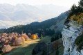
Very beautiful view at the start of the hike.

Machine-translated

tchoumi
tchoumi

Overall rating : 4.7 / 5

Date of your route : Jul 06, 2024
Reliability of the description : ★★★★★ Very good
Ease of following the route : ★★★★★ Very good
Route interest : ★★★★☆ Good
Very busy route : No

A lovely half-day walk through wide, flower-filled meadows, charming little clearings and deep woodland.
In early July, the flora is simply enchanting. Sharp limestone pavement, a formation typical of the Vercors, is a common sight along the route.

Machine-translated

Other walks in the area

For more walks, use our search engine .

The GPS track and description are the property of this route's author. Please do not copy them without permission.