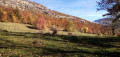
Lake Mariet in the Bauges massif

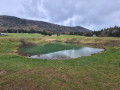
Lake Mariet owes its existence to the impermeable glacial moraines of Montagne de Bange.
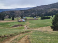
It’s an easy, short walk that takes you through the mountain pastures, dotted with numerous well-maintained chalets.
Suitable for beginners and young people given the elevation gain and distance.
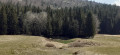
Don’t go looking too hard for a ‘lake’ – it’s more of a pond covering a few hundred square metres at the northern end of the mountain pasture.

Details

48914512
Creation:
Last update:
Last review:
  • Walking
    Activity: Walking
  • ↔
    Distance: 4.55 mi
  • ◔
    Average duration: 2h 35 
  • ▲
    Difficulty: Easy

  • ⚐
    Back to start: Yes
  • ↗
    Ascent: + 518 ft
  • ↘
    Descent: - 518 ft

  • ▲
    Highest point: 3,307 ft
  • ▼
    Lowest point: 2,884 ft
  • ⚐ Country: France
  • ⚐
    Areas: Alps, Bauges
  • ⚐ City: Arith (73340)
  • ⚑
    Start/End: N 45.713976° / E 6.066286°
  • ❏
    IGN map(s): Ref. 3332OT, 3431OT, 3431OTR, 3432OT, 3432OTR
  • Hour-by-hour weather

Photos

Description of the walk

Access by car: Arith is recognised by your sat-nav, but Montagny is not.
Coming from Lescheraines, the sign for “Arith” via the D62B is easy to spot. Once past the “Arith” town sign, carry straight on uphill; you’ll see the small “Montagny” sign in front of you.
When you arrive in Montagny, facing a beautiful chapel, turn left, following the sign for “car park 1,000 metres ahead”.
The large car park is well laid out at the entrance to the forest.

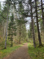
(S/E) Follow the wide forest track heading north-north-west. The sign at the entrance to the woods reads: “Montagny car park, altitude 880 m; Lac Mariet 0h50”.
The landmarks for this first section are small signs attached to the trees, coloured white with a red overlay.

(1) After barely 15 minutes’ climb, continue northwards along the wide forest track until you reach the first and only hairpin bend: 100 metres further on, on the right, is a place known as “Sous le Chênay, altitude 961 m”.
Turn right for another steep but short climb, which enters the woods, heading east, then north-west.

(2) 450 m further on, you’ll reach a Fork in the road with a wayside cross (wooden cross) at the place known as “Les Taillis, altitude 993 m”. Take the path on the right towards Lac Mariet, a 25-minute walk away, heading north. A few metres further on, ignore a small path on the right and stay on the wider path.
The signposts are now yellow on a green background. After about 300 m, you’ll reach a Fork in the road.

(3) Take the right-hand branch, signposted with a wooden sign reading “Lac Mariet”. You’ll reach the entrance to a mountain pasture (information boards).

(4) Follow the sign for “le Lac, circular route of Mariet 0h15”; turn right onto the path heading due north.
This path skirts the mountain pasture on the right.

(5) After passing a final chalet, enter the woods. The current direction indicated by the trail markers is to turn left towards the west to rejoin the main return path.
Cross the entire mountain pasture lengthways, heading south.

(4) Back in the woods, at the Fork in the road, follow the wide path on the right, signposted “Montagny car park 0h25”, which takes you back to a junction you passed on the way out.

(3) Retrace your steps along the route you took on the way out to reach the Montagny car park (S/E).

Waypoints

  1. S/E : mi 0 - alt. 2,884 ft - Montagny car park
  2. 1 : mi 0.27 - alt. 3,012 ft - Common junction. Return
  3. 2 : mi 0.98 - alt. 3,255 ft - Common junction. Return
  4. 3 : mi 1.18 - alt. 3,291 ft - Common junction. Return
  5. 4 : mi 1.48 - alt. 3,287 ft - Turn right onto the descending path
  6. 5 : mi 2.23 - alt. 3,268 ft - Junction, turn left - Lac du Mariet
  7. S/E : mi 4.55 - alt. 2,884 ft - Montagny car park

Notes

Do not stray from the route described, as:

1) The terrain is riddled with holes caused by the karst system that drains the Mont Bange.
Between (4) and (5) you will also see landslide craters. Do not venture into them; it is extremely dangerous (they are partially blocked).
2) The mountain pasture is mainly used for haymaking, so if you flatten the hay by walking on it, it cannot be salvaged. The work of the farmers must be respected.
It is advisable to keep your dogs on a lead and on the path from (4) to prevent them from straying into the mountain pasture and leaving their waste.

Signs are posted at regular intervals to remind you of this.

Walking shoes are sufficient; there are stones and roots, but no other difficulties.

On the ascent, there are several possible routes; we have chosen the one indicated by the signs, but you can vary the route. We have also chosen to walk around the mountain pasture in an anti-clockwise direction, as this seemed to us to be the most scenic route.

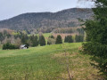
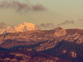
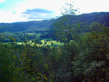
Along the forest track, there are several viewpoints over the ‘heart of the Bauges’ – Bellecombe-en-Bauge, Arith… – all framed by the Mont Charbon, a south-north-facing ridge rising from Mont Trelod (2,181 m).

Worth a visit

A warm welcome in the Bauges, perfect for a variety of hikes.
The Devil’s Bridge, further east, makes for a fitting end to this half-day hike. It’s very easy to reach from the road.

Reviews and comments

4.4 / 5
Based on 4 reviews

Reliability of the description
4.8 / 5
Ease of following the route
4.8 / 5
Route interest
3.8 / 5
Le Dex
Le Dex

Overall rating : 4.3 / 5

Date of your route : Jul 20, 2026
Reliability of the description : ★★★★★ Very good
Ease of following the route : ★★★★★ Very good
Route interest : ★★★☆☆ Average
Very busy route : Yes

To avoid the crowds, we took a few unmarked tracks (shown on the map), which made the route all the more enjoyable.

Machine-translated

atp17
atp17

Overall rating : 4.3 / 5

Date of your route : Jun 29, 2026
Reliability of the description : ★★★★☆ Good
Ease of following the route : ★★★★★ Very good
Route interest : ★★★★☆ Good
Very busy route : Yes

A lovely, pleasant walk, partly through woodland – which is a real treat in this weather

Machine-translated

Laurent WENTZEL
Laurent WENTZEL

Overall rating : 4.7 / 5

Date of your route : Aug 09, 2025
Reliability of the description : ★★★★★ Very good
Ease of following the route : ★★★★★ Very good
Route interest : ★★★★☆ Good
Very busy route : No

A pleasant and easy hike, partly through woodland, with beautiful mountain pastures. The lake is more like a pond, but the area is peaceful.

Machine-translated

chantal.raffin
chantal.raffin

Overall rating : 4.3 / 5

Date of your route : Jul 21, 2025
Reliability of the description : ★★★★★ Very good
Ease of following the route : ★★★★☆ Good
Route interest : ★★★★☆ Good
Very busy route : No

Easy route for children

Machine-translated

Other walks in the area

For more walks, use our search engine .

The GPS track and description are the property of this route's author. Please do not copy them without permission.