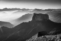
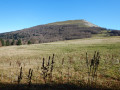
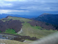
Col du Rousset, Cabane Pré Peyret and return via the Balcon du Glandasse

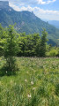
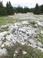
The Col du Rousset is known as the starting point for magnificent hikes towards the Vercors Regional Nature Park. You can also do a double circular route via Pré Peyret, returning via the Pas de Chabrinel and then the Balcon du Glandasse, a route that is less frequented but very pleasant thanks to its gentle ascent through the woodland. The effort required due to the elevation gain is thus spread between the morning and the afternoon, with the total hike taking around 6 hours including breaks. Hikers are advised that in hot, sunny weather, it is essential to bring a substantial supply of water, as there are no water sources on this route.

Details

98359916
Creation:
Last update:
Last review:
  • Walking
    Activity: Walking
  • ↔
    Distance: 8.64 mi
  • ◔
    Average duration: 6h 00 
  • ▲
    Difficulty: Moderate

  • ⚐
    Back to start: Yes
  • ↗
    Ascent: + 2,356 ft
  • ↘
    Descent: - 2,369 ft

  • ▲
    Highest point: 5,568 ft
  • ▼
    Lowest point: 4,508 ft

Description of the walk

Beure car park, 5 km above the main Col de Rousset station. Do not take the tunnel. Position yourself at the start of the Beure car park.

(S/E) Turn south. Ignore the path branching off to the right towards the west. Take the path climbing up the south-facing mountain pasture to reach, a little further up, a well-marked path leading straight towards the edge of the ridges. Pass close to the top of the Échelette ski lift. Continue southwards to the ridge.

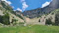
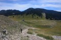
(1) At the edge of the ridge, turn left towards the east and follow it until you come to a wide stony path. (Our route passes through a valley with a panoramic view of the Grand Veymont).

(2) Turn right to descend this path, which forms part of the GR®93 (red and white markings).

(3) Once at Pas des Écondus, continue north-eastwards up the GR®93. A little further on, enter the protected park; there are no more markings but the route is clearly eastwards.

(4) Take the main path heading straight east; ignore the less clearly marked path on the left (a signpost indicates you are less than 2 km from Pré Peyret).

(5) Pré Peyret hut: leave the GR®93 and head down to the right, with your back to the refuge, heading south.

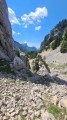
(6) Pass the Pas de Chabrinel and take great care where you step; stones roll under your feet and the slope is steep.

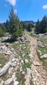
(7) At the flat section at the bottom of this difficult stretch, take the path climbing to the right into the woods towards the Pas des Écondus. You are now on the Balcon du Glandasse. The start of the climb is steep, then the path levels out and climbs gently.

(8) At the Fork in the road, continue climbing along the path on the right. The slope becomes quite steep again up to the Pas; keep your spirits up, it’s very short!

(3) At the Pas des Écondus, turn left towards the south-west, then north-west onto the GR®93 and you’ll come to a fork you passed on the way out.

(2) Continue straight on up the wide stony path, which forms part of the GR®93.

(9) After several successive climbs, you’ll reach a summit (elevation 1641m) with a single signpost. Take the path on the right heading north towards the Beure car park.This path becomes a forest track all the way to the car park (S/E).

Waypoints

  1. S/E : mi 0 - alt. 4,573 ft - Beure car park
  2. 1 : mi 1.03 - alt. 5,259 ft - Ridge, to the left - Pas de l'Échelette (1620m)
  3. 2 : mi 2.27 - alt. 5,269 ft - Crossroads 1st circular loop
  4. 3 : mi 2.57 - alt. 5,072 ft - Crossroads: 2nd circular loop - Pas des Econduis (1546m)
  5. 4 : mi 3.7 - alt. 5,430 ft - Junction
  6. 5 : mi 4.26 - alt. 5,249 ft - Cabane de Pré Peyret
  7. 6 : mi 4.57 - alt. 5,112 ft - Descent - Pas de Chabrinel
  8. 7 : mi 4.98 - alt. 4,514 ft - Junction. Path through the forest
  9. 8 : mi 6.16 - alt. 4,721 ft - Junction. Balcon du Glandasse.
  10. 9 : mi 7.26 - alt. 5,377 ft - Signpost, turn right
  11. S/E : mi 8.64 - alt. 4,577 ft - Beure car park

Notes

Equipment: sturdy hiking boots and walking poles are strongly recommended as you will be walking over scree at Chabrinel.

There is no water along the route; the Fontaine des Endettés is often dry. In hot weather, allow 3 litres per person as there is no shelter except on the return journey, at the Balcon du Glandasse, in the forest.

This route passes through a protected area, which may be subject to special regulations:

Always be cautious and plan ahead when you're outdoors. Visorando and the author of this route cannot be held responsible for any accidents occurring on this route.

The GR® and PR® markings are the intellectual property of the Fédération Française de Randonnée Pédestre.

Other walks in the area

For more walks, use our search engine .

The GPS track and description are the property of this route's author. Please do not copy them without permission.