From Sassenage to Noyarey on the slopes of the Vercors

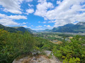
This exploratory hike along the paths on the northern flank of the Vercors should be treated as a training session if it is cold higher up. There are three viewpoints, two of which have been developed.
That said, the constant change in gradient along this route is sure to please any hiker or runner hoping to tackle the drovers' road leading to the Sornin plateau at a later date.
This walk is only enjoyable in dry weather, as the slopes become slippery after rain.

Details

3616963
Creation:
Last update:
Last review:
  • Walking
    Activity: Walking
  • ↔
    Distance: 3.77 mi
  • ◔
    Average duration: 2h 45 
  • ▲
    Difficulty: Moderate

  • ⚐
    Back to start: No
  • ↗
    Ascent: + 1,125 ft
  • ↘
    Descent: - 1,119 ft

  • ▲
    Highest point: 1,490 ft
  • ▼
    Lowest point: 656 ft
  • ⚐ Country: France
  • ⚐
  • ⚐ City: Sassenage (38360)
  • ⚑
    Start: N 45.217981° / E 5.66118°
  • ⚑
    End: N 45.24355° / E 5.631419°
  • ❏
    IGN map(s): Ref. 3235OT, 3334OT, 3334OTR, 3335OT, 3335OTR
  • Hour-by-hour weather

Photos

Description of the walk

Park in the Carrefour Market car park, which allows vehicles to park there.

(S) Head north-east up Rue des Grands Champs, cross the next junction and take the stony path along the stream, heading north-east. At the end, turn left onto Chemin des Moirons and you’ll soon reach Avenue de Valence. Cross it carefully and head west along Rue des Engenières until you reach a Fork in the road.

(1) Turn right onto Chemin des Gingeolles, which is a dead end for cars. At the end of this tarmac road, follow the footpath through the woodland, heading north, then north-north-west and finally north-west, until you reach the Belvédère des Gingeolles, situated alongside another stony track.

(2) Follow this stony track uphill to reach a plateau where signposts point towards Les Batteries.

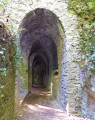
(3) Cross the field and climb the steps leading up to the now-empty fortification. Follow the path all the way through the fortification to reach the second viewing point overlooking the valley.

(4) Turn your back on the valley; on your right, you’ll see a sign at the entrance to a downhill path indicating the direction of Noyarey Saint-Jean. Carefully descend the thirty or so steps, then follow the path to reach the La Carrière crossroads.

(5) Turn left towards Noyarey Saint-Jean and Les Glairons. The path is wide and runs north-north-west.
You’ll reach the Les Glairons crossroads.

(6) Head back up the path to the left, facing the cliff, then head west towards Noyarey Town Hall. The route is marked by yellow bars on the trees. Occasionally, narrower paths lead back down; ignore these (they are marked with a Yellow Cross).

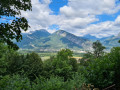
First cross the Draye de Séblou, then the Ruisseau des Balmes. Enjoy athird view of the valley at this point.
Take care in this section: there is a slightly vertiginous section protected by a safety cable on the open side. Underneath a power line, you’ll reach a junction of paths.

(7) Keep following signs for ‘Noyarey Mairie’ until you reach the village, at a place called Le Maupas.
Notes on this section: the route winds a little at times, and whilst there are numerous possible paths, the direction is clearly marked.
Finish by walking down Rue du Maupas to reach Noyarey Town Hall (E).


Waypoints

  1. S : mi 0 - alt. 663 ft - Supermarket car park
  2. 1 : mi 0.46 - alt. 666 ft - At the fork in the road, turn right onto the Chemin des Gingeolles
  3. 2 : mi 1.23 - alt. 1,145 ft - Gingeolles Viewpoint
  4. 3 : mi 1.58 - alt. 1,316 ft - Crossing the meadow
  5. 4 : mi 1.73 - alt. 1,417 ft - A well-hidden path towards Noyarey
  6. 5 : mi 1.86 - alt. 1,217 ft - At the crossroads, turn left
  7. 6 : mi 1.99 - alt. 1,214 ft - Path facing south
  8. 7 : mi 3.17 - alt. 1,234 ft - Crossroads beneath the power line
  9. E : mi 3.77 - alt. 669 ft - Town Hall

Notes

No water points, no shelters.
You’ll need footwear with grippy soles – not necessarily high-top boots – and walking poles are recommended for walkers. Runners will find this an almost complete training ground. For your information, there are mountain bike tracks here.
As you will all have gathered, the initial direction is towards Noyarey Saint-Jean, then on to Les Glairons and Noyarey Town Hall.
The batteries are the remains of the ‘Iron Defence’ following 1870.

Worth a visit

(E) The return journey can be made either:
- on foot across the plain, following the communal paths to explore the vegetable gardens tended by local market gardeners. This involves heading north from Sassenage along the Chemin de Pra Paris to the River Isère, then heading east along the Furon Canal and up Rue de Clémencière in Sassenage to return to the starting point,
- by bus, taking the number 20.

Reviews and comments

4.3 / 5
Based on 2 reviews

Reliability of the description
4.5 / 5
Ease of following the route
4 / 5
Route interest
4.5 / 5
elisacharlotte
elisacharlotte

Overall rating : 5 / 5

Date of your route : Aug 11, 2025
Reliability of the description : ★★★★★ Very good
Ease of following the route : ★★★★★ Very good
Route interest : ★★★★★ Very good
Very busy route : No

Superb hike
The forest is simply magical
Some steep but accessible sections
However, I recommend using walking sticks and perhaps avoiding this hike in wet weather as the path can be slippery

Machine-translated

Kirib
Kirib

Overall rating : 3.7 / 5

Date of your route : Jun 25, 2023
Reliability of the description : ★★★★☆ Good
Ease of following the route : ★★★☆☆ Average
Route interest : ★★★★☆ Good
Very busy route : No

The route itinerary is accurate

Machine-translated

Other walks in the area

For more walks, use our search engine .

The GPS track and description are the property of this route's author. Please do not copy them without permission.