


 Country:

 City:
City:


Access by car towards Uvernet-Fours; enter ‘Col de la Cayolle’ into your sat-nav. Le Villard d’Abas is situated on the D902, a narrow road requiring careful driving. Drive past Le Villard for about a hundred metres, cross a bridge over a stream and park just after the Maison Technique, on the right as you go uphill (4 spaces).
(S/E) Get kitted out and head back down the D902 towards the west for about 800 metres. Avoid the two or three tracks on the right, as they are private. In particular, avoid the Chemin du Serret; a rather humorous sign marks the private property. It serves as a landmark, incidentally, as the path begins 150 metres further down on the right, before the bridge spanning a small torrent.
(1) Turn right towards the north and follow the path uphill (signpost: “Villard d’Abas Fuvaux, alt 1502 m, Baume Longe 4 km”. The estimated time is 1h00, but it took us 2 hours!). After about 100 metres, level with a house on the right, follow the path as it turns left, heading west. Yellow markings are quite sparse. Climb the steep slope, crossing all the valleys, until you reach Baume Longe, where there are ruins.
(2) Turn your back on the ruins, facing east, and climb the least visible path opposite, heading towards Ravin Pasquiers. This takes you back over the first ascent and then into a forest.
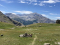
(3) At the crossroads, turn right, heading south (signpost: ‘Ravin Pasquiers Alt 2040 m, towards Col de Cloche 0.4 km’). Climb the rest of the slope until you reach the Col de Cloche. End of the ascent! Cross the mountain pastures via Cloche and then the Pré de Cloche.
(4) At Pré de Cloche (altitude 1,969 m), take the path on the right heading south, ignoring the one that continues eastwards (signposted “Villard d’Abas, le Serre, 2 km”)
(5) As you approach the village, there’s a small gate to open and close which passes over a private property and then runs alongside it (two barking but friendly dogs). Cross the tarmac road leading to this property and take the path heading down towards the south. You’ll reach the car park (S/E); be careful, as the final steps along the stream are very steep.
 Visorando Member
 Difficult
 Tourist office
 Easy
Easy 
