


cathyferrer

 Visorando Member
 Premium user
- Location: Davézieux (07430)
- Gender: woman
Sign up:
Published route(s)
 Towards the heights of Saint Sauveur-en-Rue to the west of Bourg-Argental
 8.77 mi
 +1,526 ft
 -1,522 ft
 5h 20
 Moderate
 Departure from Bourg-Argental (Loire)
A hike west of Bourg-Argental, towards Saint-Sauveur-en-Rue, between the Déôme and Riotet valleys. Beautiful views at Ss Montchal and the Taillard Forest, to the east towards the Alps and to the north towards the Col de la République. A route alternating between very quiet roads and good paths and trails.
From the Col d’Oderen to Drumont via La Hutte
 10.48 mi
+2,405 ft
-2,392 ft
6h 55
Moderate
Departure from Ventron (Vosges)
Explore the Vosges mountains, from the Col d’Oderen to the summit of the Drumont at an altitude of 1,200 metres, with its sturdy orientation table and views over the Vosges and Alsatian peaks.
There are numerous shelters along the route.
Circular route at Hauterives
11.54 mi
+945 ft
-958 ft
6h 10
Moderate
Departure from Hauterives (Drôme)
A circular route starting from Hauterives, in the Drôme hills, with beautiful views of the Pilat Massif, the Vercors and the Alps.
From Izeaux to Saint Paul and Parménie
 11.42 mi
+1,959 ft
-1,975 ft
6h 55
Moderate
Departure from Izeaux (Isère)
A hike through the Isère hills between the Bièvre plain to the north and the Isère plain to the south. Explore the religious site of Notre-Dame des Croix in Parménie, with spectacular views of the Chartreuse, the Alps and the Vercors from the orientation point there.
West of Chantraine between the forest and the lake
 9.59 mi
+682 ft
-689 ft
5h 00
Moderate
Departure from Chantraine (Vosges)
A hike through the beautiful Vosges forest to Lac de Bouzey with some historical remains.
From Saint-Barthélémy-De-Vals to Claveyson
11.92 mi
+889 ft
-866 ft
6h 15
Moderate
Departure from Saint-Barthélemy-de-Vals (Drôme)
An easy walk through the Drôme hills, including a section near the River Galaure. The route alternates between quiet roads, pebbly or very sandy paths, and deep ravines carved out by erosion.
West of Savas in the Annonay Basin
8.30 mi
+1,417 ft
-1,440 ft
5h 05
Moderate
Departure from Félines (Ardèche)
A circular route to the west of Savas from the Col du Fayet to the hamlet of Éteize, offering beautiful views of the Annonay Basin.
Around Tence in the land of daffodils
 11.77 mi
+1,266 ft
-1,257 ft
6h 30
Moderate
Departure from Tence (Haute-Loire)
Circular route between Tence and Chenereilles, between the Velay and the Lignon. A chance to explore the beautiful town of Tence with its rather exceptional stone architecture, even out in the countryside.
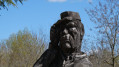
East of Hauterives
 11.46 mi
+938 ft
-925 ft
6h 05
Moderate
Departure from Hauterives (Drôme)
A walk through the Drôme hills, offering sweeping views and few forests.
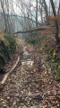
In Ampuis, between the Rhône, vineyards and forests.
 11.14 mi
+1,677 ft
-1,670 ft
6h 35
Moderate
Departure from Ampuis (Rhône)
Discover the fantastic vineyards on the slopes of Ampuis. With beautiful forests in the hinterland, then a return to the Rhône river with magnificent views of the Pilat massif, the Alps and the Rhône valley.
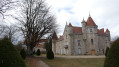
North-east of Saint Romain-Lachalm
 11.84 mi
+1,181 ft
-1,184 ft
6h 30
Moderate
Departure from Saint-Romain-Lachalm (Haute-Loire)
A long but easy hike on the plateau towards Saint-Romain-Lachalm in a landscape alternating between meadows, forests and rivers. Beautiful farm buildings still in use or converted. Crossing the Bois des Cartaires with its oratory dedicated to the Virgin Mary.
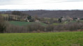
From the village of La Chapelle-de-Surieu to the chapel at La Salette
 11.34 mi
+1,056 ft
-1,056 ft
6h 10
Moderate
Departure from La Chapelle-de-Surieu (Isère)
Across the Isère hills between the Varèze and Sanne valleys to the Chapel of La Salette in Bellegarde-Poussieu.
From Sarras to Ardoix through forests and streams to the north, then the southern ridge.
 11.77 mi
+2,169 ft
-2,165 ft
7h 20
Moderate
Departure from Sarras (Ardèche)
A rural hike along small paths that run alongside streams on the right bank of the Cance valley to near Ardoix and back via the classic ridge route leading back to Sarras.
From Salaise through the orchards towards the prison and the Tour d’Anjou
9.31 mi
+732 ft
-712 ft
4h 55
Moderate
Departure from Salaise-sur-Sanne (Isère)
In the plain between Salaise and Anjou, amongst the fruit trees, exploring the ruins.
From Rehaupal to the Roches de la Moulure and the Tendon waterfalls
 11.91 mi
+1,726 ft
-1,716 ft
7h 00
Moderate
Departure from Rehaupal (Vosges)
From the village of Rehaupal, a circular walk passing through the Roches de la Moulure, the Tendon waterfalls and the Trou de l’Enfer
The Ardèche countryside south-west of Ardoix
 8.16 mi
+774 ft
-745 ft
4h 25
Moderate
Departure from Ardoix (Ardèche)
Walk in the Ardèche foothills with interesting heritage sites.
The Serre de La Roue from Saint-Barthélémy-Grozon
 13.33 mi
+2,119 ft
-2,139 ft
8h 00
 Difficult
Departure from Saint-Barthélemy-Grozon (Ardèche)
A stretch of up to 1,000 m between the regions of Lamastre and Vernoux in the Ardèche mountains.
Roiffieux and Quintenas from Saint-Alban-d’Ay
 11.24 mi
+1,138 ft
-1,135 ft
6h 10
Moderate
Departure from Saint-Alban-d'Ay (Ardèche)
A walk across the Ardèche plain south of Annonay and through the lower foothills of the knolls of the Suc de Vent.
North-west of Saint Alban d'Ay
 7.81 mi
+1,086 ft
-1,096 ft
4h 30
Moderate
Departure from Saint-Alban-d'Ay (Ardèche)
A hike in the Ardèche countryside at the foot of the Roche des Vents.
Around Quintenas
 8.13 mi
+499 ft
-479 ft
4h 10
Moderate
Departure from Quintenas (Ardèche)
An easy route around the village of Quintenas with beautiful views, well-maintained trails and heritage sites restored by volunteers from the local community.
Villevocance and Vanosc from the north
10.74 mi
+1,716 ft
-1,699 ft
6h 25
Moderate
Departure from Villevocance (Ardèche)
Exploring the southern flank of the Vocance Valley between Villevocance, Vanosc and the ridges to the north.
From the Déôme Valley to Burdignes
7.70 mi
+1,516 ft
-1,493 ft
4h 50
Moderate
Departure from Saint-Marcel-lès-Annonay (Ardèche)
A route along the northern edge of the commune of Burdignes, passing through the village. Near Bourg-Argental, a route along the newly created Via Fluvia.
Between Ardèche and Haute-Loire, from Saint-André-en-Vivarais to Mas-de-Tence
 11.62 mi
+1,266 ft
-1,247 ft
6h 25
Moderate
Departure from Saint-André-en-Vivarais (Ardèche)
On the plateau between Ardèche and Haute-Loire, hike through the hills and valleys of the forest. Discover some very interesting buildings and enjoy a breath of fresh air.
The Lignon circulars, the footbridge and the Greenway near Grazac
 13.43 mi
+2,228 ft
-2,241 ft
8h 05
Difficult
Departure from Grazac (Haute-Loire) (Haute-Loire)
A winding hike near the magnificent Lignon Gorges, crossed by a Himalayan footbridge, with beautiful landscapes over the knolls of the Pays d'Yssingeaux. The path on the Greenway to the south will reveal the beautiful landscapes of the Lignon Gorges.
Vaudevant and Montplot from Saint-Victor
 11.40 mi
+1,670 ft
-1,663 ft
6h 40
Moderate
Departure from Saint-Victor (Ardèche) (Ardèche)
A pleasant hike in the Ardèche foothills and the lands of the legendary "L'Ardéchoise" cycling race.
From Saint-Jeure-d'Ay to Chantelermuse in a circular route
 8.29 mi
+1,329 ft
-1,306 ft
5h 00
Moderate
Departure from Saint-Jeure-d'Ay (Ardèche)
Hike in the northern Ardèche countryside with beautiful views and interesting heritage.
From Bourg-Argental to La Versanne
7.53 mi
+1,480 ft
-1,476 ft
4h 45
Moderate
Departure from Bourg-Argental (Loire)
Walk in the countryside at the foot of the Pilat massif with beautiful views and interesting heritage.
From Saint-Vallier to Beausemblant via the Blacheronde plateau
11.07 mi
+1,703 ft
-1,693 ft
6h 35
Moderate
Departure from Saint-Vallier (Drôme) (Drôme)
From the banks of the Rhône, climb up to the Blacheronde plateau and follow a circular route via Combe de Laye and the village of Beausemblant. Beautiful views of the Pilat and Vercors mountains and the Rhône valley. You can take a final break in the park along the Galaure river.
The Coulmes Forest between Presles and the Rochers du Ranc
 10.69 mi
+2,365 ft
-2,365 ft
7h 00
Moderate
Departure from Presles (Isère) (Isère)
A microcosm of the Vercors in the Coulmes forest, with its viewpoints, chasms, caves and springs.
The dam route from Tarentaise
 9.81 mi
+1,575 ft
-1,562 ft
5h 55
Moderate
Departure from Tarentaise (Loire)
This hike will take you to the north face of the Pilat massif and the Mézenc plateau, with beautiful forest crossings. Enjoy the coolness of the two dams visited and climb a rock to admire the rugged landscape of the Gouffre d'Enfer.
Peaks around Pailharès
 10.59 mi
+1,988 ft
-2,011 ft
6h 35
Moderate
Departure from Pailharès (Ardèche)
From the village of Pailharès at 690 m to the Buisson, Faux and Marchand passes via the Serre du Sardier at 1200 m. Discover the Ardèche landscape stretching to the edges of the Mézenc and Gerbier de Jonc massifs.
Pic du Lizieux and the Meygal Massif
 13.19 mi
+2,257 ft
-2,280 ft
8h 00
Moderate
Departure from Araules (Haute-Loire)
At the summit of the ancient volcanoes between Pic du Lizieux and the Meygal Massif.
A breath of fresh air in the vast Meygal Forest Massif.
A circular east of Peyrins
 10.70 mi
+1,168 ft
-1,165 ft
5h 55
Moderate
Departure from Peyrins (Drôme)
A beautiful hike in the Romanais region with magnificent views of the Isère valley and the Vercors to the east and the Vivarais mountains and the Mézenc massif to the west.
Lac des Meinettes in Saint-Jeure-d'Ay
 8.02 mi
+735 ft
-732 ft
4h 20
Moderate
Departure from Saint-Jeure-d'Ay (Ardèche)
On the Ardèche plateau, starting from the village of Saint-Jeure-d'Ay, along Lac des Meinettes and through the hills.
From Trois Croix to Chaussitre
 8.22 mi
+866 ft
-843 ft
4h 30
Moderate
Departure from Saint-Genest-Malifaux (Loire)
Hike on the plateau from the Col de la République between Saint-Genest-Malifaux and Saint-Régis-du-Coin.
The Isère countryside around Notre-Dame-de-l'Osier
 10.38 mi
+1,430 ft
-1,434 ft
6h 00
Moderate
Departure from Notre-Dame-de-l'Osier (Isère)
In the hills between the Chambaran forest and the Isère valley, discover beautiful nature and interesting heritage.
Viewpoints and vineyards above the Rhône
 7.62 mi
+1,322 ft
-1,345 ft
4h 40
Moderate
Departure from Gervans (Drôme)
Hike along the ridge above the Rhône through villages, vineyards and forests with beautiful views.
From Saint-Martin-des-Rosiers to the Tower of Albon
 7.64 mi
+968 ft
-988 ft
4h 20
Moderate
Departure from Albon (Drôme)
Among the valleys of the Drôme, overlooking the Rhône plain.
From Quintenas to the streams of Goueille and Manoha
 8.48 mi
+965 ft
-965 ft
4h 45
Moderate
Departure from Quintenas (Ardèche)
Walk on the plateau between Quintenas and Ardoix with an exploration of the Goueille and Manoha streams.
Moderator's note Difficulty between (3) and (4), see reviews.
Le Faz, La Lunette and the Coulmes forest
 8.97 mi
+2,333 ft
-2,323 ft
6h 10
Moderate
Departure from Saint-Pierre-de-Chérennes (Isère)
Hike on the Vercors plateaus between cliffs and the Coulmes forest.
Between agriculture and heritage in Saint-Marcel-d'Urfé
 11.77 mi
+1,969 ft
-1,978 ft
7h 10
Moderate
Departure from Saint-Marcel-d'Urfé (Loire)
A hike to an altitude of nearly 1,000 metres, through a farming landscape where you will encounter ancient heritage.
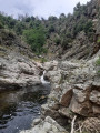
The Gorges de la Daronne and the Clauzel Dam
 10.67 mi
+2,077 ft
-2,067 ft
6h 45
Moderate
Departure from Saint-Victor (Ardèche) (Ardèche)
A discovery from Deyras of the wild valleys of the Jointine, the Daronne and the Doux to the Clauzel Dam.
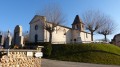
The Isère between Bièvre and Terres Froides
 12.80 mi
+1,749 ft
-1,722 ft
7h 25
Moderate
Departure from Gillonnay (Isère)
Route along the ridges between the plains of Bièvre and Liers with beautiful views of the Alpine foothills. Villages with beautiful Dauphiné architecture, castles and ruins, pilgrimage sites.
The northern Drôme via ridges and valleys
 12.68 mi
+1,827 ft
-1,850 ft
7h 25
Moderate
Departure from Saint-Avit (Drôme) (Drôme)
A hike following ridges and valleys, discovering charming villages and hamlets.
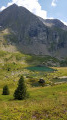
The lake plateau from Poursollet
 5.69 mi
+1,781 ft
-1,785 ft
4h 10
Moderate
Departure from Livet-et-Gavet (Isère)
A walk at the foot of the Taillefer massif amongst the many lakes.This walk passes through a Natura 2000 site and is subject to specific regulations. Please respect these.
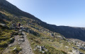
The Pas de la Mine and Lake Brouffier
 5.77 mi
+2,703 ft
-2,700 ft
5h 00
Difficult
Departure from La Morte (Isère)
All levels of the mountain up to the Pas de la Mine at 2,500 metres: forest, stubble and then red rocks.
Cool temperatures near Lac Brouffier.
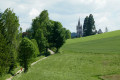
History and landscapes of Marlhes
 13.53 mi
+1,768 ft
-1,749 ft
7h 45
Difficult
Departure from Marlhes (Loire)
Enjoy a breath of fresh air in a part of Pilat that is full of valleys and rich in religious history.
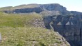
From Font d'Urle to Puy de la Gagère via the plateau and the La Chau memorial
 9.62 mi
+1,801 ft
-1,798 ft
6h 00
Moderate
Departure from Bouvante (Drôme)
Enjoy a change of scenery on the rugged limestone plateau and meadows. Then take a leap into the history of the Resistance.
 Easy