Country:

 City:
City:


Access to the town of Hauterives via the D51 road, to the east of the Rhône valley, from the town of Saint-Vallier, situated on the main Rhône route.
Start from the town centre at the car parks on the Quai de La Galaure, with tables and benches nearby.
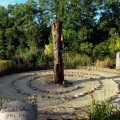
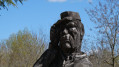
(S/E) Set off north-eastwards towards the small site with a wooden statue of Facteur Cheval.
(1) Set off along Rue Étienne Vassy, passing a care home, then the emergency services centre on the right. You’ll reach Route de Roybon; cross the road carefully and walk along the pavement on the left-hand side for 100 metres until you reach Impasse Des Roches, which leads uphill to the left.
(2) Follow the path uphill for 750 m until you reach the end of the tarmac section, then turn right onto the path to pass close to the hamlet of Reguine, situated on your right.
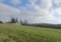
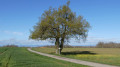
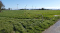
(3) You’ll come to a tarmac section again and cross the meadows, passing a remarkable tree on your left. You’ll reach the junction with Route de Fayardaie.
(4) Turn right towards the water reservoir and go round it on the right before continuing left onto Route de Fayardaie. You’ll reach the large Fayardaie farm, which you should go round on the left.
(5) 100 m from the farm, continue along the road on the right, ignoring the path leading straight ahead. Walk through the Levaux farm buildings, then arrive at a junction with a wind turbine opposite.
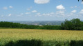
(6) Cross the road and take the path opposite, which winds its way amongst the wind turbines. Ignore a path branching off to the left towards a house. 600 m after this path, you’ll reach a junction with several paths. Ignore all the paths on the left and follow the one branching off to the right, across the meadow. After 100 m, you’ll reach a path.
(7) Follow the path to the right, along the edge of the forest. You’ll reach a tarmac section at a place called La Chana. Continue down the road, passing through the houses at Frandonnage, then Le Thon, until you reach a junction; follow the road leading to the right. After 100 m, you’ll reach a main road (D137). Watch out for traffic. Follow this road carefully for 250 m.
(8) When you see a farm, leave the road and follow the Chemin des Bessées off to the left. The path, which is flat, passes close to the Revolon house on the right and then leads to the Bessées amusement park on the left. After 600 m, ignore a road leading uphill to the right. After walking straight on, you’ll reach a major road (D51).
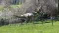
(9) Cross the Route de Roybon with care and continue straight on along the Route de Perottière. Cross the River Galaure via the footbridge or the ford if the water level is low. 100 metres after the ford, take the road on the right. After 150 metres, leave the road and head uphill along the path on the left. Walk alongside a wildlife park, situated on the left in the forest. Cross a stretch of meadows to reach a road.
(10) Follow the road to the right, then pass close to the Bonne Combe Chapel. Walk uphill until you reach a junction and continue straight on for 50 metres past this junction.
(11) At the Gengonnière crossroads, take the road on the right for 600 m and, near a house on the right, take the path opposite. The path becomes a road and then curves to the left, downhill, to reach a crossroads.
(12) Take the road on the right for 250 m. Look out for and take a path leading downhill across the meadows. You’ll reach the Route du Châtelard; follow it to the left.
(13) At the next junction by the sports centre, turn right and cross the leisure area. At the far end of the sports centre, cross the River Galaure via the footbridge.
(1) Turn left and return to the starting point (S/E).




 Visorando Member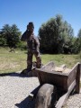

 Easy
Easy