Country:

 City:
City:


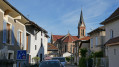
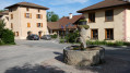
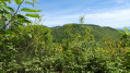
The walk starts from the village of Izeaux in the Isère department. It lies north-west of Grenoble and south-east of Grenoble/Isère Airport. Access from Grenoble is via the D1085 road, then the D519 near the village of Beaucroissant.
Parking in the village centre on Rue Albert Reynier.
(S/E) Start from the car park on Rue Albert Reynier, opposite the school. Head back north-west to Place de La Liberté.
(1) Turn left and cross the square, then follow Rue Ampère straight ahead. At the end of the street, turn left onto Rue Du Moulin and continue for 300 m. Ignore Rue Émile Zola on the left and leave Rue Du Moulin.
(2) Turn right onto Route du Plan and continue towards the stream. Cross the stream and walk uphill for 200 m until you reach a bend in the road to the right.
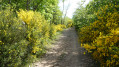
(3) Leave the road and turn left onto the grassy path. The path winds its way through meadows and willow groves until it reaches a crossroads.
(4) Continue along the road rising to the left for 150 m, then turn right up a steep slope towards the cemetery. Walk alongside the cemetery on your right until you reach the village centre and the town hall of Saint-Paul-D’Izeaux.
(5) Turn right onto Rue de La Fontaine. After 50 m, follow the road downhill to the right. After 100 m, turn left uphill onto the Fon du Bru road, which then becomes a path leading uphill through the forest and on to meadows. You’ll reach a road near a house on the right.
(6) Continue along the road to the right, heading downhill, to pass through the hamlet of Girin. At the three-way junction in the hamlet, head uphill to the left. After winding in a ‘Z’ shape, the road passes close to some buildings on the left before reaching a crossroads at the hamlet of La Tuilière. Follow the path on the right towards the forest. After 350 m, you’ll come to a water reservoir.
(7) Ignore the path on the right and continue along the path to the left of the reservoir. After 300 m, you’ll reach a path coming from the right; turn left here. After 650 m, ignore a signposted path leading downhill to the right. Then, 800 m further on, ignore another signposted path to the right.
(8) The path then curves to the left, descending steeply over very stony ground. After 400 m, the path takes a sharp right-hand bend before continuing through the meadows. You’ll reach a flat area and a tarmac section with a car park.
(9) Set off up a steep climb along the path on the left through the meadows. The path curves to the left before reaching the forest.
(10) Turn right, ignoring a path leading uphill to the left. Pass below a meadow on the left before reaching the woodland again. After 150 m, turn left, then after 50 m turn right, before walking 300 m in a straight line downhill. The path curves to the right and, after 150 m, reaches a flat area with several paths.
(11) Ignore a path branching off to the left and head straight on to the left of a large tree marked with a yellow sign. The deeply rutted path descends steeply over very stony ground. After 400 m, continue down a hairpin bend to the right, ignoring a clearly marked path branching off to the left. After 150 metres, you’ll reach the D43e.Take care – watch out for traffic.
(12) Head left along the road for 250 m before taking the road uphill to the right towards Parménie. Follow the road uphill until the first right-hand bend. At the edge of the forest, 100 m on, leave the road as it curves more gently to the right.
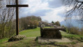
(13) At this point, you will make a return trip to Parménie. Follow the path through the woodland uphill for 200 m. Then turn sharply to the right and go round a gate to follow the Way of the Cross branching off to the left, arriving opposite the buildings at Parménie. Go round them on the left.
(14) Follow the path through the woodland to reach the meadow and the orientation table. Head westwards, following the edge of the forest as it climbs along the edge of the meadow. Near the end of the meadow, turn right onto a path leading back to the right of the buildings. Visit the buildings, including the chapel and the old fountains in the meadow on the right. Return via the Stations of the Cross route taken on the way out. Go round the gate and rejoin the path leading down through the woodland.
(13) Walk a few metres along the road, then turn slightly right onto the path running alongside the meadow. The path clearly crosses the forest, with a steep, stony descent. Before reaching a flatter section and a path.
(15) Take the path to the right for 850 m before a sharp bend to the left. After 100 m, ignore a path coming from the right. Then, 200 m further on, ignore a path branching off to the left and follow the narrower path almost directly opposite. You’ll reach a road.
(16) Follow the road to the left towards the village. Note the “La Grange Aux Érables” estate on the right, where exceptional plant species thrive. Ignore a road branching off to the right and take Rue Bayard opposite to reach Place de La Liberté directly ahead.
(1) Turn left onto Rue Albert Reynier to return to the car park (S/E).

 ,
,
 Visorando Member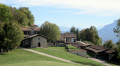

 Easy
Easy