Country:

 City:
City:


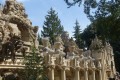
Hauterives is situated to the north of the town of Romans-sur-Isère. Access to Hauterives from the Rhône valley is via the town of Saint-Vallier, heading east on the D51. Car park at Quai de la Galaure in the town centre, near the River Galaure, close to the renowned Palais Idéal du Facteur Cheval.
(S/E) From the centre of Hauterives, at Quai de la Galaure, head east to the far end of the car park and cross the River Galaure via the footbridge on the right. Walk through the sports complex heading south-east, then south along the Route du Laris. After 400 m, you’ll reach a junction with the Route du Châtelard; turn left onto this road and follow it for about 300 m.
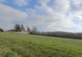
(1) Opposite the houses on the left, leave the road and follow the path uphill through the meadow. Cross the meadow and reach the D187.
(2) Follow this road to the left for 200 m, then take the steep climb up the road on the left, the Impasse de Piache Nord. After the houses, the road becomes an uphill track and then levels out.
(3) Follow the track for 1,800 m until you reach a junction with a road coming from the left at a place called Gengonnière. Turn right to go past the riding club, then head down towards the junction with the D187.
(4) Cross the departmental road with care and take the ascending road opposite, the Route du Laris. Follow this road for 1,200 metres and ignore the Route du Fayet coming from the right. Continue for 100 metres.
(5) Leave the Route d’Hauterives and turn slightly right onto the Chemin des Petites Balaises. Follow the track as it curves to the left and then to the right, passing the Bouretière lodge on your right. Walk alongside a large meadow on your left before crossing the woodland. Walk past the Naiseau house and, 250 metres further on, you’ll reach a road.
(6) Take the Chemin du Polonais, which winds sharply to the left, to reach a house on the left. The road then becomes a grassy path leading downhill. 400 m past the house, leave the downhill path and take the path that winds sharply to the right. After 700 m, you’ll reach the centre of the hamlet of Le Charaix. Ignore the road branching off to the left.
(7) Set off along the path rising slightly to the right. Note the old church with its cemetery on the left; you can walk round it. At the end of the ascending path, you’ll reach the Route d’Ambouchet; cross it and continue straight ahead. Follow this road for 1,000 m until you reach a water reservoir and a telecoms mast. Leave the road and take the path on the left into the woods. After 400 m, you’ll reach the D538.
(8) Cross the departmental road carefully on the right and take the path heading north, running alongside the road. You’ll reach a riding centre; head downhill to the left, skirting the facilities on your right. Follow the descending path to the hamlet known as Les Simians, then reach a crossroads 200 m from the hamlet.
(9) Take the Route de Charmes, which winds sharply to the right for 400 m. At a left-hand bend, where a path branches off to the right towards the houses, leave the road and take the path on the left for 100 m. Join a road and follow it to the right.
(10) After 150 m, ignore a road branching off to the right, cross the La Vermeille stream and continue in a straight line below the village of Tersanne for 700 m.
(11) After the last houses, leave the road and turn right onto the Chemin des Marnières, which leads into the village on the Route d’Hauterives. Turn right and head uphill for 300 metres towards the village centre.
(12) Before reaching the village centre, take a sharp left onto the Chemin des Combales. Follow this track for 650 metres to the last houses. Then head straight ahead along the grassy path which goes round the fence and joins a main track. Follow the path leading downhill to the left, until you reach some old farm buildings on the right. You’ll arrive at the D121 road.
(13) Clearly follow this road downhill to the right. At a sharp bend to the right, ignore the road leading off to a telecoms mast on the left. After passing through a section of woodland, walk alongside the houses in Montlivier on your left.
(14) Immediately after the houses, leave the road and take the path almost directly opposite, heading towards the village. Reach the River Galaure and cross it via the footbridge.
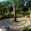
(15) Walk past the cemetery on your right. You can visit Facteur Cheval’s tomb there if you wish. Turn right and walk 100 metres towards the old cross, then follow the Chemin des Maréchaux to the right, and then turn left onto the Rue de l’Ancienne Église. Walk past the houses on your left and continue along the Chemin du Vivier, which leads onto the village’s main street, the Rue de la Vallée.
(16) Turn right towards the roundabout, then right again towards the river. Before crossing the river, turn left onto the Quai de la Galaure, which takes you back to the car park (S/E).

 Visorando Member

 Easy
Easy