


 Country:

 City:
City:



Access to the village of Saint-Alban-d’Ay, 8 km south-west of Annonay, via the D578A road linking Annonay to Satillieu. Car park near the community hall on the left as you enter the village from Annonay to the north-east.
(S/E) From the car park, head north towards the main road.
(1) Turn right onto Rue de La Fontaine and follow it for 200 m. At the first junction, leave the main road and follow Route des Vignes, which is almost directly opposite on the left. After 400 m, opposite a house, take the path leading down to the right until you reach a road.
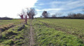
(2) Turn left onto the road, which then becomes a dirt track. Ignore the paths and tracks on either side. The track, which runs almost in a straight line, leads unambiguously to a road at a place called Chardon. Follow the road to the right for 300 m until you reach a crossroads and a cross on the left.
(3) Turn left onto the path leading downhill to reach a road.
(4) Follow the road to the right for 150 m until you reach a main road (D578a). Watch out for traffic. Cross this road and turn left onto the Chemin des Cluzeaux. After 300 m, ignore the path that continues straight ahead and joins the main road.
(5) Turn right at a right angle towards the houses at Les Cluzeaux. You’ll reach the houses at Anty; turn left onto the Chemin d’Anty. You’ll reach the D578. Watch out for traffic. Cross the road and continue straight ahead along the Route de Brezenaud for 500 m until you reach a junction.
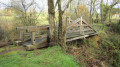
(6) Turn right onto the Route de Fély towards the hamlet of Fély. Pass through the hamlet and then take the first street on the left for 250 m until you reach a roundabout. Turn right at a right angle onto a tarmac section which then turns into a dirt track. Cross a stream and arrive at a fork at the edge of the forest.
(7) Take the path on the left to reach a road. Turn right onto the road and follow it for 1 km until you reach a main road (D578). Watch out for traffic. Cross the road and continue straight ahead along the Allée de Maure, which runs alongside a large, walled property on your right. You will reach a crossroads.
(8) Head south, almost straight ahead, along the Chemin de La Quintenassienne. This wide track runs almost in a straight line for 2 km. Cross a first small road, then reach a second road and a junction. Turn right towards the hamlet of Le Vialot along an uphill road.
(9) Ignore a road branching off to the right, then another to the left, and continue uphill along a dirt track until you reach a junction with a road near the farm buildings on the left. Ignore the road branching off to the right and head straight ahead along the track. Walk past the hamlet of Ceytère on your right and ignore a path coming from the right. Walk alongside a concrete wall on your right until you reach a large road junction.
(10) Watch out for traffic. Cross the main road towards the bus shelter. Head straight on towards the west along the uphill road known as the Chemin du Moulin à Vent. Ignore a path branching off to the right towards the Forêt du Grandbeau and follow the path climbing south-west. Walk alongside the forest and the Grandbeau sports ground. Reach the hamlet of Les Chaux on your left and the tarmac road. At the end of the hamlet, ignore a road leading down to the right and continue straight on, uphill towards the forest. Before the road turns right, a wide forest track appears on the right.
(11) Follow this to the right, heading due north, uphill, for 1,200 metres, ignoring any paths on either side. You’ll reach a high point where a path branches off to the left, heading uphill. Ignore this path and continue downhill to the right. Near a sawmill on the right, the path turns into a tarmac road. You’ll come to a road.
(12) Cross it and head downhill in a hairpin bend to the right along the grassy path. Reach a road near the first houses in the village and continue straight on. Ignore a road leading uphill to the right. Walk past the cemetery on the left. 100 m after the cemetery, turn left and head downhill along Rue de La Roche des Vents. After 100 m, you’ll reach the village’s main street. Turn left and walk for 150 m to return to the car park at the community hall (S/E).

 Visorando Member

 Easy
Easy 

 Difficult
