Country:

 City:
City:


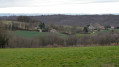

The walk starts from the village of La Chapelle-de-Surieu in Isère, situated east of Roussillon in the Rhône Valley. It can be reached from Roussillon via the D134 road, passing through Poncin and Saint-Romain-de-Surieu.
Parking is available at the entrance to the village on the right, sheltered by two canopies.
(S/E) Head towards the village centre; you’ll soon reach the crossroads by the town hall.
(1) Opposite the town hall, carefully follow the road to the left for several hundred metres, cross the bridge over the Sanne and you’ll reach a Y-junction.
(2) Head up to the left along the Chemin du Pin. Pass close to the hamlet of Le Pin on your left. The path curves to the right and then to the left. A few steps further on, you’ll come to a house and some farm buildings on your right.
(3) Ignore the path that continues straight ahead and follow the track to the left through the meadows. You’ll reach the hamlet of La Gerbaudière.
(4) Before reaching the buildings, take a sharp right-hand bend towards a timber yard. Turn 90° to the left, walking past a water tower at the side of a road. Follow the road to the right, passing houses on both sides, until you reach the edge of the forest at a crossroads.
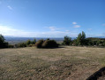
(5) Continue straight ahead along this wide track, passing through woodland and meadows and ignoring the paths on either side. At the highest point in the meadow, you’ll see a house on the right, with a road leading towards it called the Chemin des Grandes Bruyères.
(6) Take this road downhill to the right, running alongside the house. Ignore a road branching off to the right towards some houses. The road makes two very sharp bends, first to the left then to the right, before reaching a junction with a road coming from the left. After 50 metres, you’ll come to a main road. Turn left, ignoring two roads forming a three-way junction and leading uphill to the left.
(7) Cross the bridge and follow the Chemin de l’Allemane uphill to the left, passing the Allemane farmhouse on your right. The road follows the ridge in a straight line, then curves to the right and then to the left. Before entering the forest, turn right, heading due south, onto the descending path which becomes stony until you reach the junction at La Fond Du Loup.
(8) Turn right at a right angle. Cross a stream, head uphill through the woodland and emerge into an area of meadows, passing the houses of Les Ayats on your left. After the houses, the path becomes a road. After 300 metres, leave the road to follow the path opposite and arrive opposite the houses.
(9) Take the road to the left for 50 metres. Ignore two roads on the left and right and head straight on along the Chemin du Château. Walk past the houses on the left, then past a building at a junction.
(10) Turn sharply left onto Chemin de la Salette. After 700 metres, you’ll reach the Chapel of La Salette. A look around the outside is a must, but the inside is another story! Retrace your steps back to the previous junction.
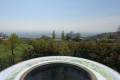
(10) Continue along the road opposite. Cross the road and follow the path opposite towards an orientation table, then proceed to a junction.
(11) Cross the road and take Route de La Feytaz opposite. The route runs almost in a straight line for 2,500 metres. After 700 metres, ignore a road branching off to the right. After 800 metres, cross a road. Reach the hamlet of La Feytaz. On leaving the hamlet, ignore a road leading downhill to the left and, after 50 metres, reach a junction and the Chemin de la Cunière on the right.
(12) Take the road on the right, which turns into a track after the houses at Le Mouillat. Head down the track, passing a house on the left. Walk over the stones in the bed of the Ruisseau du Sonnet.
(13) Continue along the track overlooking the stream below on the left. Near the houses, you’ll reach a road. Cross the bridge over the Ruisseau du Sonnet. Turn left onto the Route de Bellagarde and cross another bridge over the Sanne to reach the town hall square.
(1) Turn left and, after 200 metres, you’ll be back at the car park. (S/E)


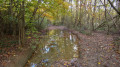
 It’s a very muddy route, that’s true, but that’s no reason to clean your shoes in the town hall’s washbasin.
 Time taken: 5 hours 10 minutes; route tracked by GPS
 Visorando Member
 Easy
Easy