Country:

 City:
City:


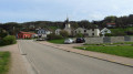
Access: from Épinal towards Gérardmer via the D11 road. Then, 7 km from Docelles, 1.5 km before Tendon, at La Poirie, turn left onto the D11d towards Houx, then Laveline and finally Rehaupal. Start from the village centre below the church, near the bus shelter.
(S/E) Red Cross signposting. Set off along Rue au Sud, with your back to the church, and walk 80 metres to the junction.
(1) Red Cross signposting. Turn right onto the Route du Tholy. Continue uphill for 700 metres, crossing the meadows and then the woodland. Ignore any turn-offs to the left. Follow the road until you reach a hairpin bend to the left.
(2) Red Right Cross signpost. Leave the road and follow the forest track straight ahead for 2.5 km until you reach a road with a stone cross and houses below on the right.
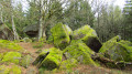
(3) Green Disc signpost. Cross the road and take the path opposite. Walk along the meadow until you reach the edge of the woodland, where a path branches off to the left. Leave the path and head uphill to the left through the woods to reach the Roches de la Moulure site. Cross the site in a straight line and follow a path that first descends and then levels out. You’ll reach the corner of a meadow with boulders and paths.
(4) Yellow Ring markings. Take the path on the right to reach the Moulure farm.
(5) No markings. Before the last building, take the road downhill to the right for 150 metres. When the road curves to the right, take the path on the left. After another 150 metres, take the path on the right into the forest. After 400 metres, take a sharp left-hand bend. Then continue almost in a straight line, cutting across a path and then ignoring a path branching off to the right. Reach the Maison des Cherrières and go past it to arrive at a path.
(6) No signposting. Take the path on the right. 300 metres further on, ignore a path branching off to the right and pass to the left of the Stöt house. Cut across a path and, 150 metres further on, reach and cross the road. Take the road on the left for 150 metres. Watch out for traffic.
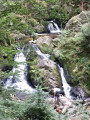
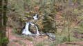
(7) Red Ring signposting. Turn right onto the path leading to the Petite Waterfall, 250 metres away.
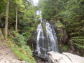
You’ll reach the Petite Waterfall site; to visit it, head 30 metres to the right. After your visit, continue along the path that climbs very gently to the right. Follow this main path without hesitation; it will take you to the Grande Waterfall site after 2 km.
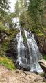
(8) Visit the Grande Cascade site: make your way to the top of the waterfall by following the path that climbs to the left, moving away from and then back towards the feeding stream and its footbridge.
(9) Return via the same path. Note: Some people venture to explore the cliffs directly, but everyone must assess the risks for themselves.
(8) Blue Cross signposting. Continue along the path, which becomes a road, towards the car park. Walk past the Maison du Creux on your left. And be sure to take a 20-metre detour to the left towards an outbuilding of the house to discover some old beehives arranged in tiers. Walk up the road until it takes a sharp bend to the left. Leave the road and head straight ahead along the path for 1.3 km to reach a tarmac section and the houses of Bonne Fontaine, then the main road D11.
(10) Blue Cross signpost. Watch out for traffic. Cross the D11 and head straight ahead along the uphill road for 400 metres. At the edge of the forest, where the road rises slightly, leave the road and turn right onto the flat path. Walk past a house on your right until you reach a road.
(11) Blue Cross signpost. Head right along the road for 20 metres, then leave the road and take the path on the left. After 300 metres, you’ll reach a junction; take the second hairpin bend on the right, heading south-east. Over the next 700 metres, the track curves slightly uphill and then downhill. At a place called Les Pierres Plates, you’ll come to a first track coming from the right and then, almost immediately, a second, wider track. Follow this second track to the right for 500 metres. You’ll reach a crossroads near the place called Haut Vacon.
(12) No signposting. Take the road on the right for 20 metres, then leave it and head straight ahead along the track for 800 metres. Ignore any tracks branching off to the right and you’ll reach a crossroads near the hamlet of Forêt du Rayeux.
(13) Blue Cross signposting. Continue along the path curving to the right. Follow the path for 500 metres, ignoring a path branching off to the right. The path curves to the left, then takes a hairpin bend down to the right and joins a road. Ignore the road and head left down the footpath. Pass close to the ‘Sapin Président’, which can be reached via a return trip to its base via a path on the left. Descend to the stream and the ‘Trou de l’Enfer’ site.
(14) Red Ring markings. Take in the view of this site in the heart of the forest. Head left, following the stream for 4 km – the route is unambiguous – until you reach the village of Rehaupal. Along the way, note the old terraces used for growing flax, dating from 1850. Ignore a path branching off to the right, then another coming from a house on the left. Near the first houses in the village, the path becomes a road. Cross via the main street to return to the church (S/E).



 Visorando Member
 Easy
Easy