Country:

 City:


Access from the south of the town of La Bresse in the Vosges. From La Bresse, head south towards Cornimont, then continue south-east towards Ventron via the D43 road, until you reach the Col d’Oderen, which marks the border between the Vosges and Alsace. Park your car here.
(S/E) Start from the Col d’Oderen. Head west along the ascending path, signposted with the Blue Disc. After one kilometre, ignore a turn-off to the right and continue uphill.
(1) Follow the Blue Disc markings until you reach the road at the Col du Page. Follow the road to the left for 50 metres. Then take the track on the left for 150 metres.
(2) Take the track, which winds sharply to the right and is signposted with a Blue Triangle, for 600 metres. When the path curves to the right, take the sharp descent to the left, signposted with a Blue Triangle. After 100 metres, take a sharp bend to the right and continue, almost in a straight line, until you reach a wider path at the edge of the forest, near the houses.
(3) Take the hairpin bend to the left on level ground and walk alongside the buildings on the right. The path becomes a road and then takes a hairpin bend to the right. Continue to the right along the road for 300 metres. Then leave the road and take the uphill path to the left, marked with a Yellow Triangle, for 800 metres. You will reach a path marked with a Blue Cross.
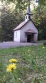
(4) Follow it to the left for 100 metres, then leave it to take the hairpin bend uphill to the right, following the Yellow Triangle markings. This path reaches a junction with the Chalet de la Petite Montagne. Take the hairpin bend uphill to the left, following the Blue Disc markings. Ignore a path leading downhill to the left. You’ll reach a road at the Plain du Repos junction, where there is a chalet and a monument.
(5) Follow the road uphill to the left for 100 metres. Then leave the road and take the path marked with a Blue Disc, heading uphill to the left, which avoids the bends in the road. After 200 metres, leave the path straight ahead and head uphill to the right, following the Blue Disc markings, until you reach the road. Cross the road and follow the path to the left, which cuts across another bend in the road and is marked with a Blue Disc. When you reach the road, cross it again to continue along the path until you reach the Drumont farmhouse inn.
(6) Walk past the buildings on their left and head straight on, up a steep, direct climb, towards the orientation table. The view from here is remarkable. Head north-east, downhill, following the Blue Rectangle markings for 750 metres, until you reach a crossroads at a place called Hasenkopf.
(7) Leave the Blue Rectangle markings and turn right, heading downhill, following the Red Triangle markings. Walk downhill for 1,600 metres through a beautiful beech forest, with the path occasionally zigzagging. When you reach a wider track, leave the Red Triangle markings heading to the right and follow the unmarked track opposite for 900 metres. This track curves to the right, then to the left. At this point, the Red Triangle-marked path joins from the right. Continue left for 150 metres to reach a crossroads and the Chemin Robert Curien.
(8) Take the path to the left, marked with a Blue Cross. Pass close to the Langenbach chalet, situated on the left. Ignore the path coming from the right and continue to the left along the Chemin des Alliés, marked with a Yellow Triangle. This path, which is clearly signposted, winds up and down and leads back to the starting point, ignoring a junction on the left marked with a Blue Rectangle and a junction on the right marked with a Green Disc.
Return to the Col d’Oderen. (S/E)

 Visorando Member

 Tourism professional
 Difficult

 Easy