Country:

 City:
City:


Start from the centre of the village of Villevocance in Ardèche on the D121 road. South-west of Annonay and north-east of the Haute-Loire and the villages of Saint-Bonnet-Le-Froid, Saint-Julien-Vocance and Vocance.
(S/E) From the town hall grounds in the centre of the village. Head south along Rue de la Libération. Follow this street for 100 m, then take the first street on the right, Rue des Contes, followed by Rue du Cimetière.
(1) 100 m past the cemetery, turn right up the steep Montée de Poinas. At the Fork in the road after this junction, ignore the road branching off to the right and continue left until the next junction.
(2) Leave the roads and take a sharp left-hand bend up a steep slope towards a house. After this house, the path climbs through meadows bordered on both sides by fences. Continue to a road near the Les Tespes buildings.
(3) Turn left onto the road to reach the hamlet of Le Claux. Walk downhill through the hamlet to the left towards a road and a stream.
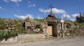
(4) Before the stream, leave the road and take the path on the right running alongside it. Continue along this path, skirting the grounds of Gerlande Castle. Ignore the path on the right leading to the Gerlande buildings and head left, passing in front of the castle’s entrance gate. 50 metres after the gate, turn right onto the uphill path.
(5) Follow the path, which then becomes a track. Cross a road straight ahead. Near the houses on the left, cross another road and follow the track towards the hamlet of Monteillet. Walk through the hamlet until you reach the D570.
(6) Follow this road to the right towards the village of Vanosc. Watch out for traffic.Reach the edge of the village and ignore a road leading uphill to the right. Once in the centre of the village, turn left onto Rue Du Bon Accueil, then head up to the right along Montée Du Pavé towards the town hall and the church. 50 m after the church, you’ll reach Chemin De La Meyve on the right.
(7) Follow this street until it takes a sharp right-hand bend downhill.
(8) Leave the road and take the path leading uphill to the left. The path curves to the right and then, 50 metres further on, turns left onto a stony section. Follow this path without hesitation until you reach a road at a place called La Côte.
(9) Cross the road and take the path leading uphill opposite. After passing through the woodland, you’ll reach the house at Fortunères.
(10) Before the house, turn right downhill and you’ll reach a junction. Take the D570 heading uphill to the left. After about 400 m, before the road curves to the left, you’ll come to a path leading downhill to the right.
(11) Turn onto this track, ignore a path branching off to the right towards the farm below, and continue to the left. You’ll reach a track; follow it straight ahead. Reach the edge of the forest and head down to the left along a series of bends. Follow this wide track, which descends slightly, then runs alongside the ruins of Lavaux on your left.
(12) Ignore a yellow/white-marked path heading uphill to the right and you’ll reach a road at a hairpin bend.
(13) Head up the road to the right towards the houses at Gacou. Walk past the houses on the left and head uphill towards the meadows. Cross the meadows and, on the ridge, reach a path crossing your path. Follow this path as it climbs to the right.
(14) Near the hamlet of Rantaux, the path widens and then becomes a road near the houses at Vertrosc.
(15) Take the road descending in a hairpin bend to the left. Follow the road past the houses at Beauregard. The road then descends due south, passing houses on the right and then on the left. Ignore a road coming from the right and reach the junction from the outward journey near the castle gate.
(5) Turn left towards the entrance to the château. Go past the gate and follow the boundary fence. Ignore the path leading straight ahead towards Gerlande Farm and continue to the right along the footpath until you reach the road you started on towards Le Claux.
(4) Ignore the road leading towards the houses and take the road on the right. After 300 m, and once you have passed the houses situated higher up on the left, join a path leading down into the meadow on the right.
(16) Follow the descending path, which then becomes a tarmac road near the houses. This road is called Chemin Des Clots and then Montée de Sauvion. Ignore two roads branching off to the right and arrive at the junction from the outward journey.
(1) Heading in the opposite direction, follow Rue du Cimetière straight ahead, then, near the school, take Rue des Contes. You’ll reach the main street running through the village; turn left towards the town hall and return to the park at Villevocance town hall (S/E).

 Visorando Member

 Difficult