Country:

 City:
City:


The town of Tence, in Haute-Loire, is accessible from Yssingeaux, to the north-west, via the D103 road, or from Montfaucon-en-Velay, to the north, via the D500 road.
Parking is available on Boulevard Léon Rocher, in the car park on the right-hand side, before the River La Sérigoule, when approaching from the town centre.
(S/E) Start from the car park on Boulevard Léon Rocher. Turn left towards Rue de Saint-Agrève.
(1) Turn right towards the town centre until you find yourself opposite the town hall. Turn left onto Grande Rue. Ignore the first dead-end on the left and take the next one. The path reaches the River Lignon; cross it.
(2) Turn left, following the river. Walk past the stadium, then past some large buildings on the right. After the buildings, follow the path leading towards a road. Caution: take the road on the left. Ignore a road branching off to the left, then a dead end. After 150 metres, ignore the roads branching off to the left and right and take the Chemin de Clotre, which climbs up opposite.
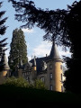
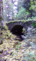
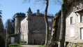
(3) Follow it uphill, then turn right into the forest and cross through it, before crossing a stream. Follow the path leading uphill to the left, towards the D103 road. Near the road, turn left onto the Route de Pouzol, then the Allée du Château. Walk past the castle buildings and then turn right to return to Route de Pouzol. Follow it to the left and, after 600 metres, you’ll reach a junction with paths and a cross.
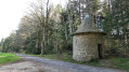
(4) Take the path on the right running alongside the woodland. Ignore a path branching off to the right. You will reach the D18 road; cross it carefully. After 100 metres, cross another road and follow the path to the left. You’ll see a small, rounded building on your right. After 250 metres, as the path curves to the left, ignore a path branching off to the right. After 500 metres, past the hamlet known as ‘Le Moulin’, take the road on the right running alongside the old mill buildings, situated below on the left. The road becomes a dirt track opposite the buildings at La Graillerie; go round them on the left. Continue through the forest until you reach and pass through the hamlet of La Bergeronne. Ignore the road branching off to the right and turn left towards the bridge over the river.
(5) Cross the bridge and head uphill towards the village of Chenereilles. Before the church, turn right towards the town hall. Ignore the road leading to the cemetery on the left and follow the path down opposite, towards the sewage treatment works. Cross the stream via the footbridge and head up towards the hamlet of Le Betz. Turn right in the hamlet and, on leaving it, turn right onto Route de Chenereilles and follow it for 250 metres.
(6) When the road curves to the right, take the road leading uphill opposite. After 50 metres, take the road leading uphill on the left. At the next bend, ignore a path straight ahead and continue along the road towards a higher point. Ignore all turnings to the right leading to the houses. Begin the descent and pass close to an aerial on the left. You will reach a crossroads at a place called Utiac.
(7) Take the road at a right angle to the right. The road then becomes a grassy track and joins a road, the Impasse des Framboises. Follow the dirt track, which winds sharply to the left. Reach the Route d’Utiac and cross it carefully. After 50 metres, take the path opposite. You’ll reach the Route de La Papeterie; follow it to the left for 50 metres. Turn right towards the buildings and walk past them on the right-hand side. After 650 metres along the path, you’ll reach the Route de La Papeterie again; follow it to the right. You’ll clearly arrive at the River Lignon; cross the bridge.
(8) After the bridge, take the road on the left to reach the La Papeterie lodge. After the buildings, the road becomes Chemin Du Mounas, leading through the forest. Ignore the Route du Cher branching off to the right and continue towards the hamlet of La Brosse. At the first junction, turn left onto the Chemin de L’École, then, at the next one, turn left again onto the Chemin de Paute. You’ll reach another junction.
(9) Turn right onto the road known as Chemin de La Brosse to cross the hamlet. Head uphill to the right, near the castle. Cross the hamlet again and, at the next junction, continue straight ahead along Chemin du Mounas for 150 metres. Continue along the path veering slightly to the left for 200 metres.
(10) Ignore the path branching off to the right and continue along the path straight ahead. After 650 metres, ignore two turnings in succession – first to the right, then to the left – and carry on straight ahead towards a tarmac section. Cross the bridge over the stream and turn left for 100 metres. Take the hairpin bend to the right at the edge of the forest. Cross the railway line and continue straight ahead towards the main road. Take care! Follow this road for 200 metres, then cross it.
(11) Turn left onto Chemin de La Croix de L’Œil and follow it for 60 metres. Once you’ve passed the building, take the path on the right called L’Allée des Sous Bois. You’ll reach a road in a residential area known as Crouzilhac. After 200 metres, you’ll come to a junction; follow the road downhill straight ahead. After 100 metres, ignore a road on the right. Continue downhill, then on level ground until you reach a car park on the right.
(12) Leave the road and take the path leading down to the right, into the woods. Cross the stream via the footbridge, then head uphill across the meadows. Walk past the buildings on the right, then reach the Route du Mazel; follow this to the right, towards the town of Tence.
(13) Continue along Route du Mazel to cross the railway line and walk past the Tence care home, situated on the right. After the care home, follow the street to the left for 100 metres to reach Rue d’Annonay, which you should cross. Carry on opposite along Rue des Écoles until you reach Boulevard Léon Rocher, opposite the starting point. Cross the river and return to the starting point (S/E).

 Visorando Member
 Difficult
 Easy
Easy