


Refine your search for walks in Santo-Pietro-di-Tenda
Santo-Pietro-di-Tenda walks


 The Orticheta Stream walk from Santu-Petru to San-Gavinu
 Association / Club / Walk leader
 4.54 mi
 +1,168 ft
 -1,165 ft
 3h 05
3h 05
 Moderate
 Departure from Santo-Pietro-di-Tenda (Haute-Corse)
What makes the villages covered by this walk unique is the length of their respective territories, each of which stretches all the way to the Agriate beaches.These are coastal municipalities, certainly, but historically rural, as Santu Petru di-Tenda and San-Gavinu di-Tenda have, since their origins, clung to the foothills of the eponymous mountain range, where the majority of their population is concentrated. Here, the route allows you to explore these two remarkable towns via a circular route. As you walk along the old communal paths that still link them, or through their respective narrow streets, you’ll linger at exceptional viewpoints and feel the sense of wonder evoked by the local natural and cultural heritage.
* Please note : You are advised to make yourself known if you see a sign stating ‘hunting in progress’, and it is essential to keep your pet on a lead.
This route is strongly advised against from 15 July to 31 October 2026
See practical information
Monte Astu, setting off from San Gavino di Tenda
7.93 mi
+3,704 ft
-3,704 ft
6h 50
 Difficult
Departure from San-Gavino-di-Tenda (Haute-Corse)
Difficult
Departure from San-Gavino-di-Tenda (Haute-Corse)
Created in 2006 by the chair of the Nebbiu Rando Association and still maintained, the signposted walking route leading from San Gavino di Tenda to Monte Astu begins at the Chiesa fountain at the top of the village. With over 1,100 metres of elevation gain, this is the most mountainous of the walks in the micro-region. In fact, it requires considerable effort on the first ‘ascent’ until you pass the A Genucula rock, at an altitude of 1,042 metres. Hikers can then catch their breath on a path with a more manageable gradient and enjoy the scenery all the way to the summit cross at 1,535 metres, where a magnificent 360° panorama awaits. The return journey along the same path is by no means uninteresting, offering exceptional photo opportunities all the way.
Piève–Sorio circular loop
 3.83 mi
+1,322 ft
-1,329 ft
2h 55
Moderate
Departure from Piève (Haute-Corse)
3.83 mi
+1,322 ft
-1,329 ft
2h 55
Moderate
Departure from Piève (Haute-Corse)
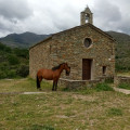
Second circular route of the route: ‘Between the Secular and the Sacred’, created on the initiative of the municipalities of Rapale, Pieve and Sorio, using the old footpaths that once linked the three villages. This route is every bit as good as the previous one when it comes to exploring the local heritage: menhir statues, wash houses, fountains, cobbled alleyways and village paths lined with walls – that’s the secular side.The sacred heritage is equally remarkable, featuring the churches of San Quilico in Pieve, San Filippu Neri in Sorio and the chapels.The return journey from Sorio to Pieve, offering a panoramic view over the Nebbiu plain and the Gulf of Saint Florent, is ideal for taking photographs.
This route is strongly advised against from 15 July to 31 October 2026
See practical information
Circular route via the Chiesa Nera
 Visorando Member
 3.59 mi
+945 ft
-945 ft
2h 30
3.59 mi
+945 ft
-945 ft
2h 30
 Easy
Departure from Piève (Haute-Corse)
Easy
Departure from Piève (Haute-Corse)
Pleasant circular walk passing the ruins of a 13th-century chapel, with lovely views of Cap Corse, the Gulf of Saint Florent and the Tenda Mountains.
Rapale and Pieve circular loop
 4.06 mi
+1,010 ft
-988 ft
2h 45
Moderate
Departure from Rapale (Haute-Corse)
4.06 mi
+1,010 ft
-988 ft
2h 45
Moderate
Departure from Rapale (Haute-Corse)
Created on the initiative of the municipalities of Rapale, Pieve and Sorio, the ‘Between the Profane and the Sacred’ route passes through these three beautiful villages in the Upper Nebbiu region, which have preserved and showcased a heritage that is an absolute must-see.Communal footpaths, mule tracks, Romanesque chapels, menhir statues, a church with an off-centre bell tower, plus a route through chestnut and oak woods, making it suitable for walking in all seasons.This description is not a copy-and-paste of the certified route but a variant split into two circular loops that follow its route. The idea is to make the route more accessible by reducing the distance and duration, thereby allowing more time to explore the heritage. This is therefore the first circular loop.
This route is strongly advised against from 15 July to 31 October 2026
See practical information
A story of stones and water in Murato
 4.17 mi
+771 ft
-768 ft
2h 35
Easy
Departure from Murato (Haute-Corse)
4.17 mi
+771 ft
-768 ft
2h 35
Easy
Departure from Murato (Haute-Corse)
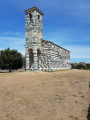
The village of Murato invites you to discover a trail called Histoire de pierres et d'eau (History of Stones and Water). It is a tourist circuit between village and nature where you can discover Murato Supranu (upper part of the village) and Murato Sottanu. You will pass through narrow streets, old houses, churches, chapels, fountains, pagliaghji (straw huts), wash houses and bread ovens.
This route is not intended to be a long hike, but it has the merit of allowing you to discover the past and can be enjoyed by the whole family.
Murato loop, nature and heritage
6.46 mi
+928 ft
-925 ft
3h 45
Moderate
Departure from Murato (Haute-Corse)
This is a lovely family walk around an exceptional village. Not only because of the natural areas you pass through and the scenery they offer, but also because of the history of the place and the preservation of its heritage.
Or quite simply because of the quality of life that Muratu, in the Corsican language, offers its residents, whether they are permanent residents or just passing through. This impression is confirmed by the condition of the buildings – from the renovated old ones to the most recent – as well as by the variety and quality of the shops.
Along the route, walkers will discover, to the south, the plateaus with their rich agro-pastoral history and the ruins of the San Frusulu chapel, which has recently been restored. After a short stretch over the heights of the village of Piève , followed by a descent through the maquis, you reach the banks of the small coastal river ‘the Bevincu’, spanned by its Genoese bridges.
The village centre offers a chance to appreciate Murato’s significant vernacular heritage.
This route is strongly discouraged from 15 July to 31 October 2026
See practical information
Circular walks from Murato via San Michele and Teppa di Lucciana
6.22 mi
+955 ft
-961 ft
3h 40
Moderate
Departure from Murato (Haute-Corse)
Here is a new route starting from the Church of Saint Michael in Murato, which quickly takes the walker to discover the ‘Queen’s Rock – Teppa di Luciana’. The archaeological excavations of this ‘enormous rocky chaos’ are described in the ‘Places to See’ section.
On the descent towards the coastal river Bevinco, traces of the area’s agricultural and pastoral past can be seen. In and around the village, there are magnificent historic buildings , including the 12th-century Pisan church , other churches and chapels, as well as restored old structures such as ovens, wash houses and fountains. On the southern outskirts, heading towards the Col de Bigorno, renovated Genoese bridges allow you to cross the Bevinco. An old ice house can be seen beside the Strada di Bigorno, which you’ll take on the return journey. Just before crossing the Pont Neuf, there is a picnic area for walkers. Finally, on arrival, you can visit the Church of San Michele, a12th-century Romanesque building in the Pisan style.
Circular Salinelle - Giru di Salinelle, in Nebbiu
 8.28 mi
+1,827 ft
-1,831 ft
5h 25
Moderate
Departure from Vallecalle (Haute-Corse)
8.28 mi
+1,827 ft
-1,831 ft
5h 25
Moderate
Departure from Vallecalle (Haute-Corse)
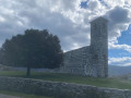
Vallecalle occupies a strategic location amongst the villages of the Upper Nebbiu.The suggested route takes walkers to Murato and then Rapale, with a return to Vallecalle made possible by the recent reopening of the Santo Pietro Vecchio mule track.In these places steeped in history, the pagliaghji (haylofts) bear witness to the region’s once-thriving agricultural and pastoral activity. The abundance and quality of the Romanesque architectural remains remind us of our ancestors’ devotion to the sacred.The cool stretches under oak and chestnut groves, followed by open terrain, and the superb panoramic views add to the appeal of this route.Visits to the villages, rich in heritage monuments and traditional crafts, are well worth a detour. Walking times should be adjusted accordingly.
This route is strongly advised against from 15 July to 31 October 2026
See practical information
The Piedalbuccio loop
1.30 mi
+226 ft
-207 ft
0h 50
Easy
Departure from Oletta (Haute-Corse)
This walking route (U Giru di Piedalbuccio) was created in March 2020 around the rapidly developing residential area of Piedalbuccio. At the time, it was necessary to adapt to the lockdown from March to April 2020, linked to the ‘Covid-19’ pandemic, which restricted time spent outside the home to a maximum of one hour. This route therefore allowed residents to stretch their legs close to home, avoiding the time wasted on road journeys. Even today, in an area where urban development has stabilised, this route remains hugely popular, which in turn minimises the need for maintenance.
Bocca di San Pancrazio, starting from Urtaca
4.00 mi
+1,919 ft
-1,919 ft
3h 30
Moderate
Departure from Urtaca (Haute-Corse)
A round-trip hike leading to Bocca San Pancraziu at 969 m via a well-marked track, offering lovely views of the Gulf of Saint-Florent and beautiful vistas of Urtaca and the surrounding mountains. No particular difficulty apart from a steady 3.5 km climb on the way there. A sign at the start indicates a 2 hour 15 minute walk to reach the destination. The walk offers little shade.
Olmeta di Tuda – Cross of San Giovanni
 3.85 mi
+1,417 ft
-1,391 ft
3h 00
Moderate
Departure from Olmeta-di-Tuda (Haute-Corse)
3.85 mi
+1,417 ft
-1,391 ft
3h 00
Moderate
Departure from Olmeta-di-Tuda (Haute-Corse)
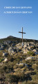
A lovely circular walk featuring a section through mid-mountain terrain. First across the Costa Nuda plateau at an altitude of 634 m, then on to the Col de San Giovanni at 705 m. At this point on the route, walkers will certainly climb up to the eponymous cross at 726 m, where they can stop to take in the beautiful scenery. Views over both seas (the Tyrrhenian and the Mediterranean), the Chjurlinu-Biguglia lagoon, the Nebbiu and Conca d’Oru plains, and the Tenda Massif. Hikers will also discover an ancient threshing floor (aghja in the Corsican language) with its round stone for threshing wheat, which still stands on the site.The return journey from the San Giovanni Pass begins heading west and continues to Bocca di Pardino, offering superb panoramic views of the Patrimonio appellation vineyards, the Gulf of Saint Florent and the start of Cap Corse. At the pass, the route heads south towards the village of Olmeta di Tuda.
This route is strongly advised againstfrom 15 July to 31 October 2026
see practical information
Circular, Oletta - Bocca di Pardinu
 3.00 mi
+889 ft
-909 ft
2h 10
Moderate
Departure from Oletta (Haute-Corse)
3.00 mi
+889 ft
-909 ft
2h 10
Moderate
Departure from Oletta (Haute-Corse)
A family hike of moderate difficulty, with a few little-known points of interest well worth discovering. An unusual viewpoint overlooking the two villages.
* Alternative route starting from the village of Olmeta di Tuda. Car park at the entrance to the village.
From 15 July to 31 October 2026
it is strongly advised not to use this route
Given the successive heatwaves since the end of May, our association has not been able to clear the paths using the appropriate heat-resistant equipment, for one thing.
Furthermore, the heat, drought and windy conditions are conducive to the outbreak of fires, which pose a maximum risk to walkers.
In these extreme conditions, you should opt for short walks along the coast or riverside. Avoid any routes that cross scrubland and/or reach mid-mountain passes.
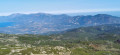
Mount Sant'Anghjulu and the Lento Refuge as seen from the Col de Bigorno
 7.66 mi
+1,959 ft
-1,962 ft
5h 15
Moderate
Departure from Bigorno (Haute-Corse)
7.66 mi
+1,959 ft
-1,962 ft
5h 15
Moderate
Departure from Bigorno (Haute-Corse)
A beautiful mid-mountain route which, from the Col de Bigorno at an altitude of 885 m, takes walkers to the summit of Sant’Anghjulu at 1,389 m. On a clear day, the 360° panorama offers views of some of the highest peaks in Southern Corsica. Nearby, the Lento Refuge is situated on the western side of the I Compuli rocks. It is made available by the local council; the key is hung near the window to the right of the entrance. The only refuge in the Tenda range, this peaceful spot overlooks the Manghjatoghju valley, where animals gather around ‘pozzine’* fed by the numerous springs. A magnificent view opens up over the peaks of Asco and Cortenais. The return journey follows the same route, with the Nebbiu plain, the Gulf of Saint-Florent and Cap Corse to the north. To the south, from the Col de Bocca Forca, the Golo valley and its hilltop villages come into view.
This route is strongly advised against from 15 July to 31 October 2026
See practical information
Nature, heritage and local character of the Oletta and Poggio d’Oletta plains
5.02 mi
+1,079 ft
-1,086 ft
3h 15
Moderate
Departure from Oletta (Haute-Corse)
Starting from the former Saint-François Convent, this walking route takes you, between the villages of Oletta and Poggio d’Oletta, to the remains of agricultural and pastoral areas from the recent past, as well as, much further back in time, the ruins of the San Petru di Mozenzana Chapel, dating fromthe 7th century. A leap forward to the18th century brings us to the events of 25 and 26 September 1769. Inscriptions on the south façade of the convent recall the tragic story of the Poggio heroine Maria Ghjentile, whose ruined house stands in the hamlet of Monticello. Returning tothe 21st century, walkers will have had the opportunity to discover, along the route, vineyards and olive groves – ‘the two pillars of the Mediterranean terroir’ – with a superb, multifaceted wine cellar serving as the highlight.
Circular route, Saint-François Convent – Oletta
 2.76 mi
+827 ft
-823 ft
2h 00
Easy
Departure from Oletta (Haute-Corse)
2.76 mi
+827 ft
-823 ft
2h 00
Easy
Departure from Oletta (Haute-Corse)
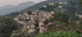
With a suggested tour of Oletta’s historic centre, explore the narrow streets that have been completely renovated by the local council yet retain their old-world charm.There’s no chance of getting lost: the lower and upper alleyways lead walkers back to the Church of Sant’Andria and its Piaza Nova; from this square or the Muntaghjò steps (at the top of the village), the views are remarkable.As the local footpaths and narrow streets are partially sheltered from the strong sunshine, this walk can be enjoyed in any season.
Extension/Alternative Route: Visit to the hamlet of Romanacce – a 1 km round trip starting from point no. 3 in the Muntaghjò district
As the Oletta Town Hall website states, “…even though the hamlet is no longer inhabited, it lives on through the miracle of the painting of the Virgin Mary that took place there in 1737”. The house where the miracle occurred can be visited free of charge, as can the adjoining Chapel of Saint Anthony.
See restrictions on use of the route in the practical information section, subject to weather conditions
Chjassu Maria Ghjentile
 3.02 mi
+745 ft
-719 ft
2h 00
Easy
Departure from Oletta (Haute-Corse)
3.02 mi
+745 ft
-719 ft
2h 00
Easy
Departure from Oletta (Haute-Corse)
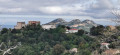
This walk between Poggio d’Oletta and Oletta was created by our association in March 2024 to honour the memory of the heroine from Poggio, Maria Ghjentile. In the spring of 2025, it underwent a significant and interesting modification. Thanks to the joint efforts of the ‘Conca d’Oru, Patrimonio Vineyard – Gulf of Saint-Florent’ Grand Site de France and the local authorities concerned, a new route has been drawn up which is sure to meet the needs of walkers.Two start/finish options are available, each with its own car park: the square by the former Saint François convent in Oletta and the car park at the town hall in Poggio d’Oletta.
Update dated 3 September 2025: the modification to the route between Poggio Town Hall and Oletta Church, proposed by our association, avoids the need to cross and then follow the Poggio-D38 road for 350 metres.
See restrictions on use of the route in the practical information section, subject to weather conditions
Le tour de la colline de Cotolone à Oletta
2.83 mi
+574 ft
-554 ft
1h 50
Easy
Departure from Oletta (Haute-Corse)
Starting from the former Saint-François convent in Oletta, this is a lovely walk through the countryside, ideal for families as it is easy going and well shaded.There are several points of interest along the route, and a lovely fountain, two-thirds of the way along, means you don’t need to carry drinking water with you.Parking is available, including on market days, which take place in the square in front of the convent every Tuesday and Friday from 1 June to 30 September, in the morning.
This route is strongly advised against from 15 July to 31 October 2026
See practical information
Chjassu Ornitulogicu di Santu Stefanu – Olmeta di Tuda
 4.50 mi
+1,188 ft
-1,165 ft
3h 05
Moderate
Departure from Olmeta-di-Tuda (Haute-Corse)
4.50 mi
+1,188 ft
-1,165 ft
3h 05
Moderate
Departure from Olmeta-di-Tuda (Haute-Corse)
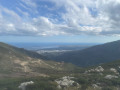
Created by the Bureau Montagne Nebbiu (Association of Mountain Guides), this walk allows you to familiarise yourself with the birdlife whilst exploring a Natura 2000 nature conservation area.The B.M.N. has improved the route signposting by installing a large sign at the start of the Col de Santu Stèfanu.
From 15 July to 31 October 2026
it is strongly advised not to use this route
Given the successive heatwaves since the end of May, our association has not been able to clear the paths using the appropriate thermal equipment, for one thing.
Furthermore, the heat, drought and windy conditions are conducive to the outbreak of fires, which pose a maximum risk to walkers.
In these extreme conditions, you should opt for short walks along the coast or riverside. Avoid any routes that cross scrubland and/or reach mid-mountain passes.
Monte Astu from Lama
 7.69 mi
+3,399 ft
-3,399 ft
6h 30
Difficult
Departure from Lama (Haute-Corse)
7.69 mi
+3,399 ft
-3,399 ft
6h 30
Difficult
Departure from Lama (Haute-Corse)
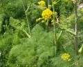
A beautiful hike through the Corsican maquis. The path winds along a beautiful marked trail to the Prunincu Refuge, then continues to climb through beautiful vegetation to the ridge overlooking the Puleghio ravine. To reach the summit, you will need to climb over some rocks (caution advised for those prone to vertigo). From Monte Astu, there is a magnificent view over the eastern plain, stretching as far as Île Rousse and the bay of Saint-Florent.
Circular walk from Roya to Punta di Cepo via the coastal path
6.19 mi
+528 ft
-505 ft
3h 20
Easy
Departure from Saint-Florent (Haute-Corse)
A lovely circular route along the coastal path starting from Roya Beach in Saint-Florent. A smooth ride along the coast on the outward leg. The return leg follows an inland track with panoramic views of the gulf, Cap Corse, Saint-Florent and the mountain range surrounding the Nebbiu region.
See restrictions on use of the route in the practical information section, subject to weather conditions
Circular loop around Lama
 2.26 mi
+869 ft
-869 ft
1h 50
Easy
Departure from Lama (Haute-Corse)
2.26 mi
+869 ft
-869 ft
1h 50
Easy
Departure from Lama (Haute-Corse)
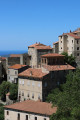
Pleasant circular path around the village of Lama. The path is very well maintained and features information boards about local life (thanks to the local council!). It is a stone path with some steps. It is not particularly difficult, apart from the climb which takes about 1 hour; it is best to wear walking shoes. The walk took 1 hour 50 minutes, but the ascent can take between 1 hour and 1 hour 30 minutes, whilst the descent takes between 50 minutes and 1 hour.Total walking time: between 1 hour 50 minutes and 2 hours 30 minutes.
Loto Beach via the coast from Saint-Florent
 13.86 mi
+912 ft
-899 ft
7h 10
Difficult
Departure from Saint-Florent (Haute-Corse)
13.86 mi
+912 ft
-899 ft
7h 10
Difficult
Departure from Saint-Florent (Haute-Corse)
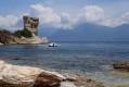
This hike takes you through part of the Agriates desert along the coastal path, from Saint-Florent to Loto beach, passing through picture-postcard landscapes.
The village of Oletta seen from Mount Tuda, circular route
 3.84 mi
+1,024 ft
-1,004 ft
2h 40
Moderate
Departure from Oletta (Haute-Corse)
3.84 mi
+1,024 ft
-1,004 ft
2h 40
Moderate
Departure from Oletta (Haute-Corse)
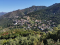
Oletta is undoubtedly one of Corsica’s most ‘photogenic’ villages. This is due to its natural beauty, its location and the excellent state of repair of its monuments and buildings in general.But there is real value in exploring our village from Mont Tuda, which also offers 360° views.The route takes you past the Mersulaccia Fountain, along the recently reopened local footpaths, past the Saint-François Convent, through the hamlet of Piedalbuccio and into the heart of the village: these are the main points of interest along this route.
“Tip: follow the route in the correct direction to climb Mont Tuda via its southern slope. This applies regardless of your chosen starting point (Municipal Car Park on the D38 or Saint-François Convent on the D82).”
See restrictions on use of the route in the practical information section, subject to weather conditions
The Mont Zucarrello circular walk starting from Oletta
7.14 mi
+2,644 ft
-2,638 ft
5h 35
Moderate
Departure from Oletta (Haute-Corse)
Mount Zuccarello is the highest peak in the municipality of Oletta. It rises to an altitude of955 m and forms part of the Serra mountain range, continuing on from Cap Corse.This route begins with a passage through Muntaghjò, a neighbourhood where, in the Middle Ages, the powerful Montalti family had built a castellu. The rest of the route takes place in mid-mountain terrain, starting with the ascent to the Col de Sant’Antonio and ending at the summit of the mountain, the highest point of the hike. The return journey begins with a beautiful escarpment near the Monts Stretti, before passing through the Col de San Giovanni. From there, splendid views of the Nebbiu and Conca d’Oru natural areas follow one after another all the way to Oletta.
From 15 July to 31 October 2026
it is strongly advised not to take this route
see practical information
Loop via Saint-Florent starting from Oletta
 5.36 mi
+351 ft
-348 ft
2h 45
Easy
Departure from Oletta (Haute-Corse)
5.36 mi
+351 ft
-348 ft
2h 45
Easy
Departure from Oletta (Haute-Corse)
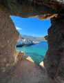
From the outskirts of Oletta, an old mule track leads to Saint-Florent across the plain. At its end stands the Cathedral of Nebbio, well worth a visit or a return visit.After a short detour through the vineyards of the Patrimonio appellation, which offers a superb view of the gulf and the start of Cap Corse, the walker reaches the town, its citadel and its harbour.The quays, once home to fishing boats, are now home to the largest marina on the ‘Isle of Beauty’. Once you’ve crossed the Pont Neuf over the Aliso, the renovated sea wall and Roya beach reveal much more accessible attractions such as angling and swimming.The return journey follows a rural municipal path lined with shepherds’ huts – known as ‘pagliaghji’ – built from white Saint-Florent stone.
See restrictions on use of the route in the practical information section, subject to weather conditions
The Memory Trail: path at Rutali - Trà aghje è Pagliaghji
 4.21 mi
+335 ft
-338 ft
2h 15
Easy
Departure from Rutali (Haute-Corse)
4.21 mi
+335 ft
-338 ft
2h 15
Easy
Departure from Rutali (Haute-Corse)
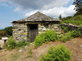
This is a route with little elevation gain in the mountains above Rutali, ideal for a family walk. In the middle of the scrubland, there are arbutus trees, oaks and a few chestnut trees. You quickly find yourself isolated in wild nature at an altitude of 600 metres with views of the sea to the east and west. We are facing the base of Cap Corse.
Ridge path to Monte Torriccella above Rutali
6.43 mi
+1,522 ft
-1,496 ft
4h 15
Moderate
Departure from Rutali (Haute-Corse)
This hike will allow you to admire the views of both seas.
Route at Poggio d’Oletta via Monte Magna and the San Petru chapel
 2.98 mi
+951 ft
-945 ft
2h 10
Easy
Departure from Poggio-d'Oletta (Haute-Corse)
2.98 mi
+951 ft
-945 ft
2h 10
Easy
Departure from Poggio-d'Oletta (Haute-Corse)
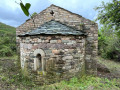
Monte Magna is situated at the western edge of the municipality of Poggio d’Oletta.Before reaching the summit, walkers will probably be tempted to take a short round trip to explore the ruins of the Chapel of San Petru di Mozenzana, whose first apse is thought to date fromthe 7th century. This dating, combined with the building’s relatively good state of preservation, is undoubtedly what makes it such a moving place.
You will need to return to the main path to reach the summit of Monte Magna at an altitude of 233 metres. The360°viewsfrom there are exceptional. As well as the villages, the Nebbiu plain and the Tenda massif, you can admire the landscapes of the ‘Conca d’Oru – Patrimonio Vineyard – Gulf of Saint-Florent’ triptych , which have earned this natural site its place in the Grands Sites de France network.
This route is strongly discouraged from 15 July to 31 October 2026
See practical information
Chjassu Maria Gentile between Poggio d'Oletta and Oletta
 Local authority
 2.78 mi
+646 ft
-656 ft
1h 50
Moderate
Departure from Poggio-d'Oletta (Haute-Corse)
2.78 mi
+646 ft
-656 ft
1h 50
Moderate
Departure from Poggio-d'Oletta (Haute-Corse)
The Chjassu Maria Gentile is a pretty walking loop connecting the neighbouring villages of Poggio d'Oletta and Oletta. The route offers rich and varied landscapes: villages, scrubland, oak forests, streams...
Its name is a tribute to Maria Gentile, a young heroine of the area who became a symbol of courage when, in 1769, at the age of just 20, she defied French soldiers who had sentenced the inhabitants of Oletta to death for plotting a conspiracy. Maria Gentile's fiancé, like his companions, was sentenced to death and executed without the right to a burial. Maria, refusing to abandon her fiancé's body, decided to defy the ban and, at nightfall, set out to recover it and give him a proper burial. Since then, Maria Gentile has been considered the Antigone of Corsica.
From Saint Florent to Saleccia via the coastal path
11.03 mi
+423 ft
-413 ft
5h 25
Moderate
Departure from Saint-Florent (Haute-Corse)
This coastal hike allows you to explore this desert via a very pleasant trail and swim in idyllic coves.
From the Citadel of Saint-Florent to Campu Maggiore Beach in Farinole
8.47 mi
+673 ft
-656 ft
4h 30
Moderate
Departure from Saint-Florent (Haute-Corse)
From Saint-Florent to Farinole along the coast, this return route allows you to discover hidden swimming spots as well as the path carved into the limestone cliffs, “marking the transition between the schistose Cap Corse peninsula and the Agriate Desert”.
The scenery, perfect for photography, is fabulous. On the outward journey, you’ll see the gulf, the ridge of Cap Corse and, on rare occasions, the mainland coastline, which can be glimpsed on clear, windy days. On the return journey, the view opens up to the south towards Saint-Florent, the Nebbiu plain and its foothills, notably featuring the Tenda range and its highest peak, Monte Astu. To the west, the coastline stretches widely from Anse de Fornali to Punta di Cuza, situated between the beaches of Lotu and Saleccia.
⚠️ Hiking is prohibited from March to August as this is the nesting season. See practical information.
From Olzu Beach to Calanca di à Torre
3.36 mi
+180 ft
-177 ft
1h 40
Easy
Departure from Saint-Florent (Haute-Corse)
From Olzu beach, follow the coastal path to admire the beautiful coves and inlets. Wear sturdy footwear.
Balcony Trail from the Barbaggio Belvedere
 5.84 mi
+1,053 ft
-1,047 ft
3h 35
Moderate
Departure from Barbaggio (Haute-Corse)
5.84 mi
+1,053 ft
-1,047 ft
3h 35
Moderate
Departure from Barbaggio (Haute-Corse)
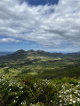
The Balcons trail, starting from the Belvédère de Barbaggio (downhill) or the RD238 (uphill), offers a nearly 10 km round trip with continuous views of the vineyards and the Conca d'Oru. It can also be taken as a one-way trip (5 km) by leaving a car at the end point and another at the starting point.
Surrounded by scrubland, this trail offers remarkable views of the landscapes of the Grand Site de France Conca d'Oru, the Patrimonio vineyards, the Gulf of Saint-Florent and the limestone chain of Mont Sant'Anghjulu, whose six iconic hills are the visual signature of the area.
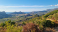
The Brietta Spring at Patrimonio
 2.90 mi
+771 ft
-758 ft
2h 00
Easy
Departure from Barbaggio (Haute-Corse)
2.90 mi
+771 ft
-758 ft
2h 00
Easy
Departure from Barbaggio (Haute-Corse)
This walk offers a splendid panoramic view of the Patrimonio valley and its vineyards, in conditions that are very rare in Corsica over this distance: a wide, easy-to-walk path that winds along the mountainside. It is therefore a very easy route, though it does involve some elevation gain. Above all, it offers extraordinary views of the vineyards, the limestone cliffs and the sea between the hills. Best done at the end of the day in hot weather, or very early in the morning to catch the beautiful light that photographers will appreciate. The only slightly frustrating thing is that it’s a return trip.
In the vineyards of Patrimonio
 5.99 mi
+456 ft
-469 ft
3h 10
Moderate
Departure from Patrimonio (Haute-Corse)
5.99 mi
+456 ft
-469 ft
3h 10
Moderate
Departure from Patrimonio (Haute-Corse)
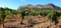
A beautiful walk, surrounded by the vineyards of Patrimonio, between Monte San'Angelo and Col de Teghime.
The heritage trail in Patrimonio
2.08 mi
+446 ft
-430 ft
1h 20
Easy
Departure from Patrimonio (Haute-Corse)
Thanks to this route, which takes in places and monuments steeped in history as well as magnificent natural surroundings, the municipality of Patrimonio—which initiated and oversaw this project—offers a lovely walk of just over 3 km. This informative walk allows you to discover the village’s historical and architectural heritage via well-shaded paths or riverside routes, which are very pleasant in summer and, for the lucky residents, at any time of year.
Chjassu Napuleone in Barbaggio
 1.86 mi
+79 ft
-761 ft
0h 55
Easy
Departure from Barbaggio (Haute-Corse)
1.86 mi
+79 ft
-761 ft
0h 55
Easy
Departure from Barbaggio (Haute-Corse)
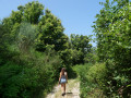
Starting from Barbaggio town hall (heading downhill), the Chjassu Napuleone crosses the village before entering a forest, where you can see old agricultural gardens on either side of the path. The richness of this route continues when you take the "imperial road" that gave the trail its name. Before becoming emperor, Napoleon Bonaparte is said to have walked this road.
The trail can also be taken in the opposite direction (uphill), starting from the bridge at the intersection of Strada San Petru and Strada Napuleone. If you are only doing a one-way trip, i.e. not returning, remember to leave one car at the starting point and another at the end.
Patrimonio – Pigno – Bocca di San Leonardo circular loop
 11.50 mi
+3,825 ft
-3,855 ft
8h 35
Difficult
Departure from Patrimonio (Haute-Corse)
11.50 mi
+3,825 ft
-3,855 ft
8h 35
Difficult
Departure from Patrimonio (Haute-Corse)
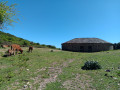
A challenging hike starting from Patrimonio, offering a variety of landscapes and magnificent sea views on both the Cap Corse and Bastia sides. There are no major difficulties along the route, although the distance means this hike should be planned as a day trip.