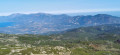
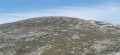
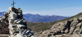
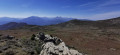
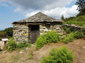
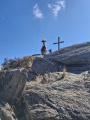
Mount Sant'Anghjulu and the Lento Refuge as seen from the Col de Bigorno

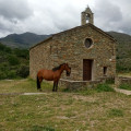
A beautiful mid-mountain route which, from the Col de Bigorno at an altitude of 885 m, takes walkers to the summit of Sant’Anghjulu at 1,389 m. On a clear day, the 360° panorama offers views of some of the highest peaks in Southern Corsica. Nearby, the Lento Refuge is situated on the western side of the I Compuli rocks. It is made available by the local council; the key is hung near the window to the right of the entrance. The only refuge in the Tenda range, this peaceful spot overlooks the Manghjatoghju valley, where animals gather around ‘pozzine’* fed by the numerous springs. A magnificent view opens up over the peaks of Asco and Cortenais. The return journey follows the same route, with the Nebbiu plain, the Gulf of Saint-Florent and Cap Corse to the north. To the south, from the Col de Bocca Forca, the Golo valley and its hilltop villages come into view.

This route is strongly advised against from 15 July to 31 October 2026

See practical information

Details

34212035
Creation:
Last update:
Last review:
  • Walking
    Activity: Walking
  • ↔
    Distance: 7.66 mi
  • ◔
    Average duration: 5h 15 
  • ▲
    Difficulty: Moderate

  • ⚐
    Back to start: Yes
  • ↗
    Ascent: + 1,959 ft
  • ↘
    Descent: - 1,962 ft

  • ▲
    Highest point: 4,511 ft
  • ▼
    Lowest point: 2,897 ft
  • ⚐ Country: France
  • ⚐ City: Bigorno (20252)
  • ⚑
    Start/End: N 42.538478° / E 9.296244°
  • ❏
    IGN map(s): Ref. 4349OT
  • Hour-by-hour weather

Photos

Description of the walk

Park at the Col de Bigorno on the side of the D5. To reach it from the Bastia area, follow the D5 via the Col de Santo Stéfano and then Murato. From the south or the centre, follow the T20 to Ponte Novu, then take the D5 through Lento and Bigorno before reaching the pass.

The route is mainly signposted with cairns and a few paint marks.

(S/E) Take the track and then the path near the radio masts, heading west.

(1) Pass the Col de Bocca Forca and continue along the path westwards to Bocca a Croce.

(2) At the end of the footpath, follow the track to the right for 50 m, then, at the junction of the two tracks, turn left and walk alongside the sheepfold’s enclosure.

(3) After going round the sheepfold and its enclosure, leave the track to the left. Take the path that starts at the opening in a low dry-stone wall, heading towards Monte Maggiore.

(4) Pass the hill and continue on to reach the Col de Croce a Carogno.

(5) The path then turns sharply westwards, initially following the contour line, then climbing more steeply. Follow a long dry-stone wall on the right.

(6) Leave the main path to the left as you cross the little Ruisseau de Forci. A few dozen metres further on, you’ll come to the enclosure around the A Tre Ciottule spring.

(7) Leave the fountain enclosure to the right and take the path climbing to the left, heading south-south-west, towards the pass visible about 500 m away.

(8) Take the path branching off to the right, heading west, then turning north-west to reach the southern face of Mount Sant’Anghjulu.

(9) Climb to the right to reach the summit at an altitude of 1389 m.

(10) Descend via the same route.

(9) Head off to the right to find a path that descends south-west until it crosses a track.

(11) Turn left and follow the track heading due south-west. After 300 m, you’ll reach the Lento mountain hut.

(12) The Lento refuge is situated on the western face of the I Compuli crags. It sleeps four, and as with all mountain refuges, you must ‘make up’ for any food and drink consumed. Continue south-west for a few dozen metres.

(13) Begin the return journey by taking the track heading north, below the refuge. Pass by the “pozzine” in the valley below and the Funtana Secca before reaching the Croce di l’Occhia Pass.

(14) Follow the path which descends to the right and passes beneath the north face of Sant’Anghjulu. Return to the junction situated not far from the Funtana a Tre Ciottule.

(6) Cross the Ruisseau de Forci once more and follow the path back along the route you took on the way out, heading east. Pass through Croce a Carogno and then Bocca A Croce at the lowest point.

(2) At the junction of the track and the path, turn left onto the path you took on the way out and follow it to Bocca Forca. Head back down towards the radio masts at Col de Bigorno and return to the car park (S/E).

Waypoints

  1. S/E : mi 0 - alt. 2,900 ft - Bigorno Pass – Antennes
  2. 1 : mi 0.82 - alt. 3,077 ft - Bocca Forca
  3. 2 : mi 1.15 - alt. 3,038 ft - Bocca a Croce
  4. 3 : mi 1.28 - alt. 3,091 ft - Track-path junction after the sheepfold
  5. 4 : mi 1.78 - alt. 3,576 ft - Monte Maggiore
  6. 5 : mi 2.23 - alt. 3,698 ft - Croce a Carogno
  7. 6 : mi 2.71 - alt. 4,016 ft - Forci stream
  8. 7 : mi 2.8 - alt. 4,124 ft - A Tre Ciottule fountain.
  9. 8 : mi 3.03 - alt. 4,344 ft - Unnamed pass
  10. 9 : mi 3.35 - alt. 4,390 ft - South face ascent of Sant'Anghjulu
  11. 10 : mi 3.46 - alt. 4,478 ft - Mount Sant'Anghjulu (alt. 1389 m)
  12. 11 : mi 3.78 - alt. 4,262 ft - Path to the Lento refuge
  13. 12 : mi 3.85 - alt. 4,259 ft - Lento Mountain Hut
  14. 13 : mi 3.92 - alt. 4,167 ft - Start of the return route
  15. 14 : mi 4.32 - alt. 4,199 ft - Croce di l’Occhia Pass
  16. S/E : mi 7.66 - alt. 2,897 ft - Bigorno Pass – Antennes

Notes

From 15 July to 31 October 2026

it is strongly advised not to use this route

Given the successive heatwaves since the end of May, our association has not been able to clear the paths using the appropriate thermal equipment, for one thing.

Furthermore, the heat, drought and windy conditions are conducive to the outbreak of fires, which pose a maximum risk to walkers.

In these extreme conditions, you should opt for short walks along the coast or riverside. Avoid any routes crossing scrubland and/or reaching mid-mountain passes.

Shelter: Lento Refuge (12).

Water points:
Funtana a Tre Ciottule at (7)
Funtana d’Acqua Fredda near (8)
Funtana Secca between (13) and (14).

Worth a visit

- Bocca Forca.
- Croce a Carogno.
- Funtana a Tre Ciottule.
- Funtana d'Acqua Fredda.
- The tabular-shaped summit of Sant’Anghulu, where the ruins of a centuries-old building still stand
- To the west, the remarkable, elliptical-shaped Mount Reghia di Pozzo, where the River Bevincu has its source.
- The Lento mountain hut.
- The Manghjatoghju valley with its ‘pozzine’ and springs.
- Herds of animals.
- The Croce di l’Occhia Pass.
- The viewpoints along the return route.

For your information

  • Extract from the Atlas of Corsican Landscapes (Prefecture of Corsica):

“To the east of the Bocca di Tenda in particular, the plateau stretching between Monte Reghja di Pozzo and the ‘chicot’ of Sant’Anghjulu is carpeted with a mosaic of wet grasslands and heathland, where the traces of ancient agricultural terraces stand out with remarkable clarity. On this plateau, a veritable water tower for the region, countless springs and resurgences gush forth, generously feeding the streams. Some of the developed springs have been restored. All these water sources create ‘oases’ that contrast with the aridity of the surrounding scrubland.”

  • “Pozzine” definition:

“meanders carved out by water on the grassland, which are in fact peat bogs formed by a glacial lake that has now disappeared”.

Reviews and comments

3.7 / 5
Based on 4 reviews

Reliability of the description
3.3 / 5
Ease of following the route
3 / 5
Route interest
4.8 / 5
1964BB
1964BB

Overall rating : 3.7 / 5

Date of your route : Apr 05, 2026
Reliability of the description : ★★★☆☆ Average
Ease of following the route : ★★★☆☆ Average
Route interest : ★★★★★ Very good
Very busy route : Yes

__This route is superb and offers some beautiful views. However, the lack of markings and the fact that the only cairns are quite far apart and hard to spot make navigating the route rather hit-and-miss. Take care at point 6: do not cross the stream, but go straight on. At Mont San Angelu, there is a superb panorama of the eastern coast and the Tuscan Islands (Monte Cristo, Elba and Capai), the Corsican mountain range, Cap Corse, Saint-Florent and the Agriates Desert.
_

Machine-translated

crinoe
crinoe

Overall rating : 3.7 / 5

Date of your route : Feb 27, 2025
Reliability of the description : ★★★☆☆ Average
Ease of following the route : ★★★☆☆ Average
Route interest : ★★★★★ Very good
Very busy route : No

We did this in February 2025 in brilliant weather and didn’t come across a soul. The scenery is magnificent, with views of the snow-capped mountains, the Gulf of St Florent and the Golo Valley. A 360° view. Absolutely brilliant! But we did have a bit of trouble finding the path. We made a small mistake at the start, after parking at Les Antennes – watch out, there are several paths! Head off to the right instead. It was a minor mistake that didn’t cause any significant delay. Then, at stage 3, we really struggled. At Bocca di Croce, after skirting the cow pen and crossing the low stone wall, the area had been heavily cleared of scrub and the path was barely visible. In fact, you need to walk past the hut, spot a terraced area and head straight on, climbing up through the heather scrub. After that, everything’s fine. Keep an eye out for the cairns.

Machine-translated

Gérard25
Gérard25
• Edited:

Overall rating : 4 / 5

Date of your route : Jan 01, 2025
Reliability of the description : ★★★★☆ Good
Ease of following the route : ★★★☆☆ Average
Route interest : ★★★★★ Very good
Very busy route : Yes

A hike undertaken in superb weather on 31 December 2024.
From the Col de Bigorno, the path is sometimes difficult to follow as far as the Col de Bocca a Croce, near
the cow pen. 50 metres past the pen, take the path on the left, which is then better marked and leads to the foot of the pass, where the Acqua Fredda stream is found.
You need to climb by sight towards the pass, then turn right towards Monte San Anghiuli.
It is then easy to reach the summit.
The Lento mountain hut, situated about 500 metres from the summit, is well worth a visit.
A very beautiful walk with no particular difficulties and superb views.

Machine-translated

Yvest
Yvest

Overall rating : 3.3 / 5

Date of your route : Nov 25, 2024
Reliability of the description : ★★★☆☆ Average
Ease of following the route : ★★★☆☆ Average
Route interest : ★★★★☆ Good
Very busy route : No

The start of the walk isn’t very well signposted. After that, it’s easier to find your way. A lovely walk to go on

Machine-translated

Other walks in the area

For more walks, use our search engine .

The GPS track and description are the property of this route's author. Please do not copy them without permission.