The Brietta Spring at Patrimonio

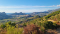
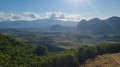
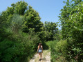
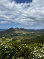
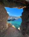
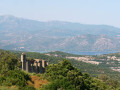
This walk offers a splendid panoramic view of the Patrimonio valley and its vineyards, in conditions that are very rare in Corsica over this distance: a wide, easy-to-walk path that winds along the mountainside. It is therefore a very easy route, though it does involve some elevation gain. Above all, it offers extraordinary views of the vineyards, the limestone cliffs and the sea between the hills. Best done at the end of the day in hot weather, or very early in the morning to catch the beautiful light that photographers will appreciate. The only slightly frustrating thing is that it’s a return trip.

Details

108214067
Creation:
Last update:
Last review:
  • Walking
    Activity: Walking
  • ↔
    Distance: 2.90 mi
  • ◔
    Average duration: 2h 00 
  • ▲
    Difficulty: Easy

  • ⚐
    Back to start: Yes
  • ↗
    Ascent: + 771 ft
  • ↘
    Descent: - 758 ft

  • ▲
    Highest point: 1,066 ft
  • ▼
    Lowest point: 351 ft
  • ⚐ Country: France
  • ⚐ City: Barbaggio (20253)
  • ⚑
    Start/End: N 42.689316° / E 9.362698°
  • ❏
    IGN map(s): Ref. 4348OT
  • Hour-by-hour weather

Photos

Description of the walk

Parking isn’t the easiest part of this walk; you’ll need to find a spot along the Strada Napoleone, which leads up towards the houses behind the village; two spots near the recycling bins seem to be the easiest.

(S/E) Just past number 1500 (on the right) you’ll find recycling bins (on the left). Take the road branching off to the right, crossing a small bridge (there’s a large green sign for Casa Andria), and follow it for about 500 metres.

(1) At the bend, leave the road and take a wide dirt track leading towards the village’s water tank and the mobile phone mast. This section runs alongside a vineyard at first, then winds its way through the scrubland.

(2) Carry on along a wide dirt track, sometimes shaded, sometimes open, which already offers a beautiful panoramic view of Patrimonio.

(3) Pass just below the new reservoir built into the hillside and continue along the track as it climbs and descends, at times offering truly breathtaking views of the Patrimonio vineyards with the sea nestled between the hills. Continue to the end of the track, beneath the cliff near the source of the Ruisseau de la Brietta

(4) Unfortunately, it’s not possible to go any further (perhaps by following the course of the Brietta, but that would be canyoning rather than hiking); turn back and follow the same route you took on the way out to return to the car park (S/E).

Waypoints

  1. S/E : mi 0 - alt. 351 ft - Parking near the recycling bins
  2. 1 : mi 0.2 - alt. 430 ft - Dirt track
  3. 2 : mi 0.5 - alt. 551 ft - Anntenne
  4. 3 : mi 0.75 - alt. 699 ft - New reservoir
  5. 4 : mi 1.46 - alt. 1,066 ft - Source
  6. S/E : mi 2.9 - alt. 351 ft - Parking near the recycling bins

Notes

Walk with no drinking water (not even at the reservoirs).

The path is extremely ‘easy to walk on’; trainers may be sufficient.

The small path leading downhill (marked as a dotted line on the topographic map) towards the end of the outward leg doesn’t really exist.

Worth a visit

Other walks in the area

For more walks, use our search engine .

The GPS track and description are the property of this route's author. Please do not copy them without permission.