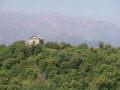
The Piedalbuccio loop

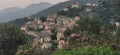
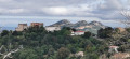
This walking route (U Giru di Piedalbuccio) was created in March 2020 around the rapidly developing residential area of Piedalbuccio. At the time, it was necessary to adapt to the lockdown from March to April 2020, linked to the ‘Covid-19’ pandemic, which restricted time spent outside the home to a maximum of one hour. This route therefore allowed residents to stretch their legs close to home, avoiding the time wasted on road journeys. Even today, in an area where urban development has stabilised, this route remains hugely popular, which in turn minimises the need for maintenance.

Details

46071496
Creation:
Last update:
Last review:
  • Walking
    Activity: Walking
  • ↔
    Distance: 1.30 mi
  • ◔
    Average duration: 0h 50 
  • ▲
    Difficulty: Easy

  • ⚐
    Back to start: Yes
  • ↗
    Ascent: + 226 ft
  • ↘
    Descent: - 207 ft

  • ▲
    Highest point: 597 ft
  • ▼
    Lowest point: 354 ft
  • ⚐ Country: France
  • ⚐ City: Oletta (20232)
  • ⚑
    Start/End: N 42.631841° / E 9.346298°
  • ❏
    IGN map(s): Ref. 4348OT
  • Hour-by-hour weather

Description of the walk

Park in the hamlet of Pietralbuccio.

To find your way, follow the yellow paint markings and the wooden signposts.

(S/E) Walk 100 metres and enter the hamlet.

(1) Head down Via Sampieru to the right, then take the second alleyway on the left, Stradella di u Loriu Rossu. Next, take the path that descends to the right between two properties. Follow the banks of the Ruisseau de Vitte until you reach the wooden signpost indicating Piedalbuccio.

(2) Ford the stream, then follow the path uphill for 400 metres to reach the hamlet of Piedalbuccio. From the car park, walk down the road for 150 metres, then turn right, following the sign for Tuda (wooden sign). After 100 metres, look out on the right for the path between the oak trees and another wooden sign for “Tuda”. This is a local footpath, recognisable by its dry-stone walls. At the end of the path, turn left.

(3) Head down to the left into a large field, then climb back up, heading north-east, alongside the houses on the Stradella di A Teppa. At the highest point, continue straight on along the path through the scrubland.

(4) After passing a small rocky plateau, leave the path to the left after 50 metres by going through the open, authorised gap in a fence. Head down through an oak grove, reach a track at the lowest point, then continue by turning left.

(5) Join Via Sambucucciu, which runs through the Evasion 2 housing estate. Continue to the finish (S/E).

Waypoints

  1. S/E : mi 0 - alt. 469 ft - Via di Piedalbuccio
  2. 1 : mi 0.06 - alt. 456 ft - Via Sampieru
  3. 2 : mi 0.3 - alt. 354 ft - Ford across the Ruisseau de Vitte
  4. 3 : mi 0.73 - alt. 476 ft - Exit from the local footpath
  5. 4 : mi 0.97 - alt. 597 ft - Passage through a fence
  6. 5 : mi 1.07 - alt. 522 ft - Via Sambucucciu
  7. S/E : mi 1.3 - alt. 469 ft - Via di Piedalbuccio

Notes

Water source and shelter: none

Hiking route created by Jean-Baptiste, a Visorandonneur and resident of the Piedalbuccio neighbourhood.

Worth a visit

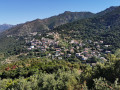
Some lovely trails and superb views – just the thing for a bit of a stroll around our neighbourhood.

Other walks in the area

For more walks, use our search engine .

The GPS track and description are the property of this route's author. Please do not copy them without permission.