Country:
 City:
City:


Parking at the Saint-François d’Oletta Convent – Departmental Road 82 between Oletta and Saint-Florent.
(S/E) Leave the car park by following Strada di u Cunventu southwards. Cross a bridge and turn right onto a track, then take the path that climbs to the right through the woodland
(1) Leave the path on the right and continue along the Strada di u Cunventu track. Pass a remarkable double thatched hut (pagliaghju) before reaching the next junction, 200 m further on. Turn left onto the Sentier de la Concia.
(2) At the highest point, the path splits into two. Turn left, towards Funtana di Mersulaccia. Further down, reach the fountain and turn right. Stay on the path until the next junction, following the signs for ‘plaine’.
(3) At the junction, leave the climb to Monticello on your right and head down to the left towards “plaine”. At the next junction, turn right at a tree with several wooden signs. Take the grassy path to the T-junction signposted “le tour de Cotolone”. Continue straight on, first through a reed bed and then under a canopy of cork oaks, until you reach the junction at the highest point.
(4) At the highest point, after passing the ruins of a farmhouse, turn left, following the orange markings and the red-and-white barrier tape. At the next junction where the footpath meets a track, head down the track to the left. At the next junction of tracks, turn left and head down the newly created track. At the next fork, head down to the right towards the west, skirting the Cotolone hill.
(5) Almost at the end of the loop around Cotolone Hill, at the inverted ‘Y’-shaped track junction, take the track on the right. Follow the signposts and the red-and-white barrier tape. At the end of the track, continue along the path which runs alongside a vineyard and then curves round it. At the gate to the vineyard, carry on straight ahead, following the local footpath lined with dry-stone walls. Leaving the path, head up to the left along a new track and reach the highest point, the northern boundary of the municipality of Oletta.
(6) Enter the territory of the municipality of Poggio d’Oletta. The view opens out onto a plain planted with vines and olive trees. Descend to the level of the first vineyard plots, leaving the vines on the slopes of Monte Magna to your right. Cross the dry Mezzano stream
(7) A few metres further on, take the path on the right into the vineyard and follow the municipal path, which is heavily overgrown and impassable. The wine and olive oil cellar, almost at the far end of the estate, is open to visitors. After going round it on the right, reach the last olive grove. Open and go through the large galvanised gate: the owners have given permission to pass through.
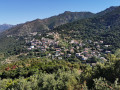
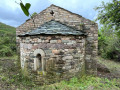
(8) After the gate, turn left onto a path and follow it for 200 metres, flanked by tall scrub. At the end of the path, visit the ruins of the San Petru Chapel, then return to the path and follow it up to the highest point. At the junction of the paths, turn left and head uphill towards the south-east. At the end of the climb, the path continues towards the hamlet of Monticello, which is visible in the distance. At the junction of the path and track, continue to the left, pass an earthen platform used for parking, and reach the Stradella di u Montemegna road, which has a steep incline.
(9) At the end of Stradella di u Montemagna, rejoin the Monticello road. After about a hundred metres, turn into the second alleyway on the right, Carrughju Giovanni Guidoni, and, 50 metres further on, you’ll see the ruins of Maria Ghjentile’s house. Retrace your steps, turn right and reach the RD38 – Stradda di Bastia.
(10) Leave the RD38 by taking the local footpath immediately on the right between two private properties. Follow the sign for “Chjassu di Maria”. Then, at the end of a descent of about 500 metres, you’ll reach the footpath junction you passed on the way there.
(3) Continue down to the right, towards the “convent” (wooden sign). Further on, on the flat section, continue in the same direction until you reach the nearby crossroads, where the path meets three tracks.
(11) Ignore the tracks to the right and left and take the one in the middle, still heading towards the “convent”, following the yellow paint markings. At the lowest point, cross the river via the ford, following the markings. Descend along the left bank, then take a dirt ramp leading to the local footpath.
(12) At the end of the local footpath, continue left onto the Stradella di i Frati and head towards the convent square. Leave the Stradella di i Frati on the left to return to the car park (S/E).
 Association / Club / Walk leader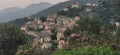
 Easy
Easy 

 Local authority