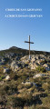
Chjassu Ornitulogicu di Santu Stefanu – Olmeta di Tuda

Created by the Bureau Montagne Nebbiu (Association of Mountain Guides), this walk allows you to familiarise yourself with the birdlife whilst exploring a Natura 2000 nature conservation area.
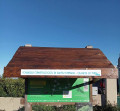
The B.M.N. has improved the route signposting by installing a large sign at the start of the Col de Santu Stèfanu.

From 15 July to 31 October 2026

it is strongly advised not to use this route

Given the successive heatwaves since the end of May, our association has not been able to clear the paths using the appropriate thermal equipment, for one thing.

Furthermore, the heat, drought and windy conditions are conducive to the outbreak of fires, which pose a maximum risk to walkers.

In these extreme conditions, you should opt for short walks along the coast or riverside. Avoid any routes that cross scrubland and/or reach mid-mountain passes.

Details

33399140
Creation:
Last update:
Last review:
  • Walking
    Activity: Walking
  • ↔
    Distance: 4.50 mi
  • ◔
    Average duration: 3h 05 
  • ▲
    Difficulty: Moderate

  • ⚐
    Back to start: Yes
  • ↗
    Ascent: + 1,188 ft
  • ↘
    Descent: - 1,165 ft

  • ▲
    Highest point: 2,313 ft
  • ▼
    Lowest point: 1,204 ft

Photos

Description of the walk

By car, drive to the Col de Santo Stèfano, the gateway to the Nebbiu, where the start and finish are located.
The car park for walkers is limited to the angled parking spaces around the roundabout between the D82 and the D5; a few spaces may be used near the war memorial at the start of the D5.
This is to prevent vehicles from being left for too long in the shops’ car park, which is reserved for customers.

Markings: yellow paint and cairns
Signage: wooden signs – metal signs – specific birdwatching signs

(S/E) Cross the car park for the shops.

(1) Head up the path that runs alongside the building on the left.

(2) Take the tarmac road through the housing estate for 50 m to the left, then turn right for 30 m.

(3) Continue along the dirt track to the water tower. Please note: remember to close the gate behind you.
Throughout the route, numbered signs with QR codes provide key information on each bird species found in the area.

(4) At the water tower, follow the direction indicated by the ‘San Ghjuvan’ sign and take the path heading due north, to the left.

(5) After a 1,400-metre climb, you will reach the Costa Nuda plateau. Continue to the right, heading north-east. Walk 700 metres along the contour line.

(6) At the sign for the Birdwatching Trail, turn right towards the east.

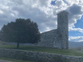
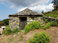
(7) A signpost and a threshing floor mark your arrival at the Col de San Giovanni at an altitude of 726 m, the highest point of the route. Continue straight on towards the east and follow the track downwards.

(8) At the track junction, turn right.

(9) At the track junction (elevation 482), carry on straight ahead.

(10) Go through the gate and reach a fork in the track that you passed on the way out.

(4) Continue down to the left to rejoin the track from the outward journey, this time heading in the opposite direction. This will take you to the Col de Santo Stèfano (remember to close the gate on the track) via the housing estate and then the shops, before returning to the car park (S/E).

Waypoints

  1. S/E : mi 0 - alt. 1,207 ft - Car park at Col de Santo Stèfano
  2. 1 : mi 0.03 - alt. 1,214 ft - Shops
  3. 2 : mi 0.06 - alt. 1,230 ft - housing estate
  4. 3 : mi 0.11 - alt. 1,243 ft - Trail
  5. 4 : mi 0.34 - alt. 1,329 ft - Water tower. Junction of the circular loop
  6. 5 : mi 1.15 - alt. 2,310 ft - Costa Nuda Plateau, 634m
  7. 6 : mi 1.57 - alt. 2,310 ft - Birdwatching sign
  8. 7 : mi 1.59 - alt. 2,313 ft - Col de San Giovanni 726m / Threshing floor
  9. 8 : mi 2.08 - alt. 1,886 ft - Trail junction > head down to the right
  10. 9 : mi 2.93 - alt. 1,591 ft - At the junction of trails, continue to the right
  11. 10 : mi 4.14 - alt. 1,342 ft - Barrier and water tower in view
  12. S/E : mi 4.5 - alt. 1,204 ft - Car park at Col de Santo Stèfano

Notes

- There are no sources of drinking water or shelters along the route.
- At the Col de Santu Stèfanu (start/finish), local shops offer food and drink

Worth a visit

  • Discover the local birdlife and learn about the habits of the various bird species that inhabit the area.
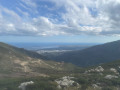
  • Extraordinary panoramic views at Bocca San Ghjuvà. Views over the Tyrrhenian Sea, the Mediterranean and Cap Corse in particular.
  • Along the route:

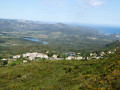
- During the ascent: panoramic views of the Nebbiu, the plain, the Tenda massif (and further afield, San Petrone), and the Gulf of Saint Florent.
- On the descent back down: unusual and impressive views of the Lancone Pass and the Bevincu Gorges, with a beautiful view of the Étang de Chjurlinu (Biguglia).

Reviews and comments

4.3 / 5
Based on 3 reviews

Reliability of the description
4.3 / 5
Ease of following the route
4.3 / 5
Route interest
4.3 / 5
Pierre Quintard
Pierre Quintard

Overall rating : 4 / 5

Date of your route : May 11, 2025
Reliability of the description : ★★★★☆ Good
Ease of following the route : ★★★★☆ Good
Route interest : ★★★★☆ Good
Very busy route : No

This is a walk best avoided in the heat of the day, but it’s well worth the effort. Lovely views and a guaranteed change of scenery. The return journey along the track is long, but becomes interesting again from elevation 482. Thanks to the B.M.N.

Machine-translated

oletta
oletta

Overall rating : 4.3 / 5

Date of your route : Jun 19, 2023
Reliability of the description : ★★★★★ Very good
Ease of following the route : ★★★★☆ Good
Route interest : ★★★★☆ Good
Very busy route : No

a lovely walk and a beautiful view

Machine-translated

libeccio20
libeccio20

Overall rating : 4.7 / 5

Date of your route : May 10, 2023
Reliability of the description : ★★★★☆ Good
Ease of following the route : ★★★★★ Very good
Route interest : ★★★★★ Very good
Very busy route : Yes

A simply magical walk, very well signposted. The ascent is very steep. What a view! Be careful, though: on the way back down, you follow the track, marked in yellow. Just after the start of the descent, the Visorando route takes you along a path to cut across the track. However, it seems this path no longer exists – at least, I couldn’t find it – or is overgrown. So I carried on along the track. It just adds 300 or 400 metres to the walk. The start of the descent is a bit monotonous at first, but that changes quickly and the scenery is marvellous, with sheer drops, ravines and extraordinary views looking down. At this time of year (May), all the plants are in bloom and it’s magnificent. Not recommended in summer as the path is always in the sun. Well done on this route! It’s a real treat… in every sense, as there’s a lovely bakery at the end.
It really is a hike not to be missed. Well done to the Mountain Office for this brilliant work.

Machine-translated

Other walks in the area

For more walks, use our search engine .

The GPS track and description are the property of this route's author. Please do not copy them without permission.