Circular route via the Chiesa Nera

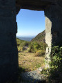
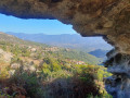
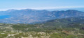
Pleasant circular walk passing the ruins of a 13th-century chapel, with lovely views of Cap Corse, the Gulf of Saint Florent and the Tenda Mountains.

Details

56882356
Creation:
Last update:
Last review:
  • Walking
    Activity: Walking
  • ↔
    Distance: 3.59 mi
  • ◔
    Average duration: 2h 30 
  • ▲
    Difficulty: Easy

  • ⚐
    Back to start: Yes
  • ↗
    Ascent: + 945 ft
  • ↘
    Descent: - 945 ft

  • ▲
    Highest point: 2,241 ft
  • ▼
    Lowest point: 1,398 ft
  • ⚐ Country: France
  • ⚐ City: Piève (20258|20246)
  • ⚑
    Start/End: N 42.580179° / E 9.288576°
  • ❏
    IGN map(s): Ref. 4348OT, 4349OT
  • Hour-by-hour weather

Photos

Description of the walk

The route starts at the church in the village of Pieve. A car park is accessible near the church via a very narrow street, on the left after the fountain when coming from Rapale. Alternatively, park at the side of the road, taking care not to obstruct traffic.

(S/E) The route starts via a path at the end of the car park to the right of the church (when facing the church).
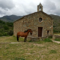
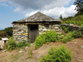
The path climbs gently up the hillside. It is in the shade quite early in the morning, and partly in the shade in the late afternoon. After half an hour’s climb, the path joins a track. Turn right onto this track and follow it for 100 metres to reach the remains of the chapel.

(1) Watch out for holes in the chapel floor. Turn back and take the track for the descent. Continue along this track for two hairpin bends. After about 45 minutes’ descent along this track, a path branches off to the left, markedPR®. A sign points towards Pieve.

(2) Take this path, which runs alongside a tiny stream and leads out behind the village cemetery. Carry on straight ahead to reach the church. (S/E)

Waypoints

  1. S/E : mi 0 - alt. 1,427 ft - Pieve car park
  2. 1 : mi 1.14 - alt. 2,175 ft - Chiesa Nera church
  3. 2 : mi 3.08 - alt. 1,732 ft - PR
  4. S/E : mi 3.59 - alt. 1,398 ft - Pieve car park

Notes

Fountain on the main road, below the church.
A bar opposite the fountain.

Worth a visit

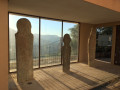
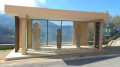
Menhirs in front of the church.
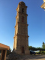
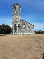
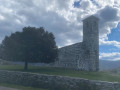
Church and bell tower.
Romanesque chapel built of chlorite (green stone, like that of the Pisan church of San Michele de Murato). The chapel was probably part of a series of chapels erected for pilgrims, possibly linked to the pilgrimage to Santiago de Compostela.
A typical village in the Pieve area.

Always be cautious and plan ahead when you're outdoors. Visorando and the author of this route cannot be held responsible for any accidents occurring on this route.

The GR® and PR® markings are the intellectual property of the Fédération Française de Randonnée Pédestre.

Reviews and comments

4.5 / 5
Based on 2 reviews

Reliability of the description
4 / 5
Ease of following the route
5 / 5
Route interest
4.5 / 5
User 11947731

Overall rating : 4.3 / 5

Date of your route : Nov 09, 2025
Reliability of the description : ★★★★☆ Good
Ease of following the route : ★★★★★ Very good
Route interest : ★★★★☆ Good
Very busy route : No

A very pleasant hike in autumn and accessible to all. Beautiful views throughout the route.

Machine-translated

Remysapin@club-internet.fr

Overall rating : 5 / 5

Date of your route : Oct 13, 2024
Reliability of the description : Not used / Not applicable
Ease of following the route : ★★★★★ Very good
Route interest : ★★★★★ Very good
Very busy route : No

A lovely, varied walk offering views over Saint Florent Bay. We particularly enjoyed the climb along an old track, as well as the final stretch along a path leading back to the village of Pieve.

Machine-translated

Other walks in the area

For more walks, use our search engine .

The GPS track and description are the property of this route's author. Please do not copy them without permission.