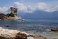
From the Citadel of Saint-Florent to Campu Maggiore Beach in Farinole

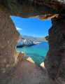
From Saint-Florent to Farinole along the coast, this return route allows you to discover hidden swimming spots as well as the path carved into the limestone cliffs, “marking the transition between the schistose Cap Corse peninsula and the Agriate Desert”.

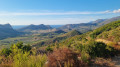
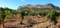
The scenery, perfect for photography, is fabulous. On the outward journey, you’ll see the gulf, the ridge of Cap Corse and, on rare occasions, the mainland coastline, which can be glimpsed on clear, windy days. On the return journey, the view opens up to the south towards Saint-Florent, the Nebbiu plain and its foothills, notably featuring the Tenda range and its highest peak, Monte Astu. To the west, the coastline stretches widely from Anse de Fornali to Punta di Cuza, situated between the beaches of Lotu and Saleccia.

⚠️ Hiking is prohibited from March to August as this is the nesting season. See practical information.

Details

n°108976538
Creation:
Last update:
Last review:
–
  • Walking
    Activity: Walking
  • ↔
    Distance: 8.47 mi
  • ◔
    Average duration: 4h 30 
  • ▲
    Difficulty: Moderate

  • ⚐
    Back to start: Yes
  • ↗
    Ascent: + 673 ft
  • ↘
    Descent: - 656 ft

  • ▲
    Highest point: 243 ft
  • ▼
    Lowest point: 3 ft

Description of the walk

To reach Saint-Florent, in Haute-Corse, take the D82 from the Col de San Stefano via Oletta, or the D81 from the Col de Teghime via Patrimonio. Park within the citadel grounds.

(S/E) Leave the esplanade heading south, walk past the secondary school and reach the junction with the D81. Turn left onto the Dominique Vincenti promenade and follow it to Ospedale beach.

(1) Leave the promenade and head down to Ospedale beach via the steps. Continue on to Olzu beach.

(2) At Olzu, cross the Strutta stream at the ford, cross the beach and then take the coastal path on the left. Continue until you come to a road on the right, slightly above the seafront.

(3) Take the road, head uphill to the left and reach the signpost indicating the coastal path. Leave the road to the left.

(4) Follow the coastal path, keeping to the signposts, until you reach Calanca di a Torre.

(5) From Calanca di a Torre, continue on to Punta Vecchiaia.

(6) From Punta Vecchiaia, continue to Punta di Saeta.

(7) From the highest point of Punta di Saeta, descend via the path carved into the cliff face.

(8) At the bottom, cross the car park to the Fium’Albino stream.

(9) Cross the stream, which is often dry but requires you to take off your shoes during wet weather. Walk across Campu Maggiore beach.

(10) Once you reach the end of the beach, return to the starting point via the same route (S/E).

Waypoints

  1. S/E : mi 0 - alt. 59 ft - Citadel of Saint-Florent
  2. 1 : mi 0.51 - alt. 10 ft - Ospedale Beach
  3. 2 : mi 1.5 - alt. 3 ft - Olzu Beach
  4. 3 : mi 2.32 - alt. 10 ft - Private road (pedestrians permitted)
  5. 4 : mi 2.55 - alt. 69 ft - Road junction – coastal path
  6. 5 : mi 3.16 - alt. 13 ft - Calanca di a Torre
  7. 6 : mi 3.32 - alt. 56 ft - Punta Vecchiaia
  8. 7 : mi 3.64 - alt. 220 ft - Punta di Saeta
  9. 8 : mi 3.9 - alt. 59 ft - Base of the cliff, car park
  10. 9 : mi 3.99 - alt. 7 ft - Fium Albino (fleuve) - Méditerranée
  11. 10 : mi 4.23 - alt. 10 ft - The far end of Campu Maggiore beach
  12. S/E : mi 8.47 - alt. 59 ft - Citadel of St-Florent

Notes

There are no water sources or shelters along this route.

Make sure you bring plenty of water during the summer months and a lightweight waterproof.

Birdlife

The coastline of the Gulf of Saint-Florent and the cliffs of Patrimonio are home to a remarkable variety of marine and coastal birdlife, which is protected in particular within the ‘Grand Site de France’ Conca d’Oru, Patrimonio – Saint-Florent.

Worth a visit

Things to do and see along the route

  • A visit to the town of Saint-Florent.
  • The beaches and rocky coves.
  • Birdlife.
  • Driftwood on Campu Maggiore beach.
  • The picturesque and well-maintained coastal path.
  • Landscapes – Panoramas.

Other walks in the area

For more walks, use our search engine .

The GPS track and description are the property of this route's author. Please do not copy them without permission.