Country:
 City:
City:


By car, head to Olmeta di Tuda.
Coming from the Bastia area:
- at Biguglia, take the D62 (and explore the Lancone Gorge)
or
- at Ortale de Biguglia (roundabout no. 4), take the D82 towards Oletta-Rutali-Saint-Florent
Both routes lead to the Col de Santo Stefano, which marks the entrance to the Nebbiu region.
Park in the municipal car park, opposite Tuda Castle.
Along the route
Markings: Yellow paint, fluorescent yellow paint + cairns
Signage: Wooden and iron signs
(S/E) Olmeta di Tuda Municipal Car Park
Leave the car park via the dirt track heading east and head towards the tennis court, which is in sight
(1) Walk alongside the tennis court, then round its right-hand side. After the spring, climb the steps and follow a short path to reach the D82 road. Walk up the road, carefully crossing a 50-metre stretch without a pavement.
(2) After 150 m, cross the road opposite a concrete utility room, which you should go round to the right of. Walk up to the gate, go through it and close it behind you, then follow the path. Pass by the enclosure of the first reservoir and continue to the right along the track for 400 m until you reach asecond reservoir.
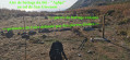
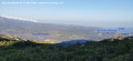
(3) Go round this second reservoir to the left and begin the climb up the path, heading north, following the iron sign for “Bocca San Ghjuvan”. At the highest point, a rest stop on the Costa Nuda plateau is a must to take in the panoramic views. Continue along the gently sloping path to reach the Col de San Giovanni – altitude 705 m.
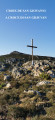
(4) You’ll come to a scree slope signposted “Chjassu Ornitulogicu”, another hiking route in the area. Turn right for 50 m, heading east. At the threshing floor, where an iron sign marks the spot, follow the path branching off to the left. After 100 m, climb the mound on the left up to the Cross of San Giovanni – altitude 726 m.
(5) Go round the cross and follow the track southwards, which descends to point no. 4, with the “Chjassu Ornitulogicu” signpost in sight.
(4) At the scree slope, head straight down westwards for about 100 m through low scrub.
(6) Find the markings on the rock and follow the very rocky path with a steep gradient. At the lowest point, reach a plateau marked by a collapsed low wall and continue in the same direction for 150 m.
(7) Look out for the markings on the ground and head south-west. Further on, the path is lined with scrubland as far as Bocca di Pardinu.
(8) Reach the pass and turn left towards Olmeta – metal sign. After passing a shepherd’s hut, cross a stream and continue along the path for 600 m.
(9) At a very sharp bend in the path, turn right and walk alongside the fence of the first house you see. Go through a small gate to reach the road leading to the highest part of the village. Walk downhill for 200 m.
(10) Walk along the cemetery wall on your left until you reach the D82 road. Cross the road and enter the village.
(S/E) Head to the municipal car park

 Association / Club / Walk leader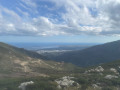


 Easy
Easy