Country:
 City:
City:


Getting to San Gavino di Tenda by car
- coming from Bastia via the D82, reach the Col de San Stefano and take the D62.
- Coming from Saint Florent, take the D82 towards Oletta, then turn off towards Lake Padula and follow the D262.
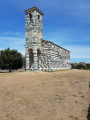
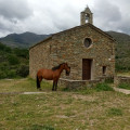
Leave the D62 at the bottom of the village and drive up to the church. Find a parking space, taking care not to obstruct traffic.
The sign for the walk is visible near the fountain opposite the town hall.
The route is mainly signposted with cairns and a few wooden signs.
(S/E) From the town hall, follow the steeply ascending village street to the last house.
(1) Take the path running under the canopy of trees. Go through a gate, making sure to close it behind you. Continue for 300 metres.
(2) Leave the path to the left, following the sign for “Monte Astu”. Pass in front of a haystack (pagliaghju) and continue along the well-marked path, initially through low vegetation which becomes denser further on, until you reach a rocky outcrop.
(3) From this rocky outcrop, follow a steep, stony path requiring particular care. Continue to the “A Genucula” rock at an altitude of 1,042 metres.
(4) After you’ve “warmed up your calves” and passed the 1,042-metre mark, the gradient becomes more manageable until the start of the final ascent, at an altitude of 1,470 metres.
(5) From this point, turn left; throughout this short ascent, the narrow, rocky path requires extra caution right up to the summit.
(6) The return journey to San Gavinu (S/E) follows the same route in the opposite direction. Be sure to keep an eye out for the signposts, which are harder to spot when travelling at a naturally faster pace on the descent.
 Association / Club / Walk leader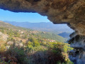
 Moderate
 Visorando Member
 Easy
Easy