Piève–Sorio circular loop

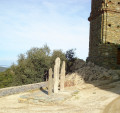
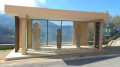
Second circular route of the route: ‘Between the Secular and the Sacred’, created on the initiative of the municipalities of Rapale, Pieve and Sorio, using the old footpaths that once linked the three villages. This route is every bit as good as the previous one when it comes to exploring the local heritage: menhir statues, wash houses, fountains, cobbled alleyways and village paths lined with walls – that’s the secular side.
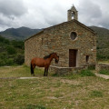
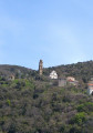
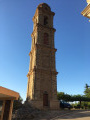
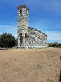
The sacred heritage is equally remarkable, featuring the churches of San Quilico in Pieve, San Filippu Neri in Sorio and the chapels.
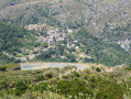
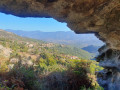
The return journey from Sorio to Pieve, offering a panoramic view over the Nebbiu plain and the Gulf of Saint Florent, is ideal for taking photographs.

This route is strongly advised against from 15 July to 31 October 2026

See practical information

Details

41722242
Creation:
Last update:
Last review:
  • Walking
    Activity: Walking
  • ↔
    Distance: 3.83 mi
  • ◔
    Average duration: 2h 55 
  • ▲
    Difficulty: Moderate

  • ⚐
    Back to start: Yes
  • ↗
    Ascent: + 1,322 ft
  • ↘
    Descent: - 1,329 ft

  • ▲
    Highest point: 2,090 ft
  • ▼
    Lowest point: 915 ft
  • ⚐ Country: France
  • ⚐ City: Piève (20258|20246)
  • ⚑
    Start/End: N 42.580419° / E 9.288201°
  • ❏
    IGN map(s): Ref. 4348OT, 4349OT
  • Hour-by-hour weather

Photos

Description of the walk

By car, reach the village of Pieve via the Col de Santo Stefano, the entrance to Nebbiu, then follow the D62. Once in the centre of Pieve, just after the fountain, take the road on the left which climbs towards the menhir statues. Park in the designated spaces in the church square.

Markings: yellow paint and cairns
Signage: wooden sign: ‘Between the Profane and the Sacred – Pieve – Sorio’.
Directions within the villages (and/or follow on an IGN map).

(S/E) Start by heading back down the Strada di a Chjesa, turn right at the junction with the D62, then left after the fountain. Walk downhill for about fifty metres.

(1) Follow the track to the right, then turn left straight away. At the lowest point, cross the Ruisseau de Ficapenta, pass the Funtana di Cargalella and reach a track.

(2) Walk 100 m to the right, then turn left onto the path which first leads to the Santa Margarita Chapel and then joins the D62 after crossing a wide track. Turn right towards the church.

(3) Cross over, walk past the church on the left, then head up the small road called Valle Fascine Cortalina. At the fountain, take a sharp right-hand bend and continue up the narrow streets to the highest point. Pass Rue Petriconi on your right and continue straight up the municipal path to the Chapel of Sant’Antone. Turn left, then immediately right to go round it, and continue for about fifty metres.

(4) Then take the path that starts on the left. Reach the highest point and a junction located after the ruins of the old San Damiano Chapel.

(5) Continue along the main path, which descends slightly to the left. At the next fork, turn sharply right, then carry on straight ahead at the next junction.

(6) Turn off to the left. Follow the track that runs alongside a property. At the junction of two tracks, keep to the left.

(7) At the next track/path junction, take the path that descends to the left and follow it until you reach the D62 road at the bottom.

(8) Turn right and follow the road uphill to the village of Piève. In the centre of the village, turn right onto the Strada di a Chjesa, following the sign for Stantare (menhir statues), until you reach (S/E) the church square, where there is a car park.

Waypoints

  1. S/E : mi 0 - alt. 1,401 ft - Church square. Piève
  2. 1 : mi 0.1 - alt. 1,309 ft - Crossroads
  3. 2 : mi 0.54 - alt. 1,020 ft - Trail junction
  4. 3 : mi 0.92 - alt. 1,168 ft - Church of Sorio
  5. 4 : mi 1.45 - alt. 1,404 ft - Sant’Antone, track/path junction
  6. 5 : mi 1.87 - alt. 1,936 ft - Three-way junction, turn left
  7. 6 : mi 2.37 - alt. 1,946 ft - Junction of paths
  8. 7 : mi 2.74 - alt. 2,044 ft - Crossroads of track and footpath
  9. 8 : mi 3.48 - alt. 1,309 ft - Strada di Funtana Rossa (D62)
  10. S/E : mi 3.83 - alt. 1,401 ft - Church square. Piève

Notes

From 15 July to 31 October 2026

it is strongly advised not to use this route

Given the successive heatwaves since the end of May, our association has not been able to clear the paths using the appropriate thermal equipment, for one thing.

Furthermore, the heat, drought and windy conditions are conducive to the outbreak of fires, which pose a maximum risk to walkers.

In these extreme conditions, you should opt for short walks along the coast or riverside. Avoid any routes crossing scrubland and/or reaching mid-mountain passes.

------------------------------------------------------------------------------------------------------------------

Please note: this description is not a copy-and-paste of the certified route but a variant split into two circular loops that follow the same routes. The aim is to make the route more accessible by reducing the distance and duration, thereby allowing more time to explore the local heritage.

Shelters, water points and places to eat in both villages.
Fountain between (1) and (2): Funtana di a Gargalella.

Worth a visit

(3) In Sorio:

  • St Philip’s Church.
  • The Romanesque chapels of Santa Margarita and Sant’Antone.
  • Narrow village streets.
  • Balcony path overlooking the Nebbiu plain.

(S/E) In Piève:

  • The parish church of San Quilico de Pieve with its off-centre bell tower.
  • Menhir-like statues.
  • The village’s narrow streets.

Reviews and comments

4.3 / 5
Based on 2 reviews

Reliability of the description
4 / 5
Ease of following the route
5 / 5
Route interest
4 / 5
luisipatrick
luisipatrick

Overall rating : 4 / 5

Date of your route : Sep 08, 2025
Reliability of the description : ★★★★☆ Good
Ease of following the route : ★★★★★ Very good
Route interest : ★★★☆☆ Average
Very busy route : No

Starting from Pieve, a loop allows you to visit the villages of Sorio and Rapale, combining the two hikes into a single route: the Pieve-Sorio loop (41722242) and the Rapale-Pieve loop (41721807).
The Pieve-Sorio loop is interesting for discovering the local heritage, but the Rapale-Pieve loop doesn't offer anything more, which is a shame.

Machine-translated

Remysapin@club-internet.fr

Overall rating : 5 / 5

Date of your route : Oct 15, 2024
Reliability of the description : Not used / Not applicable
Ease of following the route : ★★★★★ Very good
Route interest : ★★★★★ Very good
Very busy route : No

Thank you to the author for suggesting this lovely walk, which takes you through two beautiful villages in the Nebbio region along old paths and offers stunning views of the Gulf of Saint-Florent. Just before point 5, I’d suggest not missing the climb up to the San Damiano cross. After point 5, at the Carpiniccia stream, the Yellow Rectangle does not follow the Visorando route but stays slightly below the livestock farm before rejoining the route shortly after point 7.

Machine-translated

Other walks in the area

For more walks, use our search engine .

The GPS track and description are the property of this route's author. Please do not copy them without permission.