Country:
 City:




Setting off from Patrimonio, walk uphill through the village via Avenue Pierre de Bernardini, then turn left onto the D333 towards Farinole. You’ll find a few parking spaces on the left-hand side of the road in the hamlet of Ficaia.
(S/E) With your back to the car park, take the steps on the right which wind their way between the houses. At the last house on your right, walk round its left-hand corner to join a small path on the hillside above the hamlet.
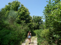
(1) This path first crosses a pasture where you may come across a few cows, then quickly enters a wooded area. Continue steadily uphill until you reach a chestnut grove.
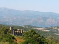
(2) The path then continues along the ridge. As you go, you can enjoy magnificent views over the Gulf of Saint-Florent and the valley’s vineyards. The climb is steep and leads out onto the road heading towards the Pigno transmission masts.
(3) Follow this road uphill to the left for a few hundred metres.
(4) Pass the last two antennae and, at the bend, leave the road to take the small path opposite which crosses over to the other side of the ridge. Here you can see one of the markers for the European Way of Saint Martin. Continue due north towards Monte Muzzone and then Monte San Columbano. Along the way, you’ll pass close to two old ice houses and enjoy magnificent views of Bastia and the Étang de Biguglia Nature Reserve.
(5) At an altitude of 819, the path splits into two. Take the path on the right; the one on the left leads to Cima di Gratera. Pass under the high-voltage power line and continue downhill through heather and arbutus trees until you reach a junction.
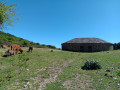
(6) Turn right and emerge into the Bocca Pruna clearing, where there is a beautiful, fully renovated ice house. Walk round it to reach a wide track further downhill.
(7) Cross the Ruisseau de Grigione. Leave the yellow markings behind and take the wide path immediately on your left, which climbs steeply.
(8) After several bends, leave this path and take a narrow track on the right that leads into the scrubland. Take care, as it is hard to spot if you’re not paying attention. The start of the path is marked by a small cairn. Continue along this path for a few hundred metres. Pass under a high-voltage power line once more, where the path widens, and reach a crossroads of tracks at Bocca di San Léonardo.
(9) Here, take the second path on the left. The descent is long and technical as it is very stony. Continue to the next junction on the heights of Poggio.
(10) Keep to the left onto the small path marked by the signpost for “Couvent”. Cross the Ruisseau d’Ernaiolo and continue to the next junction.
(11) On the hills above Sparagaggio, turn left. The path winds through the woods past the ruins of an old village. Cross the Fiumicello stream and continue, ignoring the paths on either side, until you reach the ruins of Marianda Convent.
(12) As you approach the convent, walk along the fenced-off land on the left, as access to the ruins does not appear to be possible. Continue along the wide track which runs past the water tower on your left and descends to the D333. Follow this road to the left towards the village of Patrimonio.
(13) At the third bend, leave the road and take a wide track on your right. After about a hundred metres, a small cairn indicates a path on your left which you should follow. Continue towards the village, ignoring the paths on either side.
(14) As you approach Patrimonio, leave this track and take a signposted path called the “Sentier du Patrimoine”. This very pleasant route crosses two wooden footbridges over the stream, passes close to the ruins of an old mill and features several information boards explaining the site’s history. Walk past the houses and head back to the road where the car park is located, the starting point of this route (S/E).

 Association / Club / Walk leader
 Easy

 Visorando Member

 Moderate

 Local authority