Circular walks from Murato via San Michele and Teppa di Lucciana

Here is a new route starting from the Church of Saint Michael in Murato, which quickly takes the walker to discover the ‘Queen’s Rock – Teppa di Luciana’. The archaeological excavations of this ‘enormous rocky chaos’ are described in the ‘Places to See’ section.

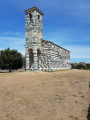
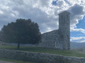
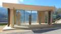
On the descent towards the coastal river Bevinco, traces of the area’s agricultural and pastoral past can be seen. In and around the village, there are magnificent historic buildings , including the 12th-century Pisan church , other churches and chapels, as well as restored old structures such as ovens, wash houses and fountains. On the southern outskirts, heading towards the Col de Bigorno, renovated Genoese bridges allow you to cross the Bevinco. An old ice house can be seen beside the Strada di Bigorno, which you’ll take on the return journey. Just before crossing the Pont Neuf, there is a picnic area for walkers. Finally, on arrival, you can visit the Church of San Michele, a12th-century Romanesque building in the Pisan style.

Details

n°93857786
Creation:
Last update:
Last review:
–
  • Walking
    Activity: Walking
  • ↔
    Distance: 6.22 mi
  • ◔
    Average duration: 3h 40 
  • ▲
    Difficulty: Moderate

  • ⚐
    Back to start: Yes
  • ↗
    Ascent: + 955 ft
  • ↘
    Descent: - 961 ft

  • ▲
    Highest point: 1,864 ft
  • ▼
    Lowest point: 1,227 ft
  • ⚐ Country: France
  • ⚐ City: Murato (20239)
  • ⚑
    Start/End: N 42.58637° / E 9.334655°
  • ❏
    IGN map(s): Ref. 4348OT, 4349OT
  • Hour-by-hour weather

Description of the walk

To reach Murato, take the D5 road from the Santo Stefano Pass, which can be reached via the D82 or D62 when coming from the Bastia area. Use the car park situated to the left of the D5 before the nearby San Michele church.

Signposting: wooden signs, red-and-white barrier tape, cairns

Start from the car park on the left-hand side of the D5, just before the Church of San Michele (signposted ‘Teppa di Luciana’).

(S/E) Take the path towards Teppa di Luciana.

(1) Reach Teppa di Luciana, a pile of rocks which you can walk round. For safety reasons, it is not advisable to venture any further into the caves.

(2) You’ll reach the first agropastoral ruin, followed by two more before the banks of the Bevinco.

(3) Follow the path along the river to the junction with the Tiloni road.

(4) At the Tiloni junction, take the road up to the right to reach the entrance to the village. Continue along I Milelli and, a little further on, you will come to the wash house/fountain on the left.

(5) At the washhouse/fountain, turn left. Continue via Piazza Muraglio and then through the arched passageway beneath the Mint. Leave Corsu di a Liberta on your right and take the short path on the left leading to Strada di u Mucale.

(6) On Strada di u Mucale, head up the road on the left towards the southern exit of Murato. You’ll reach a junction between the road and a footpath on Strada di a Costa a u Fornu.

(7) Take the path leading down to the left to reach the Genoese bridge “Ponte a e Teghjè” on the River Bevinco.

(8) Then return to the previous junction.

(7) Continue left along Strada di a Costa a u Fornu, then Strada di Bigornu, until you reach the next junction on the D5 county road (Strada di Bigornu – municipal road).

(9) At the junction where a sign points to San Roccu on the right, leave the D5 road by turning left. First, head down a short stretch of road and then follow the E Machje path. At the junction of the paths, continue to the right until you reach the esplanade of the Pont de la Croix des 4 Vents.

(10) Walk up to the esplanade of the Pont de la Croix des 4 Vents beside the D5 road. Take the path closest to the road and head down towards Bevinco. Reach and cross the Genoese bridge, then turn right. After 50 metres, head up to the left along the path. You will arrive at the D5–Strada di Bigorno road.

(11) At the junction of the footpath and the D5-Strada di Bigorno road, head down to the right to the Pont Neuf and continue along the D5 towards Murato. You will arrive at the esplanade of the Pont de la Croix des 4 Vents.

(10) Return along the path in the opposite direction to the outward journey until you reach the road.

(9) Cross the road and head up the municipal track opposite towards San Roccu. At the junction, leave the track and follow the San Roccu path, passing the chapel and its fountain. At the end of “Chjassu di San Roccu”, take the “Strada di San Ghjuvanni” track, pass the church of the same name, then reach the junction at Murato Suprano.

(12) At the junction, head left up into the village. Continue to the right through Pulatorra, then straight on towards Piccicheto and Chjassu di Campatile. At the highest point, you’ll reach the junction of Chjassi di Ghergherete and a footpath on the right.

(13) Leave Chjassi di Ghergherete and head downhill to the right along the path. At the end of the path, turn left and follow the road that passes in front of the cemetery. Then continue along A Stucaccia towards the fountain opposite the Church of San Michele.

(14) From the fountain, keep to the left of the D5-Tintinaghjoli. Pass the Church of San Michele on your right before quickly reaching the finish line, crossing the D5 road with great care (S/E).

Waypoints

  1. S/E : mi 0 - alt. 1,542 ft - Car park near San Michele
  2. 1 : mi 0.5 - alt. 1,581 ft - Teppa di a Luciana – The Queen’s Rock
  3. 2 : mi 0.65 - alt. 1,421 ft - Agricultural and pastoral remains
  4. 3 : mi 0.89 - alt. 1,227 ft - Riverbanks of the - Bevinco (fleuve)
  5. 4 : mi 1.5 - alt. 1,476 ft - Path x Tiloni Road
  6. 5 : mi 1.77 - alt. 1,601 ft - Washing house - Fontaine de Murato
  7. 6 : mi 1.99 - alt. 1,677 ft - Path x Strada di u Mucale
  8. 7 : mi 2.13 - alt. 1,693 ft - Road x Footpath
  9. 8 : mi 2.4 - alt. 1,585 ft - Genoese bridge - Bevinco (fleuve)
  10. 9 : mi 2.88 - alt. 1,729 ft - Road x E Machje path
  11. 10 : mi 3.25 - alt. 1,745 ft - Bridge of the Cross of the Four Winds
  12. 11 : mi 3.52 - alt. 1,864 ft - Path x Strada di Bigorno
  13. 12 : mi 5.22 - alt. 1,729 ft - Strada San Giovanni – Murato Soprano
  14. 13 : mi 5.71 - alt. 1,749 ft - E Ghergherete path x Footpath
  15. 14 : mi 6.07 - alt. 1,552 ft - Fountain - Église Saint-Michel (Murato)
  16. S/E : mi 6.22 - alt. 1,542 ft - Car park near San Michele

Notes

Water points: Muratu Suttanu washhouse/fountain (5) + San Roccu Chapel fountain + Murato Supranu fountain further on (12) + San Michele fountain (14)

Shelters, shops and a chemist’s in the village

Worth a visit

Places to see and/or visit

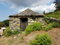
Agricultural and pastoral buildings between (2) and (3): old mill + ‘pagliaghju’ with its wheat-threshing area + well-preserved house with a large vaulted cellar.

The banks of the Bevincu between (3) and (4).

Washhouse – Murato Suttanu fountain (5).

Between (5) and (6) in the Muratu Suttanu neighbourhood, a renovated bread oven.

Palace of the Mint – see the Wikipedia page on the history of Murato + narrow streets.

Optional detour, approx. 800m round trip: at point (7), walk down to the Genoese bridge ‘A E Teghje’ over the Bevinco.

This small single-arch bridge spans a pretty natural pool and rests directly on the rock. Its name comes from the‘teghje’, flat stones – also known as ‘lauzes’ – which were once used to roof Corsican houses. They were quarried from an old quarry in the area.

Between points (10) and (11).

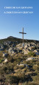
Bridge of the Cross of the Four Winds (Ponte di a Croce di i Quattri Venti)

It takes its name (Croce di e Venture) from the locality where the winds once converged. It is also sometimes called the Santa Lucia Bridge. It is a single-arch bridge that once allowed people and animals to cross over the Bevinco.

Renovated San Roccu Chapel, point no. (12).

Between (9) and (12) lies the Church of San Giovanni with its conical bell tower.

After (12): a washhouse, fountain and renovated bread oven, in the Muratu Supranu neighbourhood.

The superb polychrome Church of San Michele, the most visited monument in the micro-region.

Other walks in the area

For more walks, use our search engine .

The GPS track and description are the property of this route's author. Please do not copy them without permission.