


Refine your search for walks in Saint-Rémy-de-Maurienne
Saint-Rémy-de-Maurienne walks


 Tour des Chatermes
 Visorando Member
 4.83 mi
 +2,861 ft
 -2,861 ft
 4h 45
4h 45
 Difficult
 Departure from Saint-Rémy-de-Maurienne (Savoie)
A beautiful, unspoilt route around Les Chatermes with panoramic views of Les Grands Moulins and the Pointe de Rognier.
The Valette Valley
5.86 mi
+3,379 ft
-3,379 ft
5h 40
Difficult
Departure from Saint-Rémy-de-Maurienne (Savoie)
A true high-mountain experience is guaranteed on this beautiful walk in the Belledonne Massif at the foot of the Pic du Frêne
The Col de Montjoie
6.94 mi
+2,051 ft
-2,080 ft
5h 00
 Moderate
Departure from Montgellafrey (Savoie)
Moderate
Departure from Montgellafrey (Savoie)
An easy hike to the Col de Montjoie. Unobstructed views, particularly of the Aiguilles d'Arves and the Glacier de l'Etendard.
Lac de la Grande Léchère mountain hut – Montartier Lakes
10.81 mi
+4,577 ft
-3,084 ft
8h 55
Difficult
Departure from Montgellafrey (Savoie)
A lovely climb through the upper pastures where the cows that produce the milk for Beaufort cheese graze, with views of the Vanoise, the Thabor Massif, the Aiguilles d’Arves and the foothills of the Écrins. Then the route changes direction, offering views of Belledonne, the Chartreuse and the Bauges, before setting up camp at the Montartier Lakes.
Croix du Grand Praz via Lac de la Grande Léchère
 8.01 mi
+2,812 ft
-2,818 ft
6h 10
Moderate
Departure from Montgellafrey (Savoie)
8.01 mi
+2,812 ft
-2,818 ft
6h 10
Moderate
Departure from Montgellafrey (Savoie)
A hike starting from Montgellafrey, an authentic village in the Maurienne valley.
The route passes scattered hamlets, then reaches Lac de la Grande Léchère, before continuing on to Croix du Grand Praz.
Lac du Loup from Notre-Dame de Beaurevers
 5.90 mi
+1,552 ft
-1,558 ft
4h 05
Moderate
Departure from Montaimont (Savoie)
5.90 mi
+1,552 ft
-1,558 ft
4h 05
Moderate
Departure from Montaimont (Savoie)
If you enjoy the atmosphere of green mountains, the countryside, walking along small, often shaded paths that are very pleasant in hot weather, and discovering the charm of numerous hamlets with magnificent views of the surrounding area, then this is the right hike for you. Of course, you can also discover the flora and fauna, such as crocuses in August.
The Col du Paradis from the Sainte-Anne Chapel
 5.63 mi
+1,703 ft
-1,677 ft
4h 05
Difficult
Departure from Saint-François-Longchamp (Savoie)
5.63 mi
+1,703 ft
-1,677 ft
4h 05
Difficult
Departure from Saint-François-Longchamp (Savoie)
Discover the Paradis mountain pastures, above Saint-François-Longchamp, the bells of the cattle herds in the green summer pastures, with magnificent views of the surrounding mountains, the passage through the hamlet of La Perrière, then a return via the path through the Pézières Forest, with its complicated passages through muddy waterways or a tiny, vertiginous path. Beautiful emotions await you.
Cheminées des Fées, starting from Saint-François-Longchamp
 2.59 mi
+856 ft
-863 ft
1h 55
Moderate
Departure from Saint-François-Longchamp (Savoie)
2.59 mi
+856 ft
-863 ft
1h 55
Moderate
Departure from Saint-François-Longchamp (Savoie)
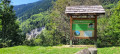
The ‘demoiselles coiffées’ (topped rock formations), known locally as the Cheminées des Fées, are a unique feature resulting from the erosion of the landscape by water runoff.
 Crête du Paradis, La Buffaz, Sainte-Marguerite Chapel loop
5.27 mi
+1,831 ft
-1,831 ft
4 hrs
Moderate
Departure from Montaimont (Savoie)
A beautiful walk in the Montaimont cirque. The walk is described in a clockwise direction, but can also be done in the opposite direction.The markings, when visible, are those for the summer period. The route sometimes deviates from the official trail.The entire loop is well cleared, offering a vast panorama. Due to its orientation and modest altitude at the start, this hike is best enjoyed at the beginning of the season.There is no risk of snow slides on this route.
The Montaimont Meadow
 6.50 mi
+1,916 ft
-1,916 ft
3 hrs
Moderate
Departure from Montaimont (Savoie)
6.50 mi
+1,916 ft
-1,916 ft
3 hrs
Moderate
Departure from Montaimont (Savoie)
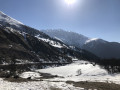
The Prairie de Montaimont is a vast, easy area that is ideal for snowshoeing. This route quickly offers magnificent panoramic views (Belledonne, Cheval Noir, the Col de la Madeleine, the Maurienne Massif, the Aiguilles d'Arves in the distance, etc.).
The Bacheux Lakes from Les Reisses
6.93 mi
+3,448 ft
-3,448 ft
6h 10
Difficult
Departure from Saint-Etienne-de-Cuines (Savoie)
A wild and little-visited valley where you can discover two superb lakes in the middle of a mountain cirque.
A true high-mountain atmosphere guaranteed.
The hamlets of Le Loup and Bonvillard above Montaimont
2.49 mi
+755 ft
-778 ft
1h 50
 Easy
Departure from Montaimont (Savoie)
Easy
Departure from Montaimont (Savoie)
A lovely walk above Montaimont through woods and mountain pastures, exploring the hamlets of Le Loup and Bonvillard
Pointe de Rognier and its surroundings
 9.52 mi
+5,692 ft
-5,692 ft
8 hrs
9.52 mi
+5,692 ft
-5,692 ft
8 hrs
 Very difficult
Departure from Presle (Savoie)
Very difficult
Departure from Presle (Savoie)
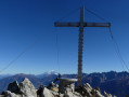
The aim of the hike is to reach Pointe de Rognier (2,341 m) while enjoying a pleasant walk in the surrounding area, via a partial circular route starting from Col de la Perche.
This is a fairly physically demanding hike given the distance and total elevation gain.
Le Col du Paradis depuis Saint-François-Longchamp
 6.80 mi
+1,608 ft
-1,608 ft
4h 30
Moderate
Departure from Saint-François-Longchamp (Savoie)
6.80 mi
+1,608 ft
-1,608 ft
4h 30
Moderate
Departure from Saint-François-Longchamp (Savoie)
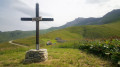
Une jolie randonnée dans la montagne à vaches (celles qui font le Beaufort). Belle vue sur la vallée de l'Arc et le massif des Grandes Rousses. Presque tout le parcours est au soleil.
Pointe de Rognier with return via the Mollards ridge
 7.55 mi
+3,196 ft
-3,196 ft
6h 15
Difficult
Departure from Saint-Alban-des-Hurtières (Savoie)
7.55 mi
+3,196 ft
-3,196 ft
6h 15
Difficult
Departure from Saint-Alban-des-Hurtières (Savoie)
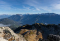
This is a beautiful hike at the northern end of the Belledonne massif. With the help of an orientation table, discover the 360° view that awaits you at the top of this peak.
As indicated in the paragraph "During the hike or nearby", part of the hike can be done with young children, with an elevation gain of about 600m.
Grand Chat loop
5.66 mi
+1,657 ft
-1,654 ft
4h 05
Moderate
Departure from Saint-Alban-des-Hurtières (Savoie)
A beautiful hike in the north of the Belledonne Massif. The ridge route offers sweeping views of the surrounding mountains. A few information boards mark the route.
Circular Lac de la Léchère and Croix du Grand Praz, starting from Longchamp 1650
9.65 mi
+2,333 ft
-2,362 ft
6h 30
Difficult
Departure from Saint-François-Longchamp (Savoie)
A lovely mountain hike, without any major difficulties, featuring a wide variety of terrain: mountain pastures, forests, wide paths and streams. A stunning view of the valley from the Croix du Grand-Praz. The Col de Montjoie will be on your left on the return from the lake, with the Cheval Noir on the other side.
Col de Montjoie as seen from Saint François Longchamp.
4.50 mi
+1,893 ft
-1,893 ft
3h 45
Moderate
Departure from Montgellafrey (Savoie)
An easy half-day route through the mountain pastures above Saint François Longchamp.
Col de Valbuche from Le Loup
5.70 mi
+3,015 ft
-3,015 ft
5h 15
Difficult
Departure from Montaimont (Savoie)
A lovely hike above Lac du Loup with beautiful panoramic views of the Alps. Discover this route by taking a little-used path.
Saint-François-Longchamp – Lac de la Grande Léchère mountain hut
3.90 mi
+833 ft
-528 ft
2h 30
Easy
Departure from Saint-François-Longchamp (Savoie)
Starting from Saint-François-Longchamp, this first stage of the Tour de la Lauzière is a gentle walk to the Grande Léchère Lake Mountain Hut, where you’ll spend your first night.
Tour de la Lauzière
56.01 mi
+20,997 ft
-20,607 ft
7 days
Difficult
Departure from Saint-François-Longchamp (Savoie)
This small mountain range undoubtedly offers one of the most stunning sequences of panoramic views. But beware of the challenging paths and the isolation. Pay particular attention to water management: streams and springs often run dry in summer.The starting point is Saint-François-Longchamp, accessible by public transport or by road. Parking is easy and free there in summer. The stages are connecting days. This route follows the Tour de la Lauzière route with a detour via La Thuile and the Col de l’Arc. You’ll spend every other night in a refuge and the rest in a bivouac.Do not attempt this hike if you are not sure-footed: although it stays on the paths (or strays very little from them), this route requires vigilance and follows routes that are very rarely used. You will almost certainly find yourself alone, or almost alone, for most of the day, in conditions where the markings are often half-faded and the paths obscured by livestock tracks. High-altitude cloud cover is common.
L'Armélaz and La Croix de la Chal via the Col de Chaussy
 7.31 mi
+1,703 ft
-1,693 ft
5 hrs
Moderate
Departure from Montaimont (Savoie)
7.31 mi
+1,703 ft
-1,693 ft
5 hrs
Moderate
Departure from Montaimont (Savoie)
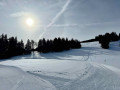
A summit with 360° views, easily accessible between forest and mountain pastures. Suitable for a family outing or for getting back into snowshoeing at the start of the season. Part of the route is shared with cross-country skiers, who are numerous around the Col de Chaussy.
Col de la Frèche – Col d’Arpingon
6.86 mi
+3,018 ft
-2,999 ft
5h 45
Moderate
Departure from Arvillard (Savoie)
This hike follows a beautiful section of the newGR® 738, inaugurated in 2018: the Haute Traversée de Belledonne.
Circular Grands Moulins route via the Col and the Refuge de la Perrière
 5.54 mi
+2,831 ft
-2,815 ft
5h 00
Difficult
Departure from Arvillard (Savoie)
5.54 mi
+2,831 ft
-2,815 ft
5h 00
Difficult
Departure from Arvillard (Savoie)
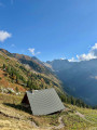
A beautiful hike in Belledonne towards a clearly visible summit. Between the Col de la Perrière and the summit, the ascent via the north-west ridge deviates from the classic route and is intended for experienced hikers.
The Refuge and the Col de la Perrière
 5.64 mi
+2,175 ft
-2,178 ft
4h 30
Moderate
Departure from Arvillard (Savoie)
5.64 mi
+2,175 ft
-2,178 ft
4h 30
Moderate
Departure from Arvillard (Savoie)
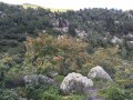
A pleasant hike in the Belledonne massif. Very pretty views and a wide variety of vegetation.
Moderator's note (Caution): The Val Pelouse road is closed to all traffic 5.5km from the car park: following a landslide in January 2022, a large section of the road has been washed away.
Les Grands Moulins via the normal route and return via the ridges
 7.03 mi
+3,284 ft
-3,274 ft
6h 05
Difficult
Departure from Arvillard (Savoie)
7.03 mi
+3,284 ft
-3,274 ft
6h 05
Difficult
Departure from Arvillard (Savoie)
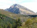
From Val Pelouse, the ascent of Les Grands Moulins (2,495 m) offers hikers a varied and magnificent route. This summit is the penultimate rocky bastion at the northern end of the Belledonne mountain range.
At the summit of Les Grands Moulins, the 360° panorama is breathtaking. To the south, Belledonne; to the west, Chartreuse and Vercors; to the north, the Chambéry cluse, Les Bauges and Les Aravis; to the east, Lauzière, Beaufortain, Vanoise and, in the background, the majestic Mont Blanc.
Le Bellachat or Pointe du Mont du Fût
 8.95 mi
+4,741 ft
-4,718 ft
8h 15
Difficult
Departure from Montaimont (Savoie)
8.95 mi
+4,741 ft
-4,718 ft
8h 15
Difficult
Departure from Montaimont (Savoie)
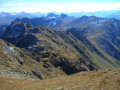
A summit at 2,822 metres on a ridge running parallel to the Lauzière, offering a magnificent 360° view of the French and even Swiss Alps.
Pic Nord du Merlet
 Tourism professional
 4.98 mi
+3,317 ft
-3,258 ft
5h 10
Very difficult
Departure from Saint-Alban-des-Villards (Savoie)
4.98 mi
+3,317 ft
-3,258 ft
5h 10
Very difficult
Departure from Saint-Alban-des-Villards (Savoie)
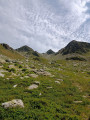
A lovely hike starting from Les Granges. The climb up the Combe du Merlet is fairly easy at first, but the slope gets steeper below the pass, which you reach without any trouble. The rest of the route follows a chamois track almost all the way to the summit, though you’ll need to keep a close eye on the path.
Pointe de l’Aup du Pont
 8.06 mi
+4,442 ft
-4,416 ft
6 hrs
Very difficult
Departure from Saint-Alban-des-Villards (Savoie)
8.06 mi
+4,442 ft
-4,416 ft
6 hrs
Very difficult
Departure from Saint-Alban-des-Villards (Savoie)
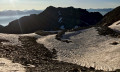
A superb viewpoint between Puy Gris and Pic du Frêne, easily accessible and offering a magnificent panorama of the main peaks of the French Alps.
This walk takes place largely off the beaten track or along very faint paths, but there are no navigation difficulties in good weather, as the terrain offers plenty of landmarks.
Vultures, chamois and ibex can be spotted, particularly below the Pointe du Villonet.
Sarvatan Pass as seen from the Col de la Madeleine road
 2.70 mi
+1,772 ft
-1,772 ft
2h 45
Difficult
Departure from Montgellafrey (Savoie)
2.70 mi
+1,772 ft
-1,772 ft
2h 45
Difficult
Departure from Montgellafrey (Savoie)
Difficult hike: the path climbs quite steeply and, on a short stretch just before the pass, the path is very narrow. After crossing meadows with characteristic flora, you end up in a more rocky, wild environment. Once you’ve rounded the first ridges, you immediately feel far from civilisation, were it not for the presence of a few marmots.
Crossing the Col de Sarvatan-Col de Monjoie via the two pass trail
 5.37 mi
+2,402 ft
-2,395 ft
4h 35
Moderate
Departure from Montgellafrey (Savoie)
5.37 mi
+2,402 ft
-2,395 ft
4h 35
Moderate
Departure from Montgellafrey (Savoie)
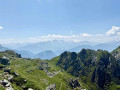
This loop south of the Lauzière allows you to explore both sides of the chain, climbing directly to the Pas de Sarvatan, then crossing the western slope via a well-marked trail before descending from the Col de Monjoie through beautiful meadows.
Montjoie Pass
 3.91 mi
+1,434 ft
-1,430 ft
3h 05
Moderate
Departure from Montgellafrey (Savoie)
3.91 mi
+1,434 ft
-1,430 ft
3h 05
Moderate
Departure from Montgellafrey (Savoie)
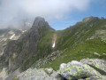
Family hike to the Col de Monjoie (but it's still uphill) then a short off-trail exploration towards the peaks that border it.
From the Col de Chaussy to Fontanious
2.79 mi
+2,126 ft
-2,126 ft
3 hrs
Moderate
Departure from Pontamafrey-Montpascal (Savoie)
A sunny walk starting from the Col de Chaussy.
This is a south-facing route where you can enjoy plenty of sunshine even in the middle of winter.
The route is the start of the trail leading to the Grand Coin.
Combe and Col du Merlet
 9.23 mi
+3,737 ft
-3,737 ft
7h 30
Difficult
Departure from Saint-Alban-des-Villards (Savoie)
9.23 mi
+3,737 ft
-3,737 ft
7h 30
Difficult
Departure from Saint-Alban-des-Villards (Savoie)
A lovely walk through a beautiful, unspoilt valley in the Belledonne range. It’s a bit of a long walk, but well worth the effort.
Col de la Perche and Col de l'Arbarétan
 7.01 mi
+2,457 ft
-2,457 ft
5h 20
Moderate
Departure from Presle (Savoie)
7.01 mi
+2,457 ft
-2,457 ft
5h 20
Moderate
Departure from Presle (Savoie)
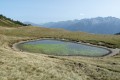
Hike in the Val Gelon, varied landscapes with beautiful views of Mont Blanc and the Belledonne mountain range.
Pic du Cheval Noir
 Association / Club / Walk leader
 5.05 mi
+3,130 ft
-3,133 ft
5h 05
Difficult
Departure from Saint-François-Longchamp (Savoie)
5.05 mi
+3,130 ft
-3,133 ft
5h 05
Difficult
Departure from Saint-François-Longchamp (Savoie)
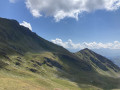
Discover a peak with a 360° view of the Savoie mountains.
Circular Prodin, Lac des Grenouilles, Chapotet
6.26 mi
+2,667 ft
-2,671 ft
5h 10
Easy
Departure from Presle (Savoie)
A lovely late summer walk in Belledonne.
From the start, there is a superb view of the Bauges Massif.
There is also a small orientation table at the start.
The Balcons de Saint-François-Longchamp
 4.37 mi
+1,348 ft
-1,322 ft
3h 10
Easy
Departure from Saint-François-Longchamp (Savoie)
4.37 mi
+1,348 ft
-1,322 ft
3h 10
Easy
Departure from Saint-François-Longchamp (Savoie)
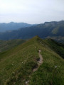
This route takes you through what I consider to be one of the most beautiful areas in the municipality: Les Balcons. It boasts a rich diversity of flora, fauna and geology, as well as varied landscapes and terrain. All this in a place that feels wild and far from civilisation.
See the ‘Practical information’ section regarding the path after the (3).
Route in Saint-Georges-d’Hurtières
7.14 mi
+827 ft
-833 ft
4h 00
Moderate
Departure from Saint-Alban-des-Hurtières (Savoie)
A short walk climbing from Lac d’Huretières to the village of Saint-Georges.
The lake, a former gravel pit, features a leisure area and a protected area.
Along the way, there are beautiful views of the Lauzière mountain range.
Tour du Grand Coin
 14.09 mi
+6,509 ft
-6,506 ft
2 days
Difficult
Departure from Pontamafrey-Montpascal (Savoie)
14.09 mi
+6,509 ft
-6,506 ft
2 days
Difficult
Departure from Pontamafrey-Montpascal (Savoie)
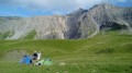
A two-day hike with a bivouac around the Grand Coin above Saint-Jean-de-Maurienne.
It offers the chance to explore a little-known and rarely visited area on the edge of the Vanoise National Park.
Montpascal – Valbuche
8.10 mi
+4,413 ft
-1,834 ft
5 hrs
Very difficult
Departure from Pontamafrey-Montpascal (Savoie)
First day of a two-day hike in the Maurienne with a bivouac.
Hike completed in 2016 with a break at the Col de la Baisse, another above the Chalet des Brunes and a final one at the Chalet du Tovet.
Note: The route shown is based on my GPS watch, which I never paused, which explains the circular patterns in certain places.
The Col de Montfosset via Les Balmettes
 4.07 mi
+2,418 ft
-2,428 ft
4h 00
Moderate
Departure from Saint-Colomban-des-Villards (Savoie)
4.07 mi
+2,418 ft
-2,428 ft
4h 00
Moderate
Departure from Saint-Colomban-des-Villards (Savoie)
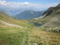
A beautiful hike in a wild area of Belledonne.
With a bit of luck, you may encounter streams, lakes and trout, blueberries, marmots and chamois.
Col et Lac des Balmettes and Brèches de la Passoire
 5.88 mi
+3,333 ft
-3,333 ft
5h 35
Difficult
Departure from Saint-Colomban-des-Villards (Savoie)
5.88 mi
+3,333 ft
-3,333 ft
5h 35
Difficult
Departure from Saint-Colomban-des-Villards (Savoie)
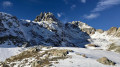
An original way to explore Lac des Balmettes and its pass, continuing on to the Col du Villonet – offering a front-row view of the imposing Pic du Frêne – and then on to the Brèches de la Passoire, which provide a superb view of the Grésivaudan.Along the way, you’ll spot ibex and chamois in the magnificent and little-visited Combe Rousse.The route is partly off-trail but poses no navigation difficulties.
Montvernier hairpin bends and the Bérold circuit from Pontamafrey
 6.20 mi
+1,762 ft
-1,739 ft
4h 25
Moderate
Departure from Pontamafrey-Montpascal (Savoie)
6.20 mi
+1,762 ft
-1,739 ft
4h 25
Moderate
Departure from Pontamafrey-Montpascal (Savoie)
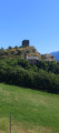
An unusual hike, half tarmac (with little traffic) and half footpath, through some remarkable landscapes. Beautiful views of the Montvernier hairpin bends, the Bérold Tower, the Aiguilles d’Arves and Saint-Jean-de-Maurienne. The descent along the Ravoire torrent is also well worth a look.
The Knights of Huile
 3.94 mi
+302 ft
-289 ft
2h 05
Easy
Departure from Bourget-en-Huile (Savoie)
3.94 mi
+302 ft
-289 ft
2h 05
Easy
Departure from Bourget-en-Huile (Savoie)
The perfect family outing, this route will introduce you to the Bourget-en-Huile and Pontet marshes.
You will learn about the flora and fauna, the marshes, how they were formed and how they are being restored. There is also information about the woods and mining, castles and even Hannibal. All this is provided by information points along the route. A booklet offering a fun approach to the trail is on sale at the Chalet du Verney.
Montartier Lakes – Refuge de la Thuile
11.51 mi
+4,298 ft
-5,128 ft
9h 00
Very difficult
Departure from Argentine (Savoie) (Savoie)
From a bivouac, all alone in the world, a long stage. The secured sections of the Passage des Moutons, Lac de Clartan, the descent to the Chalet du Tour, the paths winding up and down through Pétillat and its waterfall. The ascent to Lac Noir, the passage along the western ridge of the Petit Arc, a bit of off-trail walking; before trudging tirelessly towards a final climb through the woodland to reach the Refuge de la Thuile. What a view from its cross!
More walks in Saint-Rémy-de-Maurienne
Select a point of interest below: