Country:

 City:
City:


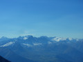
The start is near the hamlet of Le Loup (Route du Lac du Loup leading from Bonvillard) in Montaimont, which can be reached from La Chambre in the Maurienne Valley.
(S/E) Head up alongside the stream (Ravin des Cétives) and, after 200 metres, cross it either where it bends or further up at the sign visible on the left bank. From this sign, take the path that climbs due south between two fences, moving away from the stream. It climbs along the hillside to the Closet chalet, where it descends slightly to reach the junction with the path coming from Les Avannières.
(1) Turn left and follow the main track, which becomes a path and climbs steadily up the hillside, heading eastwards, until you cross the first stream. From there, the path becomes more uneven, changing direction several times (south-east, north-east, south-east and east), alternating between crossing torrents (offering brief descents) and climbing ridges that are sometimes overgrown with willows or prone to the occasional landslide. The path remains easy to follow, however, and climbs to a distinctive rock at the top of a steep ascent.
(2) This rock, which is larger and, above all, more pointed than the others, serves as a visual landmark that may prove useful on the return journey. From there, you enter the mountain pasture and the terrain becomes less steep. The path winds its way up through the pasture, taking a wide detour to the left before veering back to the right (south-south-east) to the foot of the pass, which it climbs via well-defined, though somewhat eroded, switchbacks.
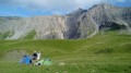
This section of mountain pasture is criss-crossed by numerous tracks left by the sheep that spend the summer near the Grande Combe sheepfold.
(3) A large cairn marks the entrance to the wide notch of the Col de Valbuche. At the pass signpost, leave the path and head off to the left to climb to the Pointe de Valbuche, visible at the top of the grassy slopes to the north. It is possible to climb these steep slopes, but there is a less strenuous option: head eastwards, following one of the visible tracks to ascend the gentler grassy slopes in a diagonal line whilst avoiding the rocky areas. There are several tracks to choose from: do not go too far up as they eventually lead to steep, straight climbs heading due north.
Start a gentler ascent and continue in this way until you reach the edge of the cliffs overlooking the Combe des Chevriers. Once on this ridge, it is easy to climb up to the left in stages to the Pointe de Valbuche, keeping close to the cliff on your right.
(4) The Pointe de Valbuche is in fact made up of two peaks separated by a fault. Here, there are two options:
- climb the summit (the left-hand peak) by skirting it to the left, along its grassy slope,
- head into the canyon between the two points.
In both cases, you’ll emerge at the top of the ridge running due north towards the Mollard des Bœufs. Descend this steep but untroublesome ridge, keeping closely to the path, then follow the ridge past a few humps. Next, head back up towards the Mollard des Bœufs, or rather its secondary summit (the main summit itself lies on a ridge running further east). Halfway up the slope, look out for a cairn that is clearly visible from below, and walk past it.
(5) A few metres past this cairn, look out for a path on the left that heads up the eastern flank of the Mollard des Bœufs, traversing more or less downwards. Follow it until it joins the ridge coming from the summit and leading to the Bellachat.
(It is possible to continue from the cairn to the summit of the secondary peak and then descend towards the Bellachat).
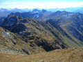
Follow this relatively wide ridge, which passes through several low points before climbing back up towards the summit, marked by a clearly visible cross, which you reach by crossing a small, grassy plateau at the end.
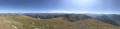
Make the most of the 360° view from the summit.
(6) Descend via the same route, sticking strictly to it until you reach the ascent to the Pointe de Valbuche.
(4) From here, continue more freely towards the Col de Valbuche: the gentlest route is to follow the ascent track down the ridge bordering the Combe des Chevriers to around 2,500 metres, then turn right to traverse towards the pass; however, you can attempt several more direct but also steeper routes, with the pass always in sight.
(3) Veer to the right and rejoin the ascent route.
Further down, near the sheepfold, the multitude of tracks left by the animals can easily cause you to lose the path: you can follow them, but they have an unfortunate tendency to level out or even head back uphill. Descend then from one track to the next down the grassy slope, which isn’t very steep here, keeping your eyes on the rock you spotted on the way up. Get back onto the right path by veering right upstream of this rock and rejoining it.
(2) The rest of the descent presents no difficulty, apart from the fact that the small descents turn into brief ascents, which are easily managed. You’ll then return to the starting point (S/E).


 Visorando Member
 Easy
Easy 
 Moderate
 Very difficult