Combe and Col du Merlet

A lovely walk through a beautiful, unspoilt valley in the Belledonne range. It’s a bit of a long walk, but well worth the effort.

Details

2502327
Creation:
Last update:
Last review:
  • Walking
    Activity: Walking
  • ↔
    Distance: 9.23 mi
  • ◔
    Average duration: 7h 30 
  • ▲
    Difficulty: Difficult

  • ⚐
    Back to start: Yes
  • ↗
    Ascent: + 3,737 ft
  • ↘
    Descent: - 3,737 ft

  • ▲
    Highest point: 7,507 ft
  • ▼
    Lowest point: 3,770 ft

Photos

Description of the walk

Start from the car park at the church in Saint Alban-des-Villards.

(S/E) After passing through the hamlet of Le Mollard, the tarmac road turns into a track which you should follow without crossing the Torrent du Merlet. After about ten minutes, you’ll reach the Croix des Charrières.

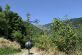
(1) The track, and then the footpath, will gradually wind its way through the Vallon du Merlet, passing through clearings and then through woodland, until you reach L’Échaut.

(2) Pass through this hamlet, cross the torrent and turn left. Then continue along a track towards Les Granges

(3) Leave the Col des Balmettes path on your left and continue into the valley. The ascent is gradual through alpine pastures

(4) Once you reach Plan des Sources, carry on straight ahead towards the Col du Merlet along a path that becomes steeper.

(5) After a well-deserved break at the pass to take in the views, head back along the same route to the car park at the church in Saint-Alban-des-Villards (S/E).

Waypoints

  1. S/E : mi 0 - alt. 3,770 ft - Church of Saint-Alban-des-Villards
  2. 1 : mi 0.18 - alt. 3,825 ft - Croix des Charrières (Saint-Alban-des-Villards)
  3. 2 : mi 1.58 - alt. 4,964 ft - L’Échaut. Towards the - Merlet (torrent) - Affluent du Glandon
  4. 3 : mi 2.78 - alt. 5,692 ft - Les Granges
  5. 4 : mi 4.3 - alt. 6,854 ft - Plan des Sources
  6. 5 : mi 4.56 - alt. 7,398 ft - Col du Merlet (2286 m)
  7. S/E : mi 9.23 - alt. 3,770 ft - Church of Saint-Alban-des-Villards

Reviews and comments

4.7 / 5
Based on 2 reviews

Reliability of the description
5 / 5
Ease of following the route
4.5 / 5
Route interest
4.5 / 5
aimjiefce
aimjiefce

Overall rating : 5 / 5

Date of your route : Aug 05, 2024
Reliability of the description : ★★★★★ Very good
Ease of following the route : ★★★★★ Very good
Route interest : ★★★★★ Very good
Very busy route : No

POSITIVE OPINION

Machine-translated

Traderofsleep
Traderofsleep

Overall rating : 4.3 / 5

Date of your route : Aug 29, 2023
Reliability of the description : ★★★★★ Very good
Ease of following the route : ★★★★☆ Good
Route interest : ★★★★☆ Good
Very busy route : No

The description is very good.
For your information: During this walk, work was underway on the lower section of the path after crossing the stream.
We completed it (as a pair) in temperatures of 38° (so make sure you take plenty of water; I usually carry 2.5 litres for this distance, but by the end of the descent I’d run out, and I’m not a heavy drinker).
We enjoyed the fact that there were no ski lifts to be seen. The ascent is gradual and takes you through the pine trees up to the start of the plateau.
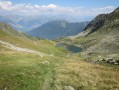
Before the climb up to the pass, there’s a lovely view of the plateau with the shepherd, his sheep and his Patou.
The climb to the pass is estimated to take 30 minutes (which is about right); however, from the bottom, the route isn’t visible, but the path is usually easy to follow thanks to the markings and cairns (piles of stacked stones).
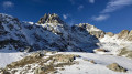
The view from the Col de Merlet is lovely (the only thing missing is the sign on the signpost showing the altitude for a souvenir photo).
The descent follows the same route without any difficulty.
There are marmots here, and I reckon that with such a peaceful atmosphere, the chamois can’t be far away (we didn’t spot any ourselves – perhaps next time?).
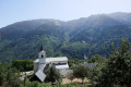
Don’t forget to take a quick stroll around the village, which is also very charming, and if you can, pop into the church.
What we enjoyed most of all was the peace and quiet throughout the hike (apart from the occasional roadworks) and the unspoilt, wild scenery. As for the length, this is suited to experienced hikers; I’d recommend taking your walking poles – they’ll help you on the ascents and descents.
Thanks to the hiker who mapped out this route.

Machine-translated

Other walks in the area

For more walks, use our search engine .

The GPS track and description are the property of this route's author. Please do not copy them without permission.