Country:

 City:
City:


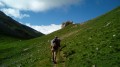
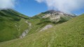
(S) Park at the church in Montpascal (if possible, leave a car at the Col du Chaussy, at the end of the circular route; otherwise, allow an extra 10 to 15 minutes’ walk)
(1) Continue along the road leading to the pass and turn left towards La Combe.
(2) Walk down the road, then after La Combe take the path on the left.
The path then climbs quite steeply; follow it, passing through the hamlets of Villaret d’en Haut and then La Barnière, to reach the Col de la Baisse.
(3) Continue along the track, which keeps climbing to the left. You’ll reach the Chalet de l’Alpettaz.
(4) As the path shown on the IGN map is no longer visible, head uphill intuitively as indicated on the route, following the track used by 4x4s to reach the Chalet des Brunes.
(5) Continue along the pleasant balcony path after the long climb. After the chalet, finally leave the track by taking the path branching off to the left.
Please note: from here onwards, the path is very poorly marked.
Climb up through the grass more or less straight up the slope to about 100 metres below the Croix des Citrées, which is clearly visible above on the right-hand side.
(6) Stay on the path, which is relatively well marked, to reach the Tovet stream.
(7) Cross it; the path disappears again. The route shown on the map is certainly not the best way to go. Continue to the Chalet du Tovet, where the shepherd lives. Walk past the chalet to find a faintly marked path and follow it to the Col du Châtelard, at the gateway to the Vanoise National Park.
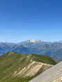
(8) Turn left towards the Col du Bonnet du Prêtre. Here you’ll find a clearly visible path for the rest of the day. Reach the Col du Bonnet du Prêtre with its distinctive rock, the highest point of the day.
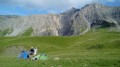
(9) Then begin the descent to the bivouac site in the Valbuche valley.
(E) Campsite. Relatively flat with water nearby. The route follows the path closely, although the path may have shifted since the map was last published.

 Visorando Member
 Difficult
 Moderate
  Easy
Easy