


Refine your search for walks in Saint-Félix (Haute-Savoie)
Saint-Félix (Haute-Savoie) walks
 Tour of the Ovens in Albens
 Visorando Member
 9.98 mi
 +1,125 ft
 -1,096 ft
 5h 35
5h 35
 Moderate
 Departure from Albens (Savoie)
A lovely walk exploring the Crosagny marshes, the bread ovens and the footpaths on the hills above Albens. A walk with no particular difficulties apart from the distance.
Fésigny Castle and return via Les Monts from Chainaz-Les-Frasses
 4.45 mi
+495 ft
-518 ft
2h 30
4.45 mi
+495 ft
-518 ft
2h 30
 Easy
Departure from Chainaz-les-Frasses (Haute-Savoie)
Easy
Departure from Chainaz-les-Frasses (Haute-Savoie)
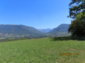
Starting from Chainaz-Les-Frasses, a circular route passing by Fésigny Castle and returning to the village via the hamlet of Bocquerat and Les Monts. Throughout the route, in good weather, there are numerous views of the Dent du Chat, a (small) section of Lake Bourget, the Semnoz, the Tours Saint-Jacques and the Montagne de Banges.
Medieval walk in Alby-sur-Chéran
0.97 mi
+243 ft
-236 ft
0h 40
Easy
Departure from Alby-sur-Chéran (Haute-Savoie)
A very short walk, perhaps just long enough for a break, offering lovely views of the Chéran and a chance to discover the medieval houses of the village. If you have a little more time, visit the Shoemaking Museum.
Les Hauts d'Albens
 8.11 mi
+1,490 ft
-1,476 ft
5h 00
Moderate
Departure from La Biolle (Savoie)
8.11 mi
+1,490 ft
-1,476 ft
5h 00
Moderate
Departure from La Biolle (Savoie)
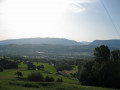
This walk takes you on a circular route through the hamlets of the Hauts d’Albens. Beautiful views over the Albanais, the Semnoz, and the Bange and Revard mountains. In Dressy, you can see an old bread oven and an ox shoeing bench.
Two loops around Cusy, Saint-Ours and Chainaz
 5.36 mi
+778 ft
-755 ft
3h 10
Easy
Departure from Cusy (Haute-Savoie)
5.36 mi
+778 ft
-755 ft
3h 10
Easy
Departure from Cusy (Haute-Savoie)
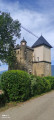
These two easy loops form a figure of 8, on low-traffic roads, tracks and paths through fields and woods. They offer beautiful views of the Clergeon, the Bauges mountains, the Semnoz and even Lake Bourget. They also pass through the villages of Saint-Ours and Chainaz-Les-Frasses, offering views of the Château de Fésigny.
Chalet du Trousset via the Sentier des Renards
9.28 mi
+2,608 ft
-2,638 ft
6h 30
 Difficult
Departure from Cusy (Haute-Savoie)
Difficult
Departure from Cusy (Haute-Savoie)
Right from the start, there is a steep climb from Cusy to reach the Chalet du Trousset. The route then mostly follows beautiful trails and paths through the woods, offering lovely views in places.
The Visorando app is highly recommended.
La Biolle Mountain
 8.06 mi
+1,732 ft
-1,762 ft
5h 15
Moderate
Departure from La Biolle (Savoie)
8.06 mi
+1,732 ft
-1,762 ft
5h 15
Moderate
Departure from La Biolle (Savoie)
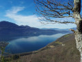
This route, starting from Villette in the commune of La Biolle, offers magnificent panoramic views of the Bauges Massif during the climb and a 360° view from the new Croix de Meyrieu (Lake Bourget, Aix-les-Bains and the surrounding mountains). The return journey is via a little-used and unmarked path, but with the Visorando app, there's no need to worry.
Circuit de la Pomme in Boussy
 5.06 mi
+587 ft
-591 ft
2h 50
Easy
Departure from Boussy (Haute-Savoie)
5.06 mi
+587 ft
-591 ft
2h 50
Easy
Departure from Boussy (Haute-Savoie)
A family hike near Rumilly that allows you to discover the right bank of the Chéran and the Albanais valleys around Boussy. The name of the circuit comes from the Croison de Boussy, a local variety of small apples that is said to have been introduced to the region by Napoleon's grognards.
Around Saint-Germain-la-Chambotte
 8.98 mi
+1,565 ft
-1,545 ft
5h 30
Moderate
Departure from La Biolle (Savoie)
8.98 mi
+1,565 ft
-1,545 ft
5h 30
Moderate
Departure from La Biolle (Savoie)
This walk allows you to explore the hamlets around Saint-Germain-la-Chambotte through woods and meadows and offers beautiful panoramic views.
Le Semnoz via the Grotte des Fours
 8.24 mi
+4,150 ft
-4,170 ft
7h 25
8.24 mi
+4,150 ft
-4,170 ft
7h 25
 Very difficult
Departure from Viuz-la-Chiésaz (Haute-Savoie)
Very difficult
Departure from Viuz-la-Chiésaz (Haute-Savoie)
The Semnoz is not just a gentle summit visited by car. Here is an interesting and varied route from Viuz-la-Chiésaz, with a steady climb through the forest, caves to visit and cliffs to overcome, leading to an alpine pasture that takes you to the Crêt de Châtillon, with sweeping views of the Alps and Pre-Alps.
The Bridal Veil circular loop
 2.53 mi
+453 ft
-427 ft
1h 35
Easy
Departure from Chapeiry (Haute-Savoie)
2.53 mi
+453 ft
-427 ft
1h 35
Easy
Departure from Chapeiry (Haute-Savoie)
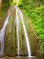
A peaceful circular route for a short half-day hike, culminating in the discovery of the Cascade du Voile de la Mariée, whose drapery can vary depending on the flow of the Nant de l’Eau Salée stream.
Cessens to La Chambotte circular loop
 5.79 mi
+1,306 ft
-1,322 ft
3h 50
Moderate
Departure from Cessens (Savoie)
5.79 mi
+1,306 ft
-1,322 ft
3h 50
Moderate
Departure from Cessens (Savoie)
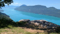
This walk is a circular route starting at Notre-Dame de la Salette (Cessens) and ending at La Chambotte. It passes by the Tours de César and the castle ruins before descending towards the hamlet of La Chambotte, following the ridge.
Circular route south of Saint-Offenge-dessous
 6.09 mi
+1,119 ft
-1,102 ft
3h 45
Moderate
Departure from Saint-Offenge-Dessous (Savoie)
6.09 mi
+1,119 ft
-1,102 ft
3h 45
Moderate
Departure from Saint-Offenge-Dessous (Savoie)
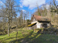
From the car park at the church in Saint Offenge-dessous, this circular route leads south through countryside, forest and hamlets. Alternating between roads with very little traffic, paths and trails, it offers some beautiful views.
On the cliffs of Cessens
2.08 mi
+656 ft
-646 ft
1h 30
Moderate
Departure from Cessens (Savoie)
A short walk on the Cessens mountain, with views of the lake and the Bugey.
 Circular route on Sapenay Mountain
 2.83 mi
+840 ft
-817 ft
2 hrs
Easy
Departure from Cessens (Savoie)
2.83 mi
+840 ft
-817 ft
2 hrs
Easy
Departure from Cessens (Savoie)
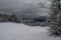
This is an unmarked and little-used route that is best taken in the middle of winter if you want to have enough snow, as the altitude remains modest (between 800 and 950 metres). The views of Lake Bourget are magnificent.
In summer, it is possible to follow a marked route called "le tour de la montagne du Sapenay" (the Sapenay mountain tour), which does not, however, take the section directly overlooking the lake.
The Dolca circular loop starting from Saint-Offenge-dessous
 7.74 mi
+2,474 ft
-2,457 ft
5h 45
Difficult
Departure from Saint-Offenge-Dessous (Savoie)
7.74 mi
+2,474 ft
-2,457 ft
5h 45
Difficult
Departure from Saint-Offenge-Dessous (Savoie)
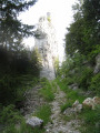
This circular route starting from Saint-Offenge allows you to admire the rocks of Château Larron and then the panoramic view from the summit of La Dolca.
Beautiful views of Lake Bourget and Montagne du Chat from Chalet Trousset.
There are also lovely views from the Golet du Pont.
Balmont circular loop
4.44 mi
+797 ft
-797 ft
2h 45
Easy
Departure from Seynod (Haute-Savoie)
A circular route with varied landscapes around the old village of Balmont.
The Tours de César
 4.42 mi
+1,004 ft
-988 ft
2h 55
Easy
Departure from Saint-Germain-la-Chambotte (Savoie)
4.42 mi
+1,004 ft
-988 ft
2h 55
Easy
Departure from Saint-Germain-la-Chambotte (Savoie)
A loop above lake Bourget for a late afternoon walk.
A walk amid historical sites and beautiful viewpoints.
Mont Laval and the Tours de César
 5.14 mi
+1,604 ft
-1,601 ft
3h 45
Moderate
Departure from Saint-Germain-la-Chambotte (Savoie)
5.14 mi
+1,604 ft
-1,601 ft
3h 45
Moderate
Departure from Saint-Germain-la-Chambotte (Savoie)
This hike takes you to the summit of Mont Laval and then follows a circular route via the Tours de César to return via the Col de la Chambotte. Beautiful views of Lac du Bourget and the surrounding mountains.
Tours of César and Mont Laval circular loop
 4.22 mi
+1,181 ft
-1,184 ft
3h 00
Moderate
Departure from Saint-Germain-la-Chambotte (Savoie)
4.22 mi
+1,181 ft
-1,184 ft
3h 00
Moderate
Departure from Saint-Germain-la-Chambotte (Savoie)
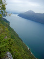
Les Tours de César offers a variety of routes suitable for all seasons. The circular route follows the cliffs of Mont Laval as closely as possible: at the foot of the cliffs on the way out, along the edge of their summit on the way back.
Tour of the Montagne de Bange
 12.60 mi
+4,094 ft
-4,072 ft
9h 20
Difficult
Departure from Cusy (Haute-Savoie)
12.60 mi
+4,094 ft
-4,072 ft
9h 20
Difficult
Departure from Cusy (Haute-Savoie)
This walk takes you round this mountain, situated between the Semnoz to the north and the Revard massif to the south. Initially, you’ll follow theGRP® trail, which will take you to the summit (Crêt de la Dolca) and on to the Col de la Cochette (orientation table).
Moderator’s note : reviews of this walk indicate that from (14) onwards, the path no longer exists. The only alternative is to follow the D911 for 4 km. See details in the description
Mont Clergeon from the Col du Sapenay
 8.80 mi
+1,362 ft
-1,345 ft
5h 15
Moderate
Departure from Cessens (Savoie)
8.80 mi
+1,362 ft
-1,345 ft
5h 15
Moderate
Departure from Cessens (Savoie)
This hike will allow you to discover the natural site of the Grande Cuve and then take you to the summit of Mont Clergeon and its orientation table. You can also discover the traditional habitat of these mountains in the hamlet of Montclergeon.
On the heights of Marcellaz-Albanais
 6.83 mi
+620 ft
-650 ft
3h 40
Moderate
Departure from Marcellaz-Albanais (Haute-Savoie)
6.83 mi
+620 ft
-650 ft
3h 40
Moderate
Departure from Marcellaz-Albanais (Haute-Savoie)
A circular loop that follows communal paths and some sections of quiet roads between Marcellaz-Albanais and Montagny-les-Lanches. Numerous panoramic views of the Jura, Bornes les Aravis and Bauges mountains.
Loop above Brison
 8.20 mi
+2,326 ft
-2,359 ft
5h 50
Easy
Departure from Brison-Saint-Innocent (Savoie)
8.20 mi
+2,326 ft
-2,359 ft
5h 50
Easy
Departure from Brison-Saint-Innocent (Savoie)
This loop starts in Brison and climbs to the Croix de Meyrieu, then follows the ridge line to La Chambotte and returns to the starting point via a path through old vineyards. This walk offers numerous views of Lake Bourget.
Mont de Corsuet via the Meyrieux crosses
 7.21 mi
+2,195 ft
-2,172 ft
5h 15
Moderate
Departure from Brison-Saint-Innocent (Savoie)
7.21 mi
+2,195 ft
-2,172 ft
5h 15
Moderate
Departure from Brison-Saint-Innocent (Savoie)
This is a hike with magnificent views of Lake Bourget, the Chat Mountains, the Chartreuse Mountains, as well as the Albanais and Bauges regions, on a well-maintained path.
Sentier des Granges trail starting from Lac du Bourget
 9.68 mi
+2,651 ft
-2,644 ft
6h 45
Difficult
Departure from Brison-Saint-Innocent (Savoie)
9.68 mi
+2,651 ft
-2,644 ft
6h 45
Difficult
Departure from Brison-Saint-Innocent (Savoie)
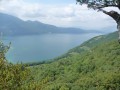
A hike mainly through woodland with beautiful views of Lac du Bourget.
Circular route from Montagny-les-Lanches
5.96 mi
+804 ft
-810 ft
3h 25
Moderate
Departure from Montagny-les-Lanches (Haute-Savoie)
A very beautiful walk through fields and woods, around the village of Montagny-les-Lanches, with very little walking on roads, but offering stunning views of the Semnoz to the east and the Monts de l’Albanais to the east. Very pleasant in spring and autumn, but make sure you bring plenty of water in summer. As you pass through the hamlets, you’ll see beautifully renovated farms, adorned with flowers and well-maintained.
The Blue Path of Moye
 4.29 mi
+607 ft
-630 ft
2h 30
Easy
Departure from Moye (Haute-Savoie)
4.29 mi
+607 ft
-630 ft
2h 30
Easy
Departure from Moye (Haute-Savoie)
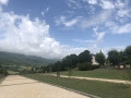
Half-day family hike from the village of Moye. The climb at the start offers views of the Rumilly plain and the Haut-Savoyard foothills. The second part of the circuit takes you through the various hamlets of Moye, not forgetting the little extras: the small waterfall and the bridge over the Rivière du Parmand.
Col de la Cochette circular from Saint-Offenge-Dessus
 7.04 mi
+2,205 ft
-2,228 ft
5h 10
Moderate
Departure from Saint-Offenge-Dessus (Savoie)
7.04 mi
+2,205 ft
-2,228 ft
5h 10
Moderate
Departure from Saint-Offenge-Dessus (Savoie)
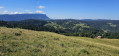
This route offers stunning panoramic views of the Bauges and Mont Blanc on one side, and the Revard and the Albanais on the other. With an ascent and descent through the cool forest and a mountain pasture plateau at the top offering magnificent views, this route has many attractions. The route presents no technical difficulties. Note that there is a section with a cable after the Mermet chalets, which is not particularly difficult.
Col de la Cochette and Château de Larron
 5.36 mi
+2,277 ft
-2,277 ft
4h 25
Moderate
Departure from Saint-Offenge-Dessus (Savoie)
5.36 mi
+2,277 ft
-2,277 ft
4h 25
Moderate
Departure from Saint-Offenge-Dessus (Savoie)
Route from Saint-Offenge-Dessus via the Col de la Cochette and Château de Larron
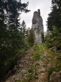
An easy hike, mostly through woodland, with a short stretch across mountain pastures.
The Saint-Jacques Towers loop
5.77 mi
+2,431 ft
-2,411 ft
4h 45
Moderate
Departure from Allèves (Haute-Savoie)
The Saint-Jacques Towers are a group of three monoliths that have broken away from the cliff and continue to slide 2 to 3 cm per year.
The suggested route allows you to see them from different angles, from above and below.
Along the way, note the paved road and the massive log barns.
Mont-Clergeon and Grande Cuve
 5.75 mi
+938 ft
-951 ft
3h 30
Moderate
Departure from Ruffieux (Savoie)
5.75 mi
+938 ft
-951 ft
3h 30
Moderate
Departure from Ruffieux (Savoie)
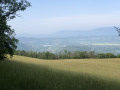
Mont Clergeon, with its summit at over 1,000 metres, is not one of the most popular peaks in Savoie. However, it offers a 360° view of the Rhône valley and the Bauges, Aravis and Mont Blanc mountains. The route is mostly shaded.
The Fairy Cave from Brison-Saint-Innocent
 2.49 mi
+906 ft
-932 ft
1h 55
Moderate
Departure from Brison-Saint-Innocent (Savoie)
2.49 mi
+906 ft
-932 ft
1h 55
Moderate
Departure from Brison-Saint-Innocent (Savoie)
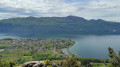
A family walk taking around two hours there and back, including a visit to the cave. An easier alternative to the existing hike, the Combe aux Moines and the Grotte des Fées, which is a bit long for young children. Starts from the last accessible car park on the Chemin de la Grotte des Fées
Following comments, the difficulty has been changed to "Medium", which wasn’t my initial impression as the walk was done with young children. Take particular care on the Chemin du Singe.
⚠️ To reach the car park at the start of the Grotte des Fées, from Aix-Les-Bains, follow the “Chemin du Ponsonnet” to the left of the D48, then turn right onto the “Chemin de la grotte des fées”.
La Combe aux Moines, the Fairy Cave
 7.10 mi
+1,673 ft
-1,660 ft
3h 25
Easy
Departure from Brison-Saint-Innocent (Savoie)
7.10 mi
+1,673 ft
-1,660 ft
3h 25
Easy
Departure from Brison-Saint-Innocent (Savoie)
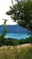
A walk offering a variety of landscapes, points of interest and pleasant views of Lake Bourget.In autumn, you can find chestnuts and mushrooms.
13/05/2026: Start of the modified walk.
Vieugy Forest Trail
3.47 mi
+682 ft
-676 ft
1h 45
Easy
Departure from Seynod (Haute-Savoie)
This short walk starts in the centre of Vieugy, passes through residential neighbourhoods and then winds its way through the pleasant woodland overlooking the village. The return route takes you through “Vieux Vieugy”, where the former commune was established, which was incorporated into Seynod in 1965 and then into Annecy in 2020.
Le creux de Lachat via Le Mariet
 5.25 mi
+1,575 ft
-1,578 ft
4 hrs
Moderate
Departure from Arith (Savoie)
5.25 mi
+1,575 ft
-1,578 ft
4 hrs
Moderate
Departure from Arith (Savoie)
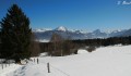
A snowshoe hike enhanced by a stop at the Creux de Lachat refuge. It's always an opportunity to meet someone, even if it's just the caretaker.
Panoramic views of Les Bauges and, further away, Les Aravis and Mont Blanc.
Circuit around the Col de la Cochette and the Altar of the Priest in Arith
 7.54 mi
+2,415 ft
-2,405 ft
5h 35
Moderate
Departure from Arith (Savoie)
7.54 mi
+2,415 ft
-2,405 ft
5h 35
Moderate
Departure from Arith (Savoie)
This circular route allows you to explore the north-eastern tip of the Revard Plateau. The gentle, undulating terrain offers views of the Bauges massif and Lake Bourget, and, at the highest point, a wider vista of the Alpine arc and Mont Blanc.A short detour to the Autel du Curé will take you in the footsteps of the Reign of Terror in Savoie.
Lake Mariet in the Bauges massif
 4.55 mi
+518 ft
-518 ft
2h 35
Easy
Departure from Arith (Savoie)
4.55 mi
+518 ft
-518 ft
2h 35
Easy
Departure from Arith (Savoie)
Lake Mariet owes its existence to the impermeable glacial moraines of Montagne de Bange.
It’s an easy, short walk that takes you through the mountain pastures, dotted with numerous well-maintained chalets.
Suitable for beginners and young people given the elevation gain and distance.
Don’t go looking too hard for a ‘lake’ – it’s more of a pond covering a few hundred square metres at the northern end of the mountain pasture.
The Crêt de la Dolca on snowshoes
7.65 mi
+2,077 ft
-2,054 ft
5 hrs
Moderate
Departure from Arith (Savoie)
The Crêt de la Dolca via La Revêche and Les Trois Bornes. This description leads to the Crêt de la Dolca; this peak is not marked as such on the IGN map—there is only an altitude of 1434—but on the ground it is signposted with this name.
This is a route that often strays from the marked paths, so you really need to use the map to find your way.
Alpine pastures and Lake Mariet
 5.99 mi
+928 ft
-909 ft
3h 35
Moderate
Departure from Arith (Savoie)
5.99 mi
+928 ft
-909 ft
3h 35
Moderate
Departure from Arith (Savoie)
A pleasant and easy hike in the heart of the Bauges Natural Park, mainly through the woods, allowing you to discover the Mariet mountain pastures dotted with pretty chalets and a small lake... a touch of water in a sea of flower-filled meadows.
GPS recommended!
Les Pendants, La Culaz and Les Creusates in a circular loop from Montagny
 12.00 mi
+2,776 ft
-2,762 ft
7h 55
Difficult
Departure from Arith (Savoie)
12.00 mi
+2,776 ft
-2,762 ft
7h 55
Difficult
Departure from Arith (Savoie)
Large circular loop visiting the areas between Montagne de Bange and the Nordic areas of Saint-François-de-Sales. The ascent is via Mariet dessus to Creux de Lachat, then via the refuge, a climb to Les Pendants and back down via the ridge and its orientation table to Col de la Cochette. Climb back up to La Culaz and take a short detour to discover a curious altar dedicated to a refractory priest and a cross in the middle of the forest, before descending to the Chalet de la Plate and further down to the GR® trail to climb back up to the Tourbière des Creusates and the Croix des Bergers. The return journey is still long through the forest and then down the seemingly endless descent from La Plate to Montagny.A varied route between forests and mountain pastures, don't overlook the number of ascents and descents, but the views are well worth the effort.
Circular walk in the Montagne de Bange, via Le Mariet and Le Creux de Lachat
 10.05 mi
+3,225 ft
-3,222 ft
7h 25
Difficult
Departure from Arith (Savoie)
10.05 mi
+3,225 ft
-3,222 ft
7h 25
Difficult
Departure from Arith (Savoie)
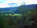
This wide circular loop explores several features of the Montagne de Bange, including the Pic de Bange, the natural arch, Lac du Mariet and the Crête de la Revêche at Dolca and then at the Creux de Lachat. As the route mainly follows forest paths and, in part, mountain pastures, unobstructed views are only available at the top of the cliffs and at the Crêt de Dolca. Whilst there are no technical difficulties, several sections are off-trail and require particular care with regard to navigation.
Creux de Lachat and viewpoints from Montagny
7.29 mi
+2,392 ft
-2,388 ft
5h 25
Moderate
Departure from Arith (Savoie)
A circular route allowing you to quickly gain altitude to visit the cows and horses that occupy the high pastures in the summer. Passes by a few lookout points offering beautiful views.The Visorando app is useful for certain sections.
Château de Montrottier - Berges du Fier
1.77 mi
+210 ft
-223 ft
1h 00
Easy
Departure from Lovagny (Haute-Savoie)
Balade qui permet de découvrir le Château de Montrottier avec son architecture remarquable et son imposant donjon situé sur une colline puis les berges du Fier, de la « Pierre aux Fées » à une perte qui s'engouffre sous la roche sur quelques mètres.
Above the Gorges du Fier 1
4.17 mi
+492 ft
-499 ft
2h 20
Easy
Departure from Lovagny (Haute-Savoie)
A short, easy hike to complement your visit to the Gorges du Fier and/or Montrottier Castle.
Above the Gorges du Fier 2
 5.34 mi
+820 ft
-833 ft
3h 10
Easy
Departure from Lovagny (Haute-Savoie)
5.34 mi
+820 ft
-833 ft
3h 10
Easy
Departure from Lovagny (Haute-Savoie)
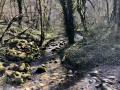
A short, easy hike that complements a visit to the Fier Gorges and/or Montrottier Castle.
Corsuet Forest and Cross
5.71 mi
+968 ft
-968 ft
3h 30
Easy
Departure from Aix-les-Bains (Savoie)
The Corsuet Forest is criss-crossed, indeed criss-crossed by numerous paths and trails. It is an open space that allows you to escape the urban environment whilst remaining close to the town.
The numerous signposts will provide useful guidance for walkers.
The route described here is just a modest example of the possibilities offered by the Corsuet Forest.
Here, the paths have taken their names from the animal kingdom.