Country:

 City:
City:


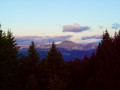
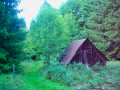
From Plainpalais or the D911 in the Chéran valley, head towards Arith. Pass through the village (Bourchigny) then the hamlet of Montagny and continue along the road to the Montagny car park.
(S/E) Start by heading back down the road (or cutting across the meadow if there are no animals) to Montagny, which you cross at the same level to take the Route du Chenay, towards Chez Breton. 100 metres after the last house, a path branches off to the left.
(1) Take this path to climb towards Montagne de Bange. Ignore a few tracks branching off to the right and left and stick to the path marked with red lines (even though this marking is more typical of a forest trail than a hiking route). The slope gradually levels out until you reach a three-way junction.
Ignore the path on the left, which rejoins the main route a little further on; to pass via the highest point, veer right and head for the open cliff edge. Turn left (westwards) and follow a path through the forest, keeping a little way back from the cliff, until you come up against the vertical rock face of the Pic de Bange. Go round this rock on the left to reach the southern flank of the summit, the only accessible route for climbing it, off the beaten track.
(2) From the summit, head back along the ridge you ascended, heading south, and as you approach the bottom of the trough, veer right to reach, heading west, a junction of paths marked with yellow and red markings.
(3) Ignore the path branching off to the left from the three-way junction encountered on the ascent before the summit, but, following a circular route that makes use of the terrain, head north to the second summit, which is more open and lies at the edge of the cliff.
(4) Return to the previous junction and look out for a path heading south-west down the slope.
(3) Follow this path downwards; it is marked with old red dots that are barely visible. This descent through the forest leads to a wide ledge where the path becomes a proper track and veers to the left to pass under a remarkable natural arch.
(5) After taking a look around, continue down the path leading to Lac du Mariet.
(6) From the lake, take the correct path heading north, which is initially level before climbing up to the edge of the cliff.
(7) Go back a little way and turn right (as you return), heading north-west, onto paths climbing through the forest. These often lead back to the cliff; keep clear of it and follow the winding paths heading up towards the south-west (a few cairns) to climb to the summit of the wooded Revêche ridge.
(8) The Revêche mountain pasture is visible below. Head down to it and climb over a high fence to ascend the opposite side of the pasture towards a cattle shelter, then follow an old track up to the top of the meadow, cross the fence again and, after a short stretch through the woods, emerge onto the main path leading up from the Grand Raie.
(9) Follow this path to the left; it is mostly level but climbs a few times to reach the Trois Bornes junction.
(10) Carry on straight ahead to the Dolca, the highest point where the path emerges from the forest. On the southern slope, turn left straight away onto the path which climbs in 5 minutes to the Crêt de la Dolca through the mountain pastures, for a more unobstructed view.
(11) Return to the main path and descend to the Creux de Lachat at the pass where the path from Saint-Offenge joins.
(12) Head back up opposite into the mountain pasture, pass the Chalets du Creux de Lachat and continue to the junction marked ‘Pâturage de Lachat’.
(13) Turn left onto the path that leads into the forest and reach the first junction.
(You can turn left here for a descent via the Mariet-dessus, towards Arith).
Head down to the right, which is a more direct route, towards the Montagny car park. The path winds down the slope, joins the one coming from the Col de la Cochette and then leads onto the forest road that runs along the mountainside.
(14) Cross it head-on to rejoin the descending path, which meets the road further down; follow this road to the right to reach the car park (S/E).

 Visorando Member
 Moderate
 Easy
Easy