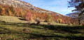
: reviews of this walk indicate that from (14) onwards, the path no longer exists. The only alternative is to follow the D911 for 4 km. See details in the description


 Country:

 City:
City:


Park at the Grand Raie car park.
(S/E) Take the path and, after about a hundred metres, take the path on the right which becomes the Sentier des Lacets as it climbs up the mountain and leads you to Trousset-Dessous.
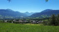
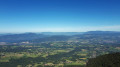
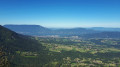
(1) Continue the climb to the left, passing the Chalet de Trousset with lovely views over Lake Bourget, towards Les Trois Bornes.
(2) Turn right and carry on towards Le Loret – Creux de Lachat.
(3) At Le Loret, carry on straight ahead towards Le Creux de Lachat.
(4) At La Dolca, take the path on the left up to the summit of Montagne Bange (panoramic view).
Then turn back and continue to the left towards Creux de Lachat.
(5) Turn left towards the Col de la Cochette, passing by the Chalets du Creux de Lachat to reach a crossroads of paths.
(6) At Pâturage de Lachat, follow the path on the right, heading due west, towards the Col de la Cochette.
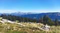
(7) At Les Pendants, continue towards the Col de la Cochette. Just before reaching the pass, you’ll find a viewpoint with an orientation board offering a 180° panoramic view of the Albanais region and the surrounding mountain ranges.
(8) Take the path on the left towards Arith and head down a forest track (elevation 1297).
(9) At this point, take the path straight ahead that leads into the valley, leaving the stony track on your right, as well as the path that climbs to the left.
This path continues sometimes in the bed of a stream, sometimes along its edge, until it joins another path that will take you to a junction with a track.
(10) At Les Franges du Crêt, cross the track and continue along the path to Montagny.
(11) Continue along the ‘Chez Breton’ road. Beautiful views over the valley, the Margériaz, the Monts Trélod and Colombier.
(12) Head down the path on the right, not far from a telecoms mast, to reach the D 62. Continue left, heading due north, along the road for about 600 m.
(13) Editor’s note: Reviews of this walk indicate that the path from (14) no longer exists. Alternative: at (13) continue along the minor road D62 to join the D911. Follow this road with care until you reach the car park at the start. This ‘alternative’ route involves approximately 5 km on roads, 4 km of which are on a road that is likely to be busy.
Take the farm track on the left.
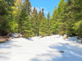
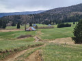
(14) Walk uphill along the meadow to reach the woodland and continue along the path through it.
Caution! The path is barely visible in places, sparsely signposted, and has a few difficult sections; by following the route on the app, you’ll reach a wider track.
(15) Head down this path to the right to join the Sentier de la Revêche.
(16) Continue to the right along this path to reach the Grand Raie car park, which offers a lovely view of the Tours Saint-Jacques to the north-east (S/E).


 Visorando Member
 Moderate
 Easy
Easy