Col de la Cochette circular from Saint-Offenge-Dessus

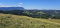
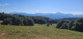
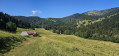
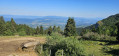
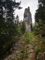
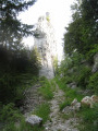
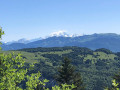
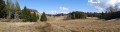
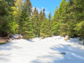
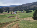
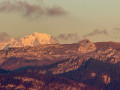
This route offers stunning panoramic views of the Bauges and Mont Blanc on one side, and the Revard and the Albanais on the other. With an ascent and descent through the cool forest and a mountain pasture plateau at the top offering magnificent views, this route has many attractions. The route presents no technical difficulties. Note that there is a section with a cable after the Mermet chalets, which is not particularly difficult.

Details

100816613
Creation:
Last update:
Last review:
  • Walking
    Activity: Walking
  • ↔
    Distance: 7.04 mi
  • ◔
    Average duration: 5h 10 
  • ▲
    Difficulty: Moderate

  • ⚐
    Back to start: Yes
  • ↗
    Ascent: + 2,205 ft
  • ↘
    Descent: - 2,228 ft

  • ▲
    Highest point: 4,852 ft
  • ▼
    Lowest point: 2,625 ft

Photos

Description of the walk

Head to the car park above the hamlet of Les Combes in Saint-Offenge-dessus.

(S/E) Take the forest road that climbs straight up towards the mountain. You’ll reach a junction.

(1) Follow the forest track on your left until the next junction at the hamlet of Le Rosset.

(2) Take the track on the right and continue along the forest road to reach the Pierre Bouvard refuge: viewpoint.

(3) Continue along the forest road.

(4) Keep to the left, ignore a path branching off to the right about fifty metres further on, and negotiate the bend to the right.

(5) Leave the small forest track and take the path on the left: marked with a yellow stripe on a green background. Reach the Col de la Cochette.

(6) Follow the path on the right and continue to the next junction as you emerge from the forest.

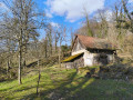
(7) Take the faintly marked path on the left which goes round the hillock and leads to the Pernet chalet: take a moment to stop and admire the view.

(8) Carry on straight ahead to reach the top of the hill, then head down to the left to the junction below. Follow the well-marked path on the left, which joins a forest track. Continue to the Chalet de la Plate

(9) Take the track to the right, heading south. At the sharp bend to the left, head straight on along the GR®96, which follows a small valley and leads to the Mermet chalets.

(10) Take the hairpin bend on your right, heading due north to reach the forest. Follow the path that runs along the mountainside. At the Chalet des Turres junction, this path becomes a forest track; follow it straight on to return to the starting junction.

(1) Turn left and head down the forest track to the car park.

Waypoints

  1. S/E : mi 0 - alt. 2,648 ft - Car park
  2. 1 : mi 0.4 - alt. 3,012 ft - Junction of the circular loop
  3. 2 : mi 0.65 - alt. 3,196 ft - Le Rosset
  4. 3 : mi 0.85 - alt. 3,386 ft - Pierre Bouvard Refuge
  5. 4 : mi 1.19 - alt. 3,714 ft - Les Grangettes
  6. 5 : mi 1.3 - alt. 3,835 ft - Path junction
  7. 6 : mi 1.65 - alt. 4,449 ft - Col de la Cochette (1310m)
  8. 7 : mi 1.91 - alt. 4,715 ft - Exit from the forest
  9. 8 : mi 2.13 - alt. 4,846 ft - Chalet de Pernet
  10. 9 : mi 3.2 - alt. 4,442 ft - Chalet de la Plate
  11. 10 : mi 4.76 - alt. 3,894 ft - Chalets Mermet
  12. S/E : mi 7.04 - alt. 2,625 ft - Car park

Notes

Please remember to close the gates to the fenced-off areas behind you.

Always be cautious and plan ahead when you're outdoors. Visorando and the author of this route cannot be held responsible for any accidents occurring on this route.

The GR® and PR® markings are the intellectual property of the Fédération Française de Randonnée Pédestre.

Other walks in the area

For more walks, use our search engine .

The GPS track and description are the property of this route's author. Please do not copy them without permission.