


Refine your search for walks in Remilly-sur-Tille
Remilly-sur-Tille walks


 The mill at Arc-sur-Tille
 Association / Club / Walk leader
 1.69 mi
 +10 ft
 -10 ft
 0h 45
0h 45
 Easy
Easy
 Departure from Arc-sur-Tille (Côte-d'Or)
A superb walk along the River Tille, during which you’ll discover the watermill and the church at Arc-sur-Tille.
From one mill to another in Arc-sur-Tille
 Visorando Member6.65 mi
+66 ft
-79 ft
3h 05
Visorando Member6.65 mi
+66 ft
-79 ft
3h 05
 Average
Departure from Arc-sur-Tille (Côte-d'Or)
Average
Departure from Arc-sur-Tille (Côte-d'Or)
Country walk between Arc-sur-Tille and Remilly-sur-Tille, taking in their mills.
Around the lake and green spaces of Arc-sur-Tille
6.30 mi
+16 ft
-16 ft
2h 55
Easy
Departure from Arc-sur-Tille (Côte-d'Or)
This hike will take you through the town's green spaces, around the lake and along the Tille river.
Between Tille and Gourmerault
9.92 mi
+33 ft
-33 ft
4h 35
Average
Departure from Arc-sur-Tille (Côte-d'Or)
This circular walk, between the two rivers that flow through our villages, takes you along these waterways and allows you to explore the church and the old mill at Arc-sur-Tille, Bressey-sur-Tille Castle, and the ponds at Remilly-sur-Tille.Did you know that the bell tower of the church at Arc-sur-Tille owes its flat roof to the Chape telegraph (1841)?
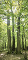
Les Six Filles
 4.86 mi
+79 ft
-79 ft
2h 20
Easy
Departure from Cessey-sur-Tille (Côte-d'Or)
4.86 mi
+79 ft
-79 ft
2h 20
Easy
Departure from Cessey-sur-Tille (Côte-d'Or)
A short, easy walk offering the chance to see a remarkable tree, ‘Les Six Filles’, and to pay tribute to the Maquis des Lochères.
Vaux-sur-Crosne circular
 4.99 mi
+95 ft
-95 ft
2h 25
Easy
Departure from Remilly-sur-Tille (Côte-d'Or)
4.99 mi
+95 ft
-95 ft
2h 25
Easy
Departure from Remilly-sur-Tille (Côte-d'Or)
A quiet family route in the heart of the countryside, between woodland and open countryside. 80% shaded Vaux-sur-Crosne has been part of the Norge and Tille Community of Communes since January 2017 and boasts a highly varied water system, partly due to the presence of the rivers Tille and Crosne, and partly due to the presence of a pond, the Lochère, and numerous former gravel pits now reserved for fishing.
Around Couternon
 5.84 mi
+39 ft
-39 ft
2h 45
Easy
Departure from Couternon (Côte-d'Or)
5.84 mi
+39 ft
-39 ft
2h 45
Easy
Departure from Couternon (Côte-d'Or)
A leisurely walk around Courternon. This route will take you round the village and allow you to discover it in a different light.
The route is in open countryside with little shade. Make sure you bring suitable gear if the sun is strong.
Through woods and fields west of Belleneuve
5.82 mi
+148 ft
-148 ft
2h 50
Easy
Departure from Arceau (Côte-d'Or)
An easy hike through woods and fields as you approach Belleneuve (Côte-d'Or).
Marais Trail in Magny-sur-Tille
3.07 mi
+13 ft
-13 ft
1h 25
Easy
Departure from Magny-sur-Tille (Côte-d'Or)
An easy, well-signposted family walk around the ponds of Magny-sur-Tille
The Bois du Vieux Dijon in Arçon
 5.86 mi
+98 ft
-98 ft
2h 45
Easy
Departure from Belleneuve (Côte-d'Or)
5.86 mi
+98 ft
-98 ft
2h 45
Easy
Departure from Belleneuve (Côte-d'Or)
An easy, family-friendly walk across the plain and through the woodland, partly shaded, partly sunny. On your way through Arçon, see the 12th-century Sainte-Anne Chapel, remodelled in the 17th century, located on Grande Rue. On leaving the woods, at a place called La Charme aux Loups, you’ll find the Sainte-Gertrude Chapel, which is not maintained.
The Tille Valley between Arcelot and Beire-Le-Châtel
12.19 mi
+131 ft
-135 ft
5h 45
Average
Departure from Arceau (Côte-d'Or)
A circular walk with no technical difficulties in the Tille valley, between Arcelot and Beire-le-Châtel, offering a lovely stroll through woods and fields, skirting the Tille on the return leg and passing buildings and monuments worth seeing or revisiting as you pass through the villages.
Plains and woods around Orgeux
 5.16 mi
+46 ft
-46 ft
2h 25
Easy
Departure from Orgeux (Côte-d'Or)
5.16 mi
+46 ft
-46 ft
2h 25
Easy
Departure from Orgeux (Côte-d'Or)
Does the village of Orgeux owe its name to ancient barley fields (Hordeu)? The Church of the Assumption dates back to the 13th century and features beautiful stained-glass windows in the choir. In the cemetery, there is a 17th-century calvary with a stone plaque. Adjacent to a small stone bridge, the wash house is built straddling a stream. A needle weir on the Norges slows the flow of the water just a stone’s throw away. A Roman road once crossed the area and, in 1967, a hoard of Gallo-Roman coins was unearthed in a sand pit.
The Norges Valley between Orgeux and Saint-Julien
9.12 mi
+56 ft
-56 ft
4h 15
Average
Departure from Orgeux (Côte-d'Or)
A walk starting from Orgeux, with no technical difficulty, which follows the pleasant Norges valley and leads to Saint-Julien. The return route takes you through woods and fields, away from the road.
Circular route via the Ogny farm, starting from Orgeux
11.51 mi
+217 ft
-207 ft
5h 30
Average
Departure from Orgeux (Côte-d'Or)
A circular route with no technical difficulties, starting from Orgeux, which takes us to the Ogny farm, then passes close to Brétigny, Ruffey-Lès-Echirey and Varois-et-Chaignot before returning to the starting point.
Circular route through the plains on the outskirts of Dijon
11.73 mi
+79 ft
-79 ft
5h 30
Average
Departure from Quetigny (Côte-d'Or)
A circular route with no technical difficulty starting from Quétigny, taking you to the outskirts of the residential areas of Saint-Apollinaire, Varois and Chaignot, Couternon, and Chevigny-Saint-Sauveur. A very pleasant route in fine weather when the path runs alongside the Vieille Tille and then the Norges between Couternon and Chevigny.
Circular walk in the Forest of Saint-Léger starting from Cirey-lès-Pontailler
 5.64 mi
+203 ft
-184 ft
2h 45
Easy
Departure from Cirey-lès-Pontailler (Côte-d'Or)
5.64 mi
+203 ft
-184 ft
2h 45
Easy
Departure from Cirey-lès-Pontailler (Côte-d'Or)
A family walk through the forest and a protected area, far from the hustle and bustle of the town and with little traffic.
Around Varois-et-Chaignot
5.40 mi
+82 ft
-82 ft
2h 35
Easy
Departure from Varois-et-Chaignot (Côte-d'Or)
An easy walk with no significant elevation gain in the Dijon plain
Around Arcelot Castle
 5.17 mi
+46 ft
-49 ft
2h 25
Easy
Departure from Arceau (Côte-d'Or)
5.17 mi
+46 ft
-49 ft
2h 25
Easy
Departure from Arceau (Côte-d'Or)
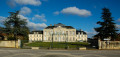
Arcelot Castle is situated in the commune of Arceau, in the Côte d’Or department, in the canton of Mirebeau-sur-Bèze. It has been listed as a Historic Monument since 22 September 1948, with the gardens listed on 30 April 1999. Behind the18th-century château lies one of Burgundy’s very first English-style parks.
Circular Arceau
 5.51 mi
+69 ft
-66 ft
2h 35
Average
Departure from Arceau (Côte-d'Or)
5.51 mi
+69 ft
-66 ft
2h 35
Average
Departure from Arceau (Côte-d'Or)
Arcelot, Arceau, Fouchanges; three villages that have always formed a single commune, crossed by the River Tille. Arceau is a rural commune situated 15 minutes from Dijon in a protected environment. Once situated on the Roman road linking Mirebeau to Dijon, the town was undoubtedly provided very early on with a single-arched bridge spanning the River Tille, which gave its name to the village. In the 17th century, General Gallas’s troops pillaged and burned the town.
A short circular loop around Trochères
 4.58 mi
+36 ft
-36 ft
2h 10
Easy
Departure from Trochères (Côte-d'Or)
4.58 mi
+36 ft
-36 ft
2h 10
Easy
Departure from Trochères (Côte-d'Or)
Taking a walk around Trochères isn’t easy; canals block our path in many places, particularly in the Bois de Mordesson, whilst the Albane and Motte streams dictate our route. Not to mention the private woods, where access is prohibited.
So I suggest this family walk, which is still enjoyable and allows us to explore the outskirts of this village.
Places to see:
A 19th-century open-air washhouse at the western exit; the village also boasts the small 13th-century Church of the Nativity, rebuilt in the 18th century and restored with ochre-coloured render.
The two mills, Haut and Bas.
The banks of the Oscara from Fauverney
 6.87 mi
+26 ft
-26 ft
3h 10
Average
Departure from Fauverney (Côte-d'Or)
6.87 mi
+26 ft
-26 ft
3h 10
Average
Departure from Fauverney (Côte-d'Or)
This walk takes place partly along the Ouche river (Oscara in Latin). It has its source in Lusigny-sur-Ouche. This commune is the guardian of the sources of the Ouche. The village is particularly charming with its stone houses.
The plain, the Norges and the Longeault-Pluvault pond from Genlis
6.51 mi
+26 ft
-26 ft
3h 00
Easy
Departure from Genlis (Côte-d'Or)
An easy walk along the banks of the River Norges, crossing the plain south of Genlis and passing by the Longeault-Pluvault pond. The route has little shade and is mostly on stony paths.
Circular along the banks of the Ouche starting from Neuilly-lès-Dijon
 6.81 mi
+33 ft
-43 ft
3h 10
Easy
Departure from Neuilly-lès-Dijon (Côte-d'Or)
6.81 mi
+33 ft
-43 ft
3h 10
Easy
Departure from Neuilly-lès-Dijon (Côte-d'Or)
The Ouche has been redeveloped, making it a great place for a walk in spring or autumn. You can collect walnuts in season. A very pleasant bucolic setting where you can watch the birds. Picnics are possible by the pond.Note:La Gaule de Neuilly is organising its Enduro Carpes from 23 to 25 May (2025) at theNeuilly-Crimoloispond.
The Clénay State Forest, starting from Saint-Julien
9.95 mi
+184 ft
-171 ft
4h 45
Average
Departure from Saint-Julien (Côte-d'Or)
A walk that combines a stroll through the old village of Saint-Julien and a visit to the surrounding area, before crossing part of the Clénay National Forest, following an active railway line, and returning via the Fontaine aux Lions in Saint-Julien, skirting Clénay.
Please note: the route on the ground does not always correspond to the route on the IGN map due to forestry operations.
From Beire-le-Châtel to Spoy and back
 5.56 mi
+72 ft
-79 ft
2h 35
Easy
Departure from Beire-le-Châtel (Côte-d'Or)
5.56 mi
+72 ft
-79 ft
2h 35
Easy
Departure from Beire-le-Châtel (Côte-d'Or)
Beire-le-Châtel: canton of Saint-Apollinaire (formerly canton of Mirebeau).
The village takes its name from the Gaulish word "Beire", meaning "plain". The discovery of a temple dedicated to Januaria recalls the position of Beire-le-Châtel in Gallo-Roman times, at the crossroads of ancient roads where the remains of two Roman roads can be found. In addition, six Gallo-Roman burials were found in 2019.
The Cradle of the King of Rome
13.78 mi
+121 ft
-121 ft
6h 25
 Difficult
Departure from Premières (Côte-d'Or)
Difficult
Departure from Premières (Côte-d'Or)
Starting from Premières, a circular route that passes through the Arboretum and the Soirans Communal Forest whilst skirting the high-speed rail line, then the Mondragon Woods, before heading into the Longchamp State Forest and its ponds, finally offering a view of the birthplace of the King of Rome.
From Mirebeau-sur-Bèze to Noiron-sur-Bèze via the national forest
 10.46 mi
+92 ft
-92 ft
4h 55
Average
Departure from Mirebeau-sur-Bèze (Côte-d'Or)
10.46 mi
+92 ft
-92 ft
4h 55
Average
Departure from Mirebeau-sur-Bèze (Côte-d'Or)
This walk through the national forest will take you past the castle, Noiron and Blagny.
It follows a path once used by horses and pack animals to carry timber, charcoal and large game out of the forests, or to bring in woodcutters, charcoal burners and their equipment.
We will visit the villages of Mirebeau-sur-Bèze and Noiron-sur-Bèze, through which the River Béze flows.
A long circular route through the Clénay Forest
 9.90 mi
+164 ft
-164 ft
4h 40
Average
Departure from Clénay (Côte-d'Or)
9.90 mi
+164 ft
-164 ft
4h 40
Average
Departure from Clénay (Côte-d'Or)
Do you enjoy wide open spaces, nature and peace and quiet, away from the beaten route?
Then come and take a walk in the Clénay state-owned forest; we’ll walk along the River La Flacière to the village of Flacey, where we can admire the wash house, the castle and its church. Then we’ll return to Clénay through the forest.