Country:
 City:
City:


Head to Premières, part of the commune of Collonges-et-Premières, via the D116. Park just before the end of Rue Basse, on the compacted verges, at the edge of the Longchamp Forest, to the north/north-east of the village.
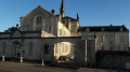
(S/E) Start with your back to the forest and walk down Rue Basse towards the centre of Premières. Then follow the Grande Rue, which runs alongside a picnic area and, further on, the town hall and the church (on the right). After crossing the bridge over the Arnison (at the edge of the built-up area), at a place called l’Hermitage, turn left.
(1) Immediately after this junction, turn left a second time onto a white, stony track heading towards a motorway bridge (in the distance) and veering left just before reaching it. Head back up towards the forest, crossing the Arnison once more.
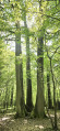
(2) At the edge of the woodland, turn right and follow the gravel track. Before it becomes grassy, keep to the left to enter the woods diagonally. Further on, the track veers slightly to the right and continues in a straight line, quite wide. At the end of this straight stretch, when you reach a Fork in the road, turn left. The path winds through the trees, crosses the Ruisseau de la Dame and emerges onto the Sommière de Soirans.
(3) Turn right and head towards the railway line; when you reach it, turn right. Cross the railway bridge to reach the Arboretum de Soirans after passing to the right under the motorway bridge. Once at the arboretum, there’s a chance to have a picnic and rest.
(4) Retrace your steps and pass under the motorway again, then turn immediately right, keeping the motorway on your right as a guide; the path continues through the arboretum, which has several picnic tables. At the fork in the road marking the entrance to the Soirans Communal Forest, keep to the right. Follow the white, stony path straight ahead, which leads to a T-junction at its end (the last few metres are on a grassy strip).
(5) Turn right, with your back to the railway line, and walk down the white path for about a hundred metres before taking the first path on the left. Follow this straight woodland path until it ends at the railway line. Keep to the right and continue in this direction, with the SNCF railway line to your left, until you reach an old white metal railway bridge.
(6) Cross it and head due north along a disused track, using the platform on your right as a guide. At the junction of tracks marked ‘restricted access’, at the end of the platform, turn left. Ignore the paths coming from the left and veer to the right. Keep following this main route, which leads to the bridge spanning the High-Speed Line (LGV), a mandatory crossing point for vehicles and animals.
(7) You may catch a glimpse of TGV trains travelling at full speed. Once you have crossed the bridge, keep slightly to the left to follow the Villers embankment for just over 100 metres before turning left onto a well-marked woodland track. Continue straight ahead along this route until you reach the La Parisotte ridge at its far end. Turn right to follow the ridge upwards, leading you to the Étoile crossroads with its wooden cross and forest ranger’s cottage. A fir tree marks the centre of the star.
(8) Head up the Sommière de Lamarche to the right along a gravel track. When you reach the top of the hill, at an altitude of 235 metres, turn left.
(9) The path leading into the woods is lined on the left by a row of fir trees planted in a single hedge. Continuing on, cross a clear-cut area where forestry work has obliterated the path. Cross a hollow and head up towards a T-junction. Turn right. Further on, on the right, there is a fenced-off pond with a shed; walk alongside it and cut across the Sommière d’Arran at its far end to continue straight ahead until you reach a second, unmaintained pond, still on the right.
(10) After taking in the view of this pond and its dam, turn back at a clear-cut area and set off diagonally to the right along a wide track carved out by forestry machinery (not shown on the IGN map). You’ll reach La Sommière d’Arran. Turn right to reach its junction with the Route Forestière Premières-Drambon, after passing through a barrier.
(11) Then turn left and follow this track straight ahead towards the south/south-west for just over 500 m. After crossing a ditch which, on the map, marks the boundary of the state-owned forest, you will reach the first wide, clear path on your right.
(12) Turn right and follow this path until it ends at a meadow (approximately 600 m). Follow the meadow, keeping to the left, and head towards the Étang de la Tuilerie (private property) until you can see its banks.
(13) Retrace your steps until you rejoin the forest track.
(12) Turn right onto the forest track until you reach the next major junction of tracks.
(14) Turn right onto the Sommière du Bouchet, at an altitude of 210. Follow this stony track for some time, using a clearing on the left as a guide. In the only remaining clump of trees on the left lies the site of the ‘Berceau du Roi de Rome’ (signpost).
(15) Oaks and hornbeams planted in 1811 following the birth of the ‘Aiglon’. Continue along the stony white track heading north-north-west. Shortly afterwards, at a grassy clearing on the left where a ditch branches off, turn left (in dry weather, the ditch forms part of a footpath). Take this path, which veers further to the left and continues straight ahead, passing between mulberry trees. Reach the next junction and turn right onto line 10 (27A). You’ll reach the D116 after about a hundred metres.
Please note: during periods of heavy rain, the footpath can turn into a torrent with deep water. In this case, it is better to reach the D116 by turning right at line 9, before passing between the mulberry trees.
(16) Turn left towards Premières. Walk carefully along the grass verge of this road until you reach the sign indicating the entrance to the built-up area of Premières. At the first junction, at kilometre marker 47, turn left (sign for ‘Forêt Domaniale de Longchamp’). The road curves to the right. Shortly afterwards, turn right onto Rue Basse to reach the starting car park (S/E).

 Visorando Member
 Easy
Easy 
 Average