Refine your search for walks in Recoubeau-Jansac
Recoubeau-Jansac walks


 Pas de la Pousterle and its panoramic views
 Visorando Member
 6.18 mi
 +2,467 ft
 -2,461 ft
 5h 00
5h 00
 Moderate
 Departure from Recoubeau-Jansac (Drôme)
A superb circular walk starting from the charming hamlet of Jansac in the Diois region, leading to a pass (pousterle) between the Drôme and Roanne valleys.
The route is mostly shaded and presents no particular difficulties, apart from a 600-metre elevation gain. It is signposted with blue circles and yellow lines.
The Pas des Baux circular route starting from Montmaur-en-Diois
 4.91 mi
+1,253 ft
-1,234 ft
3h 20
Moderate
Departure from Montmaur-en-Diois (Drôme)
4.91 mi
+1,253 ft
-1,234 ft
3h 20
Moderate
Departure from Montmaur-en-Diois (Drôme)
The Pas des Baux from Pont de Quart is a lovely little walk. The circular route from Montmaur, which is much longer, allows you to enjoy both sides of the valley and visit the old village and its Chemin du Facteur.
Circular route from Saint-Roman to Pont de Quart via the Ferme du Bès
 5.38 mi
+413 ft
-400 ft
2h 50
5.38 mi
+413 ft
-400 ft
2h 50
 Easy
Departure from Saint-Roman (Drôme)
Easy
Departure from Saint-Roman (Drôme)
A leisurely walk, suitable for all seasons, offering the chance to discover unexpected landscapes from a hill forming a promontory between the slopes of the Glandasse and the Drôme and Bès valleys. The route presents no difficulty. It follows small, paved roads with very little traffic, stony tracks leading to a few old farmhouses, and well-marked footpaths. Wooded landscapes alternate with or border cultivated fields and vineyards. Without being overly ambitious, you’ll discover beautiful views of the Drôme valley and the Montagne de Die, as well as the Glandasse towards Laval d’Aix.
The Crêtes du Col de Pennes
 4.18 mi
+1,273 ft
-1,273 ft
3h 00
Moderate
Departure from Barnave (Drôme)
4.18 mi
+1,273 ft
-1,273 ft
3h 00
Moderate
Departure from Barnave (Drôme)
This route presents certain difficulties: walking through thickets, crossing small rocks or holes dug by erosion, and passing along the edge of steep cliffs.
Absolutely not recommended in hot weather due to its south-west exposure, it remains very pleasant from autumn to spring on a beautiful sunny day. Avoid if the trail is covered with snow covering crevasses and due to the risk of slipping.
Crêtes de Solaure via the lost path of Pas d'Aix from Coste Boudonne
 3.62 mi
+915 ft
-942 ft
2h 35
Easy
Departure from Montmaur-en-Diois (Drôme)
3.62 mi
+915 ft
-942 ft
2h 35
Easy
Departure from Montmaur-en-Diois (Drôme)
A short, easy and wild circular route with beautiful views from the top of the cliffs.
The Crêtes d'Aucelon
 10.34 mi
+2,808 ft
-2,792 ft
7h 10
Moderate
Departure from Aucelon (Drôme)
10.34 mi
+2,808 ft
-2,792 ft
7h 10
Moderate
Departure from Aucelon (Drôme)
After a long climb, a 360° view awaits you on the ridges.
Three walks in one, around Châtillon-en-Diois
4.11 mi
+489 ft
-489 ft
2h 20
Easy
Departure from Menglon (Drôme)
A series of very easy circular walks around and through Châtillon-en-Diois, offering a wide variety of scenery:
- a geological discovery trail running alongside the River Bès,
- a stroll through the narrow streets of the old village,
- a short walk towards the Adoux Waterfall and the Giono Forest.
Montagne de Beaufayn from Les Derbons
 8.17 mi
+2,884 ft
-2,884 ft
6h 15
Moderate
Departure from Aix-en-Diois (Drôme)
8.17 mi
+2,884 ft
-2,884 ft
6h 15
Moderate
Departure from Aix-en-Diois (Drôme)
A few steep paths, a touch of orientation in the boxwoods and pines, a very short vertiginous ledge on the way back, a narrow passage between two cliffs, four small fords, an exceptional 360° view from the summit over the Vercors (as far as Veymont), the Devoluy, the southern peaks of the Drôme, Serre Chauvière, the Trois Becs, the Drôme Valley: this is the "Beaufayn" programme!
Menglon - La Grésière
 7.23 mi
+2,785 ft
-2,782 ft
5h 45
7.23 mi
+2,785 ft
-2,782 ft
5h 45
 Difficult
Departure from Menglon (Drôme)
Difficult
Departure from Menglon (Drôme)
This hike in the Glandasse massif takes you up to almost 1,500 metres with unobstructed views and a 360° panorama.
The originality of this hike lies in the fact that the trail takes you through a pedestrian tunnel carved into the mountainside, which is a little vertiginous.
Clamontard Mountain from the Claps departure point
 7.27 mi
+2,221 ft
-2,241 ft
5h 15
Moderate
Departure from Luc-en-Diois (Drôme)
7.27 mi
+2,221 ft
-2,241 ft
5h 15
Moderate
Departure from Luc-en-Diois (Drôme)
Set off to conquer a 1,085-metre mountain on a steep path, under a peaceful forest of tall trees and interspersed with breathtaking views of the rocky chaos of the Claps.
At the summit, enjoy a breathtaking panorama of the Diois valley and the first peaks of the Vercors.
Walk along the ridge to feast your eyes once more, this time in the direction of the Hautes-Alpes.
Finally, descend gently through a landscape typical of the South of France.
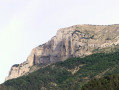
Foot of Glandasse via the Marateste
 4.68 mi
+1,506 ft
-1,503 ft
3h 30
Moderate
Departure from Châtillon-en-Diois (Drôme)
4.68 mi
+1,506 ft
-1,503 ft
3h 30
Moderate
Departure from Châtillon-en-Diois (Drôme)
At the foot of Montagne du Glandasse, I recommend a lovely walk in the hills above Châtillon-en-Diois.
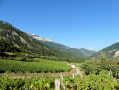
Short walk along the paths of the Châtillon-en-Diois vineyards
 2.98 mi
+207 ft
-207 ft
1h 35
Easy
Departure from Châtillon-en-Diois (Drôme)
2.98 mi
+207 ft
-207 ft
1h 35
Easy
Departure from Châtillon-en-Diois (Drôme)
I suggest you try this lovely route through the vineyards of Châtillon-en-Diois, taking in some beautiful views (notably Pié de Bœuf, Glandasse, Piémard and La Grésière).
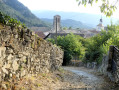
Adoux waterfall from Châtillon-en-Diois
 1.89 mi
+236 ft
-240 ft
1h 05
Easy
Departure from Châtillon-en-Diois (Drôme)
1.89 mi
+236 ft
-240 ft
1h 05
Easy
Departure from Châtillon-en-Diois (Drôme)
I suggest taking a short walk to the heights of the village of Châtillon-en-Diois to reach the Cascade de l'Adoux waterfall. The route is mainly through the woods, punctuated by some pretty views.
Please note: some sections require careful footing.
Baïn Balcony Circular Route from Châtillon-en-Diois
 6.48 mi
+2,142 ft
-2,139 ft
4h 50
Difficult
Departure from Châtillon-en-Diois (Drôme)
6.48 mi
+2,142 ft
-2,139 ft
4h 50
Difficult
Departure from Châtillon-en-Diois (Drôme)
A little-used, unmarked circular route requiring a good sense of direction and the ability to read the terrain; largely through woodland, across varied terrain. Narrow, exposed sections on rocky ridges require caution; a steep section on loose ground may pose a problem depending on conditions. Not recommended for young children. The route offers unusual views of the Haut-Diois and a landscape that is by turns gentle and rugged, ranging from heathland to beech wood.
From Châtillon-en-Diois to Ravel-et-Ferriers via the six passes
 11.58 mi
+4,177 ft
-4,173 ft
9h 00
Difficult
Departure from Châtillon-en-Diois (Drôme)
11.58 mi
+4,177 ft
-4,173 ft
9h 00
Difficult
Departure from Châtillon-en-Diois (Drôme)
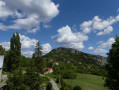
The aim of this hike is to follow a good circular route from Châtillon-en-Diois to the hamlets of Ravel-et-Ferrier, then return via Serre Chanuit (1,430m), crossing six passes in the process, including the Col du Pinet.
Discover the Glandasse massif from Châtillon-en-Diois via the GR® 91
 7.82 mi
+4,160 ft
-4,131 ft
7h 15
Difficult
Departure from Châtillon-en-Diois (Drôme)
7.82 mi
+4,160 ft
-4,131 ft
7h 15
Difficult
Departure from Châtillon-en-Diois (Drôme)
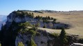
A beautiful hike that takes you to the southern tip of the Vercors plateau and its vast mountain pastures. The end of the route offers superb panoramic views of the Diois and the Cirque d'Archiane.
Circular Baïn in Châtillon-en-Diois
 7.21 mi
+2,028 ft
-2,018 ft
5h 05
Moderate
Departure from Châtillon-en-Diois (Drôme)
7.21 mi
+2,028 ft
-2,018 ft
5h 05
Moderate
Departure from Châtillon-en-Diois (Drôme)
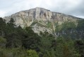
Discover the Combe de Baïn below the cliffs of Glandasse.
Châtillon-en-Diois (Le Beffroi) – Die (SNCF station), through the vineyards
 11.32 mi
+541 ft
-1,152 ft
5h 40
Moderate
Departure from Châtillon-en-Diois (Drôme)
11.32 mi
+541 ft
-1,152 ft
5h 40
Moderate
Departure from Châtillon-en-Diois (Drôme)
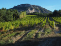
This lovely walk allows visitors staying in Châtillon-en-Diois to reach Die on foot, passing through vineyards and walnut groves situated in the foothills of the Glandasse, the southern outcrop of the Vercors overlooking the Drôme valley and the Baronnies.
The route allows time to appreciate the uniformity of this geographical landscape, which characterises the upper Drôme and its tributary, the Bez.
Le Glandasse from Chatillon-en-Diois via the Fontaine des Tuiles
 13.70 mi
+5,535 ft
-5,535 ft
7 hrs
13.70 mi
+5,535 ft
-5,535 ft
7 hrs
 Very difficult
Departure from Châtillon-en-Diois (Drôme)
Very difficult
Departure from Châtillon-en-Diois (Drôme)
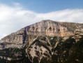
The aim of the route is to reach the summit of Glandasse mountain (known as the Dôme or Pié Ferré - 2,041 metres above sea level) via an alternative routeto the GR®91: Pié de Boeuf, near the Col de Caux (overlooking the Baïn valley), Fontaine des Tuiles (dominated by the Roc d'Ambane). The return journey is via theGR®91.
Montagne de Glandasse, long circular loop
 23.36 mi
+6,450 ft
-6,450 ft
12 hrs
Very difficult
Departure from Châtillon-en-Diois (Drôme)
23.36 mi
+6,450 ft
-6,450 ft
12 hrs
Very difficult
Departure from Châtillon-en-Diois (Drôme)
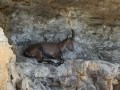
A long circular walk starting from the picturesque Mediterranean village of Châtillon-en-Diois. Fabulous scenery over the Glandasse and the Vercors High Plateaus, with a bit of a challenge when it comes to navigation. It is possible to spread the walk over two days by stopping for the night near the magnificent Pas de l’Aiguille.
Circular on Justin Mountain from Ausson
7.54 mi
+2,129 ft
-2,123 ft
5h 20
Moderate
Departure from Die (Drôme)
Circular on trails, paths and tracks, visiting some of the characteristic sites of the Justin mountain, Pas du Renard, forest lodge, Bât de l'Âne. Beautiful views of the peaks of the southern Vercors and more wooded areas.
Circular loop above Aurel
 2.87 mi
+682 ft
-699 ft
1h 55
Easy
Departure from Aurel (Drôme)
2.87 mi
+682 ft
-699 ft
1h 55
Easy
Departure from Aurel (Drôme)
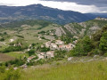
A walk through the forest overlooking Aurel with views of the village.
The Serre Chauvière Plateau via La Colombe, Fontcouverte and Col de Royet
 10.77 mi
+2,697 ft
-2,697 ft
7h 20
Difficult
Departure from Aurel (Drôme)
10.77 mi
+2,697 ft
-2,697 ft
7h 20
Difficult
Departure from Aurel (Drôme)
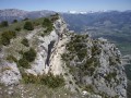
On a clear day, the Serre Chauvière plateau offers a magnificent 360° panorama of the peaks of Devoluy, Vercors, Baronnies and Diois.
A major effort has been made to re-mark and clear the trails on this superb hike, which adds considerable value.
Le Serre Chauvière via the Col du Royet, La Fescle, the Colombe trail
 12.31 mi
+3,159 ft
-3,150 ft
8h 25
Moderate
Departure from Aurel (Drôme)
12.31 mi
+3,159 ft
-3,150 ft
8h 25
Moderate
Departure from Aurel (Drôme)
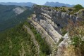
On a clear day, the Serre Chauvière plateau offers a magnificent 360° panorama of the peaks of the Devoluy, Vercors, Baronnies and Diois.
The Balcon de la Colombe is a very pretty trail.
La Servelle from Brette
 10.98 mi
+3,009 ft
-2,979 ft
7h 40
Difficult
Departure from Brette (Drôme)
10.98 mi
+3,009 ft
-2,979 ft
7h 40
Difficult
Departure from Brette (Drôme)
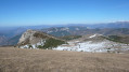
This is a long hike but without any technical difficulties apart from the relatively steep grassy slopes below the summit of La Servelle. Your efforts will be rewarded with a magnificent 360° view from Vercors to Ventoux and from Dévoluy to the Monts d'Ardèche! Return via a partial circular route passing through Champ Rabi.
Le Dôme or Pié Ferré starting from Valcroissant Abbey
6.89 mi
+4,570 ft
-4,570 ft
7h 10
Very difficult
Departure from Die (Drôme)
This route allows you to climb to the summit of the Dôme or Pied Ferré, the highest point of the Glandasse mountain in the Vercors massif, starting from Valcroissant Abbey and returning via the same route.
⚠️ 21/04/2026: 2 km before the Abbey, the road is closed due to a rockslide; it is not currently possible to access the start of this hike.
Around Valcroissant Abbey
 6.72 mi
+2,067 ft
-2,073 ft
4h 55
Moderate
Departure from Die (Drôme)
6.72 mi
+2,067 ft
-2,073 ft
4h 55
Moderate
Departure from Die (Drôme)
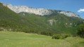
Leave the Die road and, at the mouth of a narrow gorge, you’ll find yourself facing a welcoming valley that ends at the gigantic rocky outcrop of the Glandasse. Seclusion, abundant water, forests and farmland framed by limestone cliffs: you may well be in raptures... just like those Cistercian monks who settled in November 1188 at Vallis Crescens, the starting point of the hike.
⚠️ 21/04/2026: 2 km before the Abbey, the road is closed due to a rockslide; it is not currently possible to reach the start of this hike.
The Dôme du Glandasse via Valcroissant Abbey and back via Châtillon
 18.70 mi
+7,785 ft
-7,730 ft
10 hrs
Very difficult
Departure from Die (Drôme)
18.70 mi
+7,785 ft
-7,730 ft
10 hrs
Very difficult
Departure from Die (Drôme)
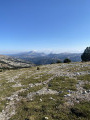
A challenging and demanding hike, with superb views of all the surrounding mountain ranges: Vercors, Dévoluy, Écrins, Mont Ventoux and the Trois Becs. Guaranteed wildlife sightings: marmots, ibex...A change of scenery and a sense of well-being...
⚠️ 21/04/2026: 2 km before the Abbey, the road is closed due to a landslide; it is currently not possible to access the start of this hike.
The Glandasse balconies starting from Valcroissant Abbey
 6.73 mi
+3,793 ft
-3,793 ft
6h 25
Difficult
Departure from Die (Drôme)
6.73 mi
+3,793 ft
-3,793 ft
6h 25
Difficult
Departure from Die (Drôme)
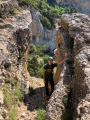
A pleasant walk, through woodland all the way, which will take you to the foot of the impressive Glandasse cliffs. Be quiet and keep an eye out – it’s not uncommon to spot ibex and chamois. This is a walking and hiking trail, signposted in yellow and green, with a section forming part of the GTV (GR®®95).
21/04/2026: 2 km before the Abbey, the road is closed due to a rockslide; it is not currently possible to access the start of this walk.User comment on 28 August 2026: The rockslide on the access road to the Abbey has been cleared
La Servelle via Volvent
 10.34 mi
+2,582 ft
-2,566 ft
7h 00
Moderate
Departure from Volvent (Drôme)
10.34 mi
+2,582 ft
-2,566 ft
7h 00
Moderate
Departure from Volvent (Drôme)
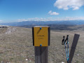
A summit in southern Diois (1613m), isolated between the Aucelon and Couspeau mountains, offers beautiful 360° views. The starting point is in Volvent, a small village of thirty inhabitants at the end of the Roanne Valley.
Les Marais des Bouligons
 1.89 mi
+305 ft
-289 ft
1h 10
Easy
Departure from Beaurières (Drôme)
1.89 mi
+305 ft
-289 ft
1h 10
Easy
Departure from Beaurières (Drôme)
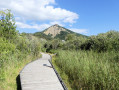
I suggest a short walk in the Marais des Bouligons and its surroundings: this is a protected area covering 65 hectares, home to remarkable flora and fauna.This walk is fairly easy and is particularly suitable for families.
Circular route in the Justin Forest from Chapiat
6.23 mi
+1,952 ft
-1,955 ft
4h 35
Moderate
Departure from Die (Drôme)
Hike in the Justin National Forest, in a typical Diois atmosphere, with narrow paths in little-used valleys, a mainly forest route with views of the southern Vercors mountains.
The Archiane vulture trail - Châtillon-en-Diois
 Local authority
 3.16 mi
+1,204 ft
-1,204 ft
2h 30
Moderate
Departure from Treschenu-Creyers (Drôme)
3.16 mi
+1,204 ft
-1,204 ft
2h 30
Moderate
Departure from Treschenu-Creyers (Drôme)
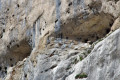
Set off to explore the majestic Archiane cirque, which has become a favourite nesting place for vultures. Discover the four species present in the Vercors through explanatory panels and observation points. As you walk along the trail, you may also spot some ibex.
Archiane and Plateaux du Vercors
 12.91 mi
+4,364 ft
-4,380 ft
9h 45
Difficult
Departure from Treschenu-Creyers (Drôme)
12.91 mi
+4,364 ft
-4,380 ft
9h 45
Difficult
Departure from Treschenu-Creyers (Drôme)
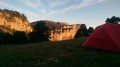
Short circular loop in the south-west of Vercors and Glandasse mountain.
Third Arch of Archiane circular loop via the Château de Tussac
 7.75 mi
+3,373 ft
-3,376 ft
6h 30
Very difficult
Departure from Treschenu-Creyers (Drôme)
7.75 mi
+3,373 ft
-3,376 ft
6h 30
Very difficult
Departure from Treschenu-Creyers (Drôme)
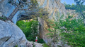
This rugged hike, starting from Archiane, requires a good sense of direction, sure-footedness and the ability to navigate a somewhat hostile and chaotic environment. However, in the end, you’ll have the pleasure of admiring the most beautiful arch in the Vercors!
Les Carnets d'Archiane
 3.73 mi
+1,250 ft
-1,266 ft
2h 50
Easy
Departure from Treschenu-Creyers (Drôme)
3.73 mi
+1,250 ft
-1,266 ft
2h 50
Easy
Departure from Treschenu-Creyers (Drôme)
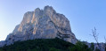
A lovely little hike that allows you to easily explore the Cirque d'Archiane. Discovering this place is magical as it is surrounded by magnificent cliffs. You are bound to come across a couple of griffon vultures nesting in the crevices of the rock and gliding over the cliffs.
The Jardin du Roi from Archiane
 11.62 mi
+3,681 ft
-3,684 ft
8h 35
Difficult
Departure from Treschenu-Creyers (Drôme)
11.62 mi
+3,681 ft
-3,684 ft
8h 35
Difficult
Departure from Treschenu-Creyers (Drôme)
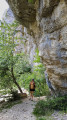
A little-used circular trail to discover one of the wildest areas of the southern Vercors. It offers magnificent views of the Diois mountains and the Cirque d'Archiane. Ibex and vultures are frequently seen here.
As it is largely unmarked, a good sense of direction and ability to read the terrain will be invaluable. GPS is strongly recommended and an IGN map is essential.
Please note: be sure to read the practical information before setting off.