Country:

 City:
City:


Park along Rue Neuve, near Place du Réviron if possible. In Châtillon, you’ll need to make the most of on-street parking, though this isn’t always easy. There is a car park on Chemin du Bez, before the swimming pool and tennis courts.
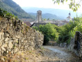
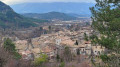
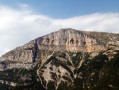
(S/E) Head north towards the town hall. Then turn left onto Rue des Rostangs, which runs through the village. Pass the curious fountain at the Maison des Consuls, built into its façade, then turn right 100 metres before the fairground. The street, with the castle rock towering over it on the right, leads to a small, curved bridge – formerly a ford – which was once the only entrance to the village.
(1) As soon as you leave the bridge, turn right onto the street that leads down to the stream – do not attempt to cross it. Follow the path which climbs up a meadow below some houses. It runs along a promontory above the valley before descending again via a short, somewhat steep track until it reaches a wider path running alongside the river.As you go, you’ll be able to spot a few stone weirs in the riverbed, designed to prevent the river from eroding too deeply.
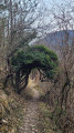
(2) Finally, fords the stream at a cliff face used as a climbing rock. Continue along the track, to the left, which also runs alongside the stream, but on the opposite bank.Note the wire-mesh gabion walls designed to prevent water from spilling onto the road during floods, then, on the right, a long retaining wall of exposed stone, which has helped preserve a beautiful terraced clearing. At the far end of this meadow, just before the river cuts across the road at this point, near an old willow with a Scots pine growing amongst its old branches, take the track that climbs steeply to the right and continue to the gate and the signs marking the entrance to the state-owned forest.
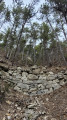
(3) Just before this, take the small path – somewhat overgrown at the start – which branches off to the left. Follow this path as it runs alongside a meadow that is gradually becoming overgrown before entering the heart of the woodland. As you pass through thefirst small valley, you’ll see a small dam used to limit erosion during heavy rainfall. Throughout the walk, note the old walls marking the terraced meadows of centuries past, the retaining wall along the path you’re following, and the remains of an old sheepfold at thefirst hairpin bend. You’ll reach a wide forest track.
(4) Head downhill along this track, which can be muddy after rain. Pass the wide Oursière valley atthe first bend, then, 300 metres further on, reach the start of a small path that veers off to the left: look for a small cairn.
(5) Turn left here. After a short climb to the edge of a deep valley, this path will remain more or less along the contour line, winding from valley to valley. These valleys bear witness to the fragility of the underlying marl rocks, now protected by the vegetation that has established itself there. You will thus reach the GR® 91, which climbs up to Glandasse.
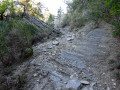
(6) Continue straight on uphill until thefirst bend. Then take the level path marked with a cross, indicating that you are leaving the GR®. It crosses erosion gullies once more; these are still active but have been mitigated by the presence of retaining walls built to stabilise the ground, thereby limiting further damage. Join the Pierre Grosse path, which you also follow to the right, heading downhill. After descending about a hundred metres in altitude, rejoin the GR® at a much larger gully, where all the others converge. Throughout the route, the observer will notice platforms – a delight for children who love building dens – surrounded by low dry-stone walls forming terraces where one can discover the remains of old dwellings, shelters or sheepfolds, which serve as a reminder of the former pastoral use of this entire area, now forested.
(7) At this point, if you head slightly uphill, you can see just how much work was required to establish the pine forest that is now ubiquitous. The entire slope was subject to manual earthworks, shaped into stepped terraces to form benches on which seedlings—planted in clusters, that is to say, comprising several seeds or small plants—were aligned along the contour lines. The staggered arrangement of all these terraces is still visible today in aerial photographs. Then continue along the path downhill
Further down, at a second hairpin bend—in a similar location to the previous one— it is possible, though off the marked path, for enthusiasts keen to gain a better understanding of the scale of the work carried out to protect the inhabitants to walk along the valley for about a hundred metres. They will discover four large retaining dams, designed to break the force of the torrential runoff at the time they were built (in 1907, a severe flood swept away the present-day Montée du Tricot, that is to say, the steeply sloping street running past the town hall) and, as soon as possible, head through the woods to rejoin the path they left behind. For the less adventurous, continue along the path until you reach the edge of a meadow, at a new hairpin bend leading off to the right this time.
(8) Alternatively, turn left, enter the meadow and follow the well-marked path carefully: keep clear of the fence, as livestock may be grazing. The path follows the contour lines as it runs alongside one of the old irrigation and water supply channels that fed the village’s many fountains. The path crosses a small aqueduct bridge, a reminder of the need to harness as effectively as possible the abundant but capricious waters flowing down from the mountains. There are numerous views of the village. The path passes above the drinking-water reservoir, which also serves as a telephone relay station. Once past the gate at the edge of the last meadow, the charred trunks of the standing trees remind us of the fragility of the environment and the risks associated with fire in this woodland landscape, which was established to protect the inhabitants. Continue along the contour line, straight ahead between fallow land and forest.
The path crosses a lovely footbridge and you’ll come across one of the information boards on the Giono Forest discovery trail. Carry on, climbing slightly until you reach the village’s water catchment area, then descend steeply to reach the Adoux Waterfall below, which is always visited by a few walkers seeking the coolness and tranquillity of the spot.
(9) From the waterfall, follow the path down alongside the Bellante. In tribute to Jean Giono and to mark the release of the film *The Man Who Planted Trees*, the area was planted with a variety of trees by schoolchildren from Châtillon several decades ago. The people of Châtillon are very fond of this site because, even before the fountains were built in the village, this is where people used to fetch water. There is a lovely nature trail here, which is regularly maintained. To return to the village, simply follow the Chemin de Rossignol at a leisurely pace, passing through meadows and past the first houses, until you reach Rue des Jardins, which runs past the school and the war memorial before leading to the three bell towers (church, belfry and temple), bringing together in one place the three religious and secular powers that bear witness to the solidarity and historical freedom of the people of Châtillon. Then turn left to return to the car park (S/E).


 Visorando Member
 Moderate
 Very difficult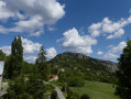
 Difficult