Country:

 City:
City:



(S) Pass under the belfry and walk through the medieval part of Chatillon-en-Diois along Rue des Rostangs. Walk past the fairground and continue down to the road to Die. Follow this road for about 200 metres towards the village exit
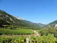
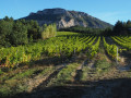
(1) Turn right to pass in front of the police station and walk alongside a residential estate before reaching the first vineyards of the Chatillon-en-Diois AOC. Carry on straight ahead, ignoring the side roads on either side. Stay on this small, more or less tarmacked road for about 1,300 metres.
Just before a shed on the left-hand side of the road, turn left onto the tarmac road heading towards the valley, Chemin du Maupas, and continue for a few metres. You’ll come to a right-angled junction.
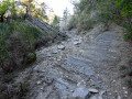
(2) Turn right towards the Col de Ferrand and Saint-Roman, taking the stony track. Continue along the slope of the Serre du Poët, passing the Ravin du Sourbier, before climbing steeply towards the pass along the zigzagging track through vineyards, copses and farmland.
(3) When you reach the pass, head downhill to reach the entrance to Saint-Roman.
(4) Continue straight on along the street closed to all motor vehicles, which leads onto cobbled lanes – the Callades – some of which are stepped. Carry on in the same direction until you reach the street overlooking the departmental road, which you should not attempt to join. After about a hundred metres in this direction, turn right, this time taking the Route des Vignes de Saint-Roman. You will arrive at the church.
Follow the picturesque little road as it climbs gradually.
(5) Pass the Col de Reychasset and then the Col de Combemare. You’ll notice, on several occasions, graves enclosed by low walls, bearing witness to the time when Protestants were buried clandestinely outside the parish cemeteries.
(6) Continue straight on and descend towards the village of Laval-d’Aix, nestled in its valley, though it is of no particular architectural interest.
(7): In the village, take the D514 local road, which first passes close to a sewage treatment works, then runs below the village of Aix-en-Diois, visible on the left by its ruined castle on a promontory.
Continue down the road along the edge of the forest, crossing the Combe de l’Ours stream (note the old bridge just upstream as you pass).
(8) Leave the road at a stony track that has a fork in it, going to the right. Carry on straight ahead until you reach a signpost by the hedge, just as the track turns sharply right towards the mountains – do not follow it any further.
(9) Instead, take the start of the path that branches off to the left and immediately winds its way through riparian woodland towards the bottom of the ravine. Follow the bed of this seasonal stream for about 100 metres, through the boxwood on this uneven path, which quickly takes you back up the right bank to rejoin a lovely path at the edge of a clearing. This path crosses two streams at fords, which are usually dry.
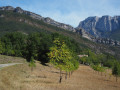
(10) Near the second ford, at the first house, turn right, without immediately heading downstream, to avoid having to follow the railway line along an uninteresting road. Stay on the higher ground and enjoy the view of the valley, as well as the panorama offered by the wooded mountains (the Grand Justin) and meadows on the right bank of the Drôme.
(11) At the T-junction, marking the entrance to the hamlet of Molières-Glandaz (in the commune of Solaure-en-Diois), head downhill until you reach the vicinity of the Route de Gap (D93), which has heavy traffic.
(12) Do not take this road, but cross the lower part of the hamlet by turning right and take Rue du Péage. Cross the Ruisseau de Valcroissant, then head straight up to the right to reach, 200 metres further on, the small tarmac road leading to Sallieres.
(13) On reaching the village, turn left to head back down towards the Drôme valley, towards Die, via the Route de Valcroissant.
(14) Just before the junction with the Route de Gap, enter the new Acacias housing estate on the right-hand side and follow the new roads heading west. After about a hundred metres, take the one-way road branching off to the left; this will lead you a little further on to the main road to Die, which changes name several times (Avenue du Texas, Rue Camille Buffardel, Avenue de la Clairette).
.
(15) After crossing the bridge that marks the entrance to the semi-pedestrianised town, which overlooks the lower parts of the town, take a break to enjoy a coffee or do some shopping in this pleasant and lively town.
(16) Continue on to the other end of the old town, and carry on along Avenue de la Clairette towards Valence. After 200 metres, just past a supermarket car park, take the small street that runs parallel to the left and leads down to the coach station and the SNCF railway station (towards Valence and Gap) (E).
.



 Visorando Member
 Very difficult
 Difficult
 Easy
Easy