A walk around the hills between the Bez and the Boidans stream, via Les Payats

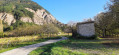
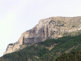
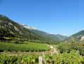
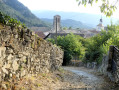
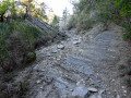
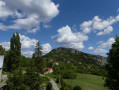
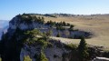
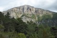
One of the few ‘countryside’ walks near Chatillon-en-Diois. This family-friendly route winds around the hills of Mont Martel and Les Bourdeaux, between the Bez stream and Les Payats. The route follows the Chemin de Saint-Martin, then descends along the right bank of the Ruisseau des Boidans, before heading towards Chatillon-en-Diois, going up the Bez valley. The circular route follows dirt tracks through vineyards, meadows, farmland, copses, orchards and walnut groves, offering beautiful views over the Diois valley, the nearby hills and the whole of the Glandasse.

Details

n°65144480
Creation:
Last update:
Last review:
  • Walking
    Activity: Walking
  • ↔
    Distance: 4.16 mi
  • ◔
    Average duration: 2h 10 
  • ▲
    Difficulty: Easy

  • ⚐
    Back to start: Yes
  • ↗
    Ascent: + 289 ft
  • ↘
    Descent: - 312 ft

  • ▲
    Highest point: 2,087 ft
  • ▼
    Lowest point: 1,719 ft

Photos

Description of the walk

Park in the car park located on the side of the road, near the Pont de Menglon.

(S/E) Leave the car park heading downhill and take the path immediately on the right. About ten metres further on, continue uphill to the right to join the Chemin de Saint-Martin. Follow this wide dirt track straight ahead; it runs along the lower part of the western slope of the Montagne de Piémard and climbs through walnut groves, vineyards and clearings until it reaches the D226, on the outskirts of the hamlet of Les Payats.

(1) Turn right, cross the hamlet, then turn left onto the D69 – taking care – until you reach the bridge over the Ruisseau des Boidans.

(2) Just before the bridge, take the dirt track on the right and follow it for a good two kilometres. Never cross the stream, which the track runs alongside at a distance of about ten metres. Heading north-east, and in the foreground, you’ll pass through walnut groves and sheep pastures. On the slopes of La Glacière and Mont Martel, vineyards, orchards, oak plantations and pine woods blend harmoniously. Opposite, there are beautiful views of the Glandasse, the Drôme valley and the vineyards of Châtillon-en-Diois, set against the region’s remarkable landscape. Pass through Le Noé below a beautiful house situated on the hillside, before joining a small, partly tarmacked road known as Impasse le Moulin.

(3) Turn right onto this small road which skirts the quarry, ignoring the paths branching off to the right. You’ll reach the hamlet of Moulin Chauvin: beautiful animal sculptures welcome you here, and you should take the time to admire them.

(4) Continue eastwards along the grassy path, running parallel to the River Bez but 200 metres away from it; it gets a bit muddy in wet weather but there’s no risk of sinking in too deeply. There are lovely views towards the Piémard mountain and the upper Bez valley, dominated by the Vercors range rising above Châtillon. The route passes through two lovely meadows, interspersed with copses, then near a renovated farm, before joining the small tarmac road at the Menglon-Châtillon recycling centre.

(5) Continue along this same road, which passes through a narrow little valley and climbs up to the plateau where a fruit grower is based, amongst orchards, walnut trees and lavender fields. Reach the junction with the D69, cross carefully, and head back to the car park where this lovely walk began (S/E).

Waypoints

  1. S/E : mi 0 - alt. 1,804 ft - Car park on the road (at the old bend). Near the - Bez ou Bès (rivière) à finaliser
  2. 1 : mi 1.12 - alt. 2,060 ft - D226
  3. 2 : mi 1.55 - alt. 1,959 ft - D69, Ruisseau des Boidans bridge
  4. 3 : mi 2.98 - alt. 1,726 ft - Junction at Impasse du Moulin on the edge of the quarry
  5. 4 : mi 3.29 - alt. 1,739 ft - The Chauvin Mill
  6. 5 : mi 3.88 - alt. 1,795 ft - Recycling centre
  7. S/E : mi 4.16 - alt. 1,808 ft - Car park on the departmental road (at the old bend)

Notes

This walk can be done in all seasons, though it is best undertaken in dry weather, as some sections can become rather muddy during wet spells. The route offers little shade and is therefore very exposed to the summer afternoon sun. We particularly recommend it in spring and autumn, when you’ll be able to fully appreciate the colours and contrasts of the landscape.

Worth a visit

Friday is market day in Châtillon, usually held at Place du Champ de Foire. A few producers open their farms in the afternoon. You’ll find a delicious sheep’s-milk ‘tome’ cheese at the Messagendre farm on the edge of the track linking Le Pouillet to the D140, and fruit (apples, walnuts) at Mr Frau’s, very close to the car park at the start of the walk.
Of course, do feel free to visit the village of Châtillon, listed as one of the most beautiful villages in France, to sample (in moderation) its wines, and to enjoy its warm welcome.

Reviews and comments

4.2 / 5
Based on 2 reviews

Reliability of the description
4.5 / 5
Ease of following the route
4.5 / 5
Route interest
3.5 / 5
amtauzin
amtauzin

Overall rating : 4.3 / 5

Date of your route : Sep 15, 2025
Reliability of the description : ★★★★★ Very good
Ease of following the route : ★★★★☆ Good
Route interest : ★★★★☆ Good
Very busy route : No

The mostly flat trail passes through varied agricultural landscapes: vineyards, walnut groves, meadows, and offers beautiful views of Glandasse and the vineyard cabins between Saint Roman and Châtillon.

Machine-translated

Julagier
Julagier

Overall rating : 4 / 5

Date of your route : Jan 02, 2025
Reliability of the description : ★★★★☆ Good
Ease of following the route : ★★★★★ Very good
Route interest : ★★★☆☆ Average
Very busy route : No

A pleasant little walk, but not particularly interesting.
Watch out for sheepdogs near the village, especially if, like me, you’re accompanied by your own.
The route is well-marked and clear.
Suitable for children; no difficulty.

Machine-translated

Other walks in the area

For more walks, use our search engine .

The GPS track and description are the property of this route's author. Please do not copy them without permission.