


Refine your search for walks in Puttigny
Puttigny walks


 The “Gros Max” at Hampont
 Visorando Member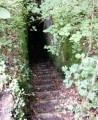
 2.30 mi
 +121 ft
 -118 ft
 1h 10
1h 10
 Easy
Easy
 Departure from Puttigny (Moselle)
The “Gros Max” is an SK-LK/45-type gun installed by the Germans between 1916 and 1917 in the “Le Chaumont” woods, near Hampont. This site has been all but forgotten today. Finding a passable route was no easy task. The location is impressive. Please note that the surrounding area may be dangerous for children or pets. There are cavities in the vicinity caused by countless underground tunnels and other structures.
The circular loop through the woods of Château-Bréhain
 8.39 mi
+400 ft
-400 ft
4h 15
8.39 mi
+400 ft
-400 ft
4h 15
 Moderate
Departure from Vannecourt (Moselle)
Moderate
Departure from Vannecourt (Moselle)
The woods of Château-Bréhain are criss-crossed with paths. You will therefore need to take care to follow the route and the description carefully. The paths (even those not shown on maps) are very wide and easily accessible. The forest is very beautiful and pleasant.
Exploring Vic-sur-Seille from Château-Salins
 10.46 mi
+751 ft
-728 ft
5h 30
Moderate
Departure from Château-Salins (Moselle)
10.46 mi
+751 ft
-728 ft
5h 30
Moderate
Departure from Château-Salins (Moselle)
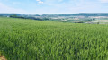
This walk will introduce you to one of the jewels of the Saulnois region: Vic-sur-Seille. The route offers a leisurely stroll through the village.
You’ll also be able to enjoy exceptional panoramic views, particularly from the Chemin du Haut de Phara.
The Chemin de la Reine in Château-Salins
 7.65 mi
+584 ft
-581 ft
4h 00
Moderate
Departure from Château-Salins (Moselle)
7.65 mi
+584 ft
-581 ft
4h 00
Moderate
Departure from Château-Salins (Moselle)
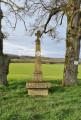
This walk around Château-Salins will offer you some superb panoramic views of the Saulnois region. Two-thirds of the route takes place in the forest. You’ll have the great honour of walking along the Chemin de la Reine, so named because it was trodden (after being restored) in 1725 by the new Queen of France, Marie Leszczynska. She was travelling with her entire entourage to join Louis XV. It’s worth noting that one section of this path is a particularly impressive tunnel of greenery.
The Majurin valley
 4.93 mi
+397 ft
-374 ft
2h 35
Easy
Departure from Château-Salins (Moselle)
4.93 mi
+397 ft
-374 ft
2h 35
Easy
Departure from Château-Salins (Moselle)
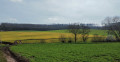
This route takes you to the Majurin valley from Château-Salins. The Majurin is a stream that flows through a plain surrounded by small woods. The valley is very close to Coutures and Château-Salins, yet you feel as though you are in the heart of the countryside, far from it all. The walk offers some beautiful panoramic views. It alternates pleasantly between sections deep in the forest and out in the open. As it presents no difficulties, this circular walk is ideal for a family outing.
Discovering the King’s Oak from Château-Voué
 5.20 mi
+459 ft
-463 ft
2h 50
Easy
Departure from Château-Voué (Moselle)
5.20 mi
+459 ft
-463 ft
2h 50
Easy
Departure from Château-Voué (Moselle)
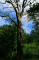
This walk, in the heart of the Saulnois region, will allow us to discover the King’s Oak. Louis XIV is said to have camped near this oak, which is estimated to be four centuries old. It is situated in the woods opposite Château-Voué, a village steeped in history. It is no longer so easy to find today, and I invite you to join me in discovering and admiring it. You will also have the opportunity to visit Château-Voué (the castle ruins and fortified house), as well as to walk along the beautiful Étang de Wuisse.
Deep in the forest on the Côte Saint-Jean
 3.34 mi
+148 ft
-141 ft
1h 40
Easy
Departure from Haraucourt-sur-Seille (Moselle)
3.34 mi
+148 ft
-141 ft
1h 40
Easy
Departure from Haraucourt-sur-Seille (Moselle)
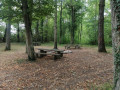
This route is truly ideal in very hot weather. It runs entirely in the shade along wide, lovely paths. The starting point is certainly of interest: it is a picturesque picnic area right in the heart of the woods. There are no significant difficulties, no steep climbs – an ideal outing for the whole family.
The Mont des Saints route
 4.92 mi
+436 ft
-433 ft
2h 40
Easy
Departure from Bellange (Moselle)
4.92 mi
+436 ft
-433 ft
2h 40
Easy
Departure from Bellange (Moselle)
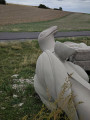
This route mainly follows paths through fields and, as you walk, reveals magnificent panoramic views of the Saulnois region. Its highlight is the discovery of Mont des Saints, a site undergoing transformation where a series of monumental statues is gradually being erected. Launched in 2023, this ambitious project is led by sculptor Michel Dardaine, whose expertise is bringing the first Lorraine figures to life. The project is a long-term undertaking that will span several decades, offering visitors the pleasure of seeing the site evolve over the years. When you reach the summit, where the route passes, take the time to enjoy an exceptional 360° view, opening onto vast, luminous and particularly photogenic landscapes.
Discovering the Gallo-Roman villa at Grémecey
 6.96 mi
+545 ft
-512 ft
3h 40
Moderate
Departure from Château-Salins (Moselle)
6.96 mi
+545 ft
-512 ft
3h 40
Moderate
Departure from Château-Salins (Moselle)
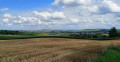
Back in the 1970s, like many schoolchildren from the Saulnois region, I visited the Gallo-Roman villa at Grémecey. It was subsequently buried and somewhat forgotten. For a long time, I believed that no remains of it existed. It has indeed become difficult to find, as it is surrounded by dense vegetation. This route takes you there, allowing you to see the remains of this building steeped in history. The route presents no significant difficulty.
Let’s go and see the daffodils at Château-Salins
 3.06 mi
+200 ft
-200 ft
1h 35
Easy
Departure from Château-Salins (Moselle)
3.06 mi
+200 ft
-200 ft
1h 35
Easy
Departure from Château-Salins (Moselle)
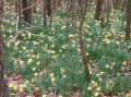
This walk has been designed to share with you a hidden gem close to Château-Salins. It takes you straight to an area teeming with daffodils (mid-March).
Reminder of the law: you may only pick one bunch of ten daffodils per person; picking flowers in bud is prohibited, as is picking leaves or digging up bulbs.
The St-Livier circular route via the Salival Stream
 3.66 mi
+341 ft
-341 ft
2h 00
Easy
Departure from Moyenvic (Moselle)
3.66 mi
+341 ft
-341 ft
2h 00
Easy
Departure from Moyenvic (Moselle)
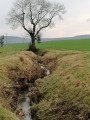
This walk, which presents no particular difficulty, will allow you to enjoy some magnificent panoramic views. The orientation table at the top of Mont St-Jean, the St-Livier Chapel and the former Salival Abbey – now a farm – are points of interest that will enhance your walk. You’ll finish with a long straight stretch along one of the banks of the Salival Stream, which is so idyllic. If, like me, you do the walk in winter, you may be lucky enough to spot the famous sheep affectionately known by the locals as ‘Dédé de St-Livier’. He’s very well known because he stubbornly refuses to return to the sheepfold during the winter. I was lucky enough to photograph him at the end of January (see photo).
Around Mesnival
 6.58 mi
+358 ft
-351 ft
3h 20
Moderate
Departure from Fonteny (Moselle)
6.58 mi
+358 ft
-351 ft
3h 20
Moderate
Departure from Fonteny (Moselle)
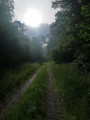
Mesnival is a charming little valley bordered by woodland. In the middle of this large clearing stands a farm. The route forms a circular route around this wonderful spot. Half the route runs along the edge of the woodland, offering views of the farm and its surroundings. On the open sections, you can enjoy stunning panoramic views towards the Moselle hillsides.
The Côte Saint-Jean as seen from Haraucourt-sur-Seille
 5.63 mi
+404 ft
-423 ft
2h 55
Easy
Departure from Haraucourt-sur-Seille (Moselle)
5.63 mi
+404 ft
-423 ft
2h 55
Easy
Departure from Haraucourt-sur-Seille (Moselle)
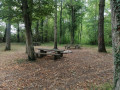
Half of the route takes place through woodland. The paths there are wide and very pleasant. The picnic area in the heart of the woods is quite unique and very welcome on hot days. There is a remarkable view from the Haute Charrière forest road. On the way back, don’t miss the Mennonite cemetery. The site has been restored and is well worth a visit.
Bois Pétard Circular Loop
 5.62 mi
+561 ft
-558 ft
3h 05
Moderate
Departure from Fresnes-en-Saulnois (Moselle)
5.62 mi
+561 ft
-558 ft
3h 05
Moderate
Departure from Fresnes-en-Saulnois (Moselle)
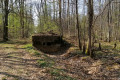
This short walk has been designed to allow you to go for a stroll in the Château-Salins area even in very hot weather. Only 50 metres of the route are in the open, and you can park your car in the shade at the starting point. Please note that Coutures is a village associated with Château-Salins (it lies just beyond it). You will only find it on a sat-nav by entering: Coutures, Château-Salins.
Moyenvic – the Côte Saint-Jean – Saint-Livier
 4.33 mi
+397 ft
-371 ft
2h 20
Easy
Departure from Moyenvic (Moselle)
4.33 mi
+397 ft
-371 ft
2h 20
Easy
Departure from Moyenvic (Moselle)
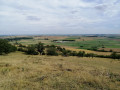
This is the most historically significant spot in the Saulnois region. You’ll be following in the footsteps of Attila and the Huns, who once camped here. From the orientation table at the summit, you’ll enjoy a superb panoramic view of the Saulnois region. Imagine the Hun leader stationed at this very spot, keeping watch over the surrounding area. Legend has it that he beheaded Saint Livier, after whom the chapel on your route is named. Perhaps you’ll be lucky enough to bump into the hermit monk who lives here.
Circular loop around Marsal
 12.57 mi
+932 ft
-932 ft
6h 35
12.57 mi
+932 ft
-932 ft
6h 35
 Difficult
Departure from Marsal (Moselle)
Difficult
Departure from Marsal (Moselle)
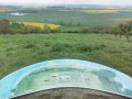
A walk that allows you to enjoy Marsal, its history and its panoramic views.
Please note the comments left in the ‘Reviews and Discussion’ section on Saturday 9 November 2019.
==> The orientation table is located on private land, but access is permitted to enjoy the view. However, please ensure you close the access gates properly to prevent the grazing sheep from escaping.
The Vic-sur-Seille, Salonnes and Château-Salins circular route
 9.31 mi
+633 ft
-659 ft
4h 50
Moderate
Departure from Vic-sur-Seille (Moselle)
9.31 mi
+633 ft
-659 ft
4h 50
Moderate
Departure from Vic-sur-Seille (Moselle)
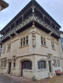
This is a circular walk starting in one of the jewels of the Saulnois region: Vic-sur-Seille. This walk will take you past some superb panoramic views. It is ideal in fine weather, offering a variety of routes along paths, as well as sections of gravel or tarmac.
Loop between Vic-sur-Seille and Moyenvic through the Bezange-la-Grande Forest
 8.14 mi
+449 ft
-449 ft
4h 10
Moderate
Departure from Vic-sur-Seille (Moselle)
8.14 mi
+449 ft
-449 ft
4h 10
Moderate
Departure from Vic-sur-Seille (Moselle)
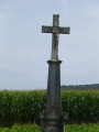
A loop in the Saulnois between Vic-sur-Seille and Moyenvic, passing through the Bezange la Grande National Forest. Walk along field paths and woodland trails with beautiful views from the highest points.
Between Chambrey and Bezange-la-Grande
 10.06 mi
+676 ft
-696 ft
4h 55
Moderate
Departure from Chambrey (Moselle)
10.06 mi
+676 ft
-696 ft
4h 55
Moderate
Departure from Chambrey (Moselle)
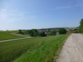
A hike along small roads, stone tracks and wood paths between Chambrey and Bezange-la-Grande, starting in the Bezange-la-Grande national forest.Along the route: the Saint-Roch Chapel, the Imperial Station and the church of Chambrey, a German memorial monument in the national forest.
Around La Mutche and La Claire Forêt
 5.48 mi
+66 ft
-72 ft
2h 35
Easy
Departure from Morhange (Moselle)
5.48 mi
+66 ft
-72 ft
2h 35
Easy
Departure from Morhange (Moselle)
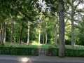
This route has two distinct sections. After following part of the path that circles the Étang de la Mutche, you will then reach the Claire Forêt. There you will discover a second, very interesting pond. This route alternates between open stretches and woodland. The paths are very well maintained and pleasant to walk on. The German military cemetery is a truly remarkable point of interest. Steeped in history, the site is impressive for its setting and grandeur.