The Mont des Saints route

This route mainly follows paths through fields and, as you walk, reveals magnificent panoramic views of the Saulnois region. Its highlight is the discovery of Mont des Saints, a site undergoing transformation where a series of monumental statues is gradually being erected. Launched in 2023, this ambitious project is led by sculptor Michel Dardaine, whose expertise is bringing the first Lorraine figures to life. The project is a long-term undertaking that will span several decades, offering visitors the pleasure of seeing the site evolve over the years. When you reach the summit, where the route passes, take the time to enjoy an exceptional 360° view, opening onto vast, luminous and particularly photogenic landscapes.

Details

88097568
Creation:
Last update:
Last review:
  • Walking
    Activity: Walking
  • ↔
    Distance: 7.92 km
  • ◔
    Average duration: 2h 40 
  • ▲
    Difficulty: Easy

  • ⚐
    Back to start: Yes
  • ↗
    Ascent: + 133 m
  • ↘
    Descent: - 132 m

  • ▲
    Highest point: 329 m
  • ▼
    Lowest point: 226 m
  • ⚐ Country: France
  • ⚐ City: Bellange (57340)
  • ⚑
    Start/End: N 48.901814° / E 6.578852°
  • ❏
    IGN map(s): Ref. 3514O
  • Hour-by-hour weather

Photos

Description of the walk

Parking is available on Chemin de la Fontaine, in Bellange (57340).

(S/E) With your back to the main road, turn left onto the tarmac road called Chemin de la Ceinture Nord, which runs between farm buildings.

(1) At the intersection, turn right. The road surface disappears after a few metres. You will arrive at the D674.

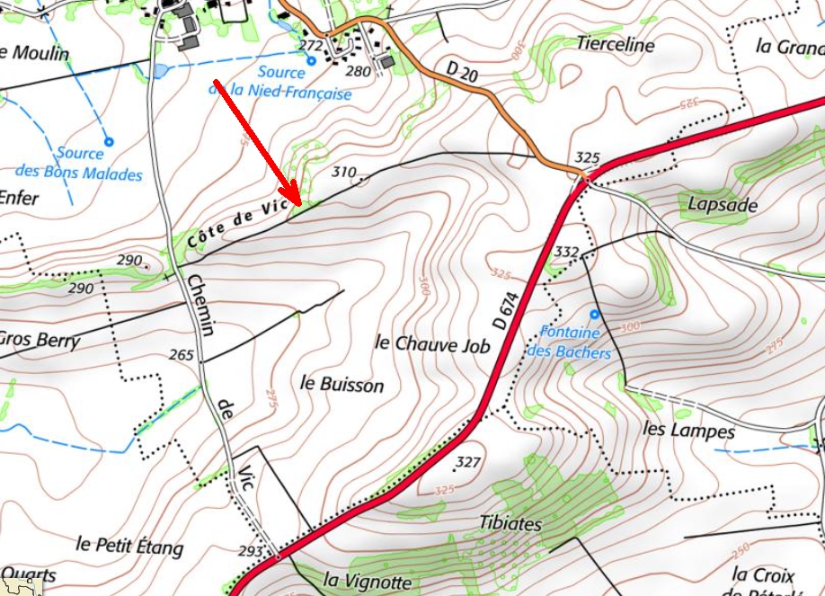
(2) Cross it carefully to reach the Chemin de Vic opposite, slightly to the left, which leads to Marthille.

(3) At the entrance to the village, take the first street on the right (Rue Jeanne d'Arc), then the first on the right (Rue du Moulin). At the end of the street, you will reach the D20.

(4) Turn right along the road, taking care.

(5) At the crossroads, cross the D674 again with caution. Continue straight on towards Achain. On your right, you will see the Mont des Saints and its statues.

(6) Just after the majestic Saint-Nicolas, turn right to climb Mont des Saints. At the top, discover the Graoully. Continue along the "La Lampe" path (marked). At the end of the path, you will come out onto the quiet D78.

(7) Turn right onto this road towards Bellange.

(8) At the entrance to Bellange, after a bend, walk along the pond, then turn right onto Chemin de l'Étang to return to the car park (S/E).

Waypoints

  1. S/E : km 0 - alt. 231 m - Chemin de la Fontaine (glass recycling point)
  2. 1 : km 0.3 - alt. 230 m - Bellange stream (intersection)
  3. 2 : km 1.59 - alt. 294 m - D674
  4. 3 : km 3.38 - alt. 265 m - Entrance to Marthille
  5. 4 : km 3.81 - alt. 265 m - Rue St Jean - Nied Française (rivière)
  6. 5 : km 5 - alt. 326 m - D674
  7. 6 : km 5.15 - alt. 317 m - Mont des Saints
  8. 7 : km 6.42 - alt. 250 m - Chemin La Lampe
  9. 8 : km 7.63 - alt. 226 m - Bellange Pond
  10. S/E : km 7.92 - alt. 233 m - Chemin de la Fontaine

Worth a visit

The Mont des Saints project, near Achain, is directly inspired by the Vallée des Saints in Brittany and aims to erect a series of monumental statues representing the great saints of Lorraine on the hill. The association in charge of the project, founded on 26 June 2024, brings together elected officials, artisans, farmers, young people and members of the Church in a cultural and heritage initiative. The first statue installed is that of Saint Nicholas, made of sandstone and inaugurated in 2023, followed by work on Saint Clement and the Graoully. The site, owned by the Diocese of Metz, offers a natural viewpoint over the surrounding countryside and is part of a dynamic local tourism initiative, supported by patrons and donors. All official information is available on the Mont des Saints website, which presents the project, its progress and the future stages of this outdoor artistic creation.

Reviews and comments

4.3 / 5
Based on 1 review

Reliability of the description
4 / 5
Ease of following the route
5 / 5
Route interest
4 / 5
logedu
logedu

Hello, thank you for your wonderful photo. Actually, the ideal walk shouldn’t go all the way to Marthille but take this path (which is currently blocked, but which I hope to be able to use during the RandoRipaille festival I’m organising on 16 August). The Mont des Saints association is currently undergoing a reorganisation, and the ascent of the Graoully (which was to be a festive event) has been postponed. The site has also suffered from vandalism (hence the position of St Clément), but the project is superb and ambitious. Let’s highlight the talent of the sculptor Michel Dardaine, who also worked on the Chêne du Roi (which I highly recommend). Thanks again for your feedback and see you soon on the trails!
Philippe Mercier - Château-Salins

Machine-translated

fanfan
fanfan

Overall rating : 4.3 / 5

Date of your route : Mar 19, 2026
Reliability of the description : ★★★★☆ Good
Ease of following the route : ★★★★★ Very good
Route interest : ★★★★☆ Good
Very busy route : No

Hello, and thank you for this lovely walk.
I do find there’s a bit too much tarmac; it’s a walk best avoided in hot weather.
In Marthille, we walked around the church and discovered a lovely cave (see photo) as well as a map of short walks starting from the village centre, complete with information boards.
Mont des Saints was a bit of a let-down; St Nicholas is certainly there, standing proudly, but we also came across two other sculptures where we couldn’t tell if they were being installed, had fallen over, or had been damaged.
At point 6, we climbed towards the summit using a rough track – no Graoully! – and, above all, no path named ‘La Lampe’ or marked with signposts. We continued using the GPS route, which initially follows a rough track that appears to be the entrance to a meadow. I recommend that future hikers on this route follow the GPS route closely.

Thank you for this lovely discovery and its magnificent views.

Machine-translated

Other walks in the area

For more walks, use our search engine .

The GPS track and description are the property of this route's author. Please do not copy them without permission.