Moyenvic – the Côte Saint-Jean – Saint-Livier

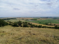
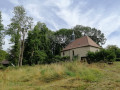
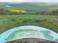
This is the most historically significant spot in the Saulnois region. You’ll be following in the footsteps of Attila and the Huns, who once camped here. From the orientation table at the summit, you’ll enjoy a superb panoramic view of the Saulnois region. Imagine the Hun leader stationed at this very spot, keeping watch over the surrounding area. Legend has it that he beheaded Saint Livier, after whom the chapel on your route is named. Perhaps you’ll be lucky enough to bump into the hermit monk who lives here.

Details

3528679
Creation:
Last update:
Last review:
  • Walking
    Activity: Walking
  • ↔
    Distance: 4.33 mi
  • ◔
    Average duration: 2h 20 
  • ▲
    Difficulty: Easy

  • ⚐
    Back to start: Yes
  • ↗
    Ascent: + 397 ft
  • ↘
    Descent: - 371 ft

  • ▲
    Highest point: 1,010 ft
  • ▼
    Lowest point: 673 ft
  • ⚐ Country: France
  • ⚐ City: Moyenvic (57630)
  • ⚑
    Start/End: N 48.782283° / E 6.5703°
  • ❏
    IGN map(s): Ref. 3514O
  • Hour-by-hour weather

Photos

Description of the walk

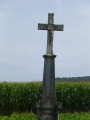
At the Moyenvic roundabout, you can park next to the wayside cross at the start of a small tarmac road.

(S/E) Head north along this road for about 800 metres.

(1) At a Fork in the road in front of a memorial to American soldiers, take the path on the right.

(2) At the junction 450 metres further on, carry straight on up the path. Turn right at the end of this path.

(3) At the end of this path, turn left onto a very steep track. At the entrance to a park, open the gate and close it carefully afterwards, as there are sometimes sheep there.

(4) After about 200 m, still within the park, turn right to reach the orientation table.

(5) Take in the view – you can even see the Vosges. Then retrace your steps to continue along the path on the right until you reach another gate, which allows you to leave the field.

(4) Turn right here. Walk round a very large field. After 1 km, the path veers sharply to the left, descending towards the Chapelle Saint-Livier, which is well worth a visit. Carry on straight ahead.

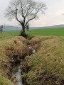
(6) After walking nearly 900 m from the chapel, just before the farm known as Salival – named after the abbey that once stood on this site – turn left onto a path that runs alongside a stream and continue to a bridge where you’ll join the GR®5.

(7) Turn left and, 200 metres further on, near a bench, take the path on the right. Then carry on until you reach the memorial to the American army.

(1) Carry on straight ahead and return to the small car park via the same route you took on the way there (S/E).

Waypoints

  1. S/E : mi 0 - alt. 673 ft - Car park at the Moyenvic roundabout
  2. 1 : mi 0.48 - alt. 732 ft - Memorial stone, on the right
  3. 2 : mi 0.76 - alt. 787 ft - Crossroads, go straight on
  4. 3 : mi 1.21 - alt. 886 ft - At the end of the path, turn left
  5. 4 : mi 1.32 - alt. 1,004 ft - After 50 metres, turn right and then head back
  6. 5 : mi 1.38 - alt. 1,007 ft - Orientation board – Valley of the - Seille (Affluent de la Moselle)
  7. 6 : mi 2.77 - alt. 722 ft - Salival, path on the left
  8. 7 : mi 3.48 - alt. 692 ft - Junction °°GR®°°5, on the left
  9. S/E : mi 4.33 - alt. 673 ft - Car park at the Moyenvic roundabout

Notes

No particular difficulty. Please be careful, however, as some sections can become very slippery in wet weather.

Worth a visit

A few benches along the path invite you to blend into the landscape.

In season, there’s an abundance of mirabelle plums, blackberries and even grapes along the hedgerows. The area is full of orchards.

To find out more about the Côte Saint-Jean, take a look at this document produced by an association in Moyenvic.

Roger Richard, a Castelsalinois and a living memory of the Saulnois region, runs the ‘Les Amis du Saulnois’ association. On the website, to learn even more, why not flick through the excellent ‘Cahiers du Saulnois’? here

Always be cautious and plan ahead when you're outdoors. Visorando and the author of this route cannot be held responsible for any accidents occurring on this route.

The GR® and PR® markings are the intellectual property of the Fédération Française de Randonnée Pédestre.

Reviews and comments

4.3 / 5
Based on 2 reviews

Reliability of the description
4.5 / 5
Ease of following the route
4.5 / 5
Route interest
4 / 5
ac92
ac92

Overall rating : 4.7 / 5

Date of your route : Mar 17, 2023
Reliability of the description : ★★★★★ Very good
Ease of following the route : ★★★★★ Very good
Route interest : ★★★★☆ Good
Very busy route : No

A lovely, very well-signposted path offering beautiful views of the Saulnois region, particularly from the orientation point at the top of the Côte Saint Jean. Best avoided in wet weather as the route passes through many areas with clay soil.

Machine-translated

Lefeuvre
Lefeuvre

Overall rating : 4 / 5

Date of your route : Oct 03, 2021
Reliability of the description : ★★★★☆ Good
Ease of following the route : ★★★★☆ Good
Route interest : ★★★★☆ Good
Very busy route : No

This route must be taken in the opposite direction to that described, due to the gradients

Machine-translated

Other walks in the area

For more walks, use our search engine .

The GPS track and description are the property of this route's author. Please do not copy them without permission.